
Henrys Lake is a small, shallow alpine lake in the western United States, in eastern Idaho. Approximately 8 square miles (21 km2) in area, at 4 miles (6.4 km) in length and 2 miles (3.2 km) in width, its surface elevation is 6,472 ft (1,973 m) above sea level.

Bear Lake is a natural freshwater lake on the Idaho–Utah border in the Western United States. About 109 square miles (280 km2) in size, it is split about equally between the two states; its Utah portion comprises the second-largest natural freshwater lake in Utah, after Utah Lake. The lake has been called the "Caribbean of the Rockies" for its unique turquoise-blue color, which is due to the refraction of calcium carbonate (limestone) deposits suspended in the lake. Its water properties have led to the evolution of several unique species of fauna that occur only within the lake. Bear Lake is over 250,000 years old. It was formed by fault subsidence that continues today, slowly deepening the lake along the eastern side. In 1911 the majority of the flow of the Bear River was diverted into Bear Lake via Mud Lake and a canal from Stewart Dam, ending 11,000 years of separation between the lake and that river system.

Bear Lake State Park is a public recreation area bordering the north and eastern shores of Bear Lake in the southeast corner of Bear Lake County, Idaho, near the Utah and Wyoming state lines. The state park sits across the lake from St. Charles and is fifteen miles (24 km) south of Montpelier. Bear Lake National Wildlife Refuge lies adjacent to the park's north unit.

St. George Island State Park is a Florida State Park located on the east end of St. George Island, approximately 10 miles southeast of Eastpoint, in northwestern Florida.

The Conecuh National Forest in southern Alabama covers 83,000 acres (340 km2), along the Alabama - Florida line in Covington and Escambia counties. Topography is level to moderately sloping, broad ridges with stream terraces and broad floodplains.

Curecanti National Recreation Area(Pronounced or .) is a National Park Service unit located on the Gunnison River in western Colorado. Established in 1965, Curecanti National Recreation Area is responsible for developing and managing recreational facilities on three reservoirs, Blue Mesa Reservoir, Morrow Point Reservoir and Crystal Reservoir, constructed on the upper Gunnison River in the 1960s by the U.S. Bureau of Reclamation to better utilize the vital waters of the Colorado River and its major tributaries. A popular destination for boating and fishing, Curecanti offers visitors two marinas, traditional and group campgrounds, hiking trails, boat launches, and boat-in campsites. The state's premiere lake trout and Kokanee salmon fisheries, Curecanti is a popular destination for boating and fishing, and is also a popular area for ice-fishing in the winter months.

Clear Lake State Park is a state park of California, United States, on Clear Lake. The park is popular for water recreation. Amenities include 149 developed campsites spread across four campground areas, two group campsites, a swimming beach with showers, a boat launch, and a marina. Since the area is a major breeding ground for grebes, there's a broad "no wake" zone in the Cole Creek launch area and near the reedy shoreline, which is conducive to canoeing and kayaking. The 590-acre (240 ha) park was established in 1949.

Beech Fork State Park is a state park located in Cabell County and Wayne County, West Virginia. The park is located on the tailwater shores of Beech Fork Lake, a flood control impoundment of the U.S. Army Corps of Engineers on the Beech Fork of Twelvepole Creek. Since its development in the mid-1970s, Beech Fork State Park has proven to be a popular recreation spot for the residents of nearby Barboursville and Huntington, West Virginia, as well as those living in the surrounding region. The park is located about 10 miles (16 km) south of the Hal Greer Exit of Interstate 64.

Foster Reservoir is a reservoir created by Foster Dam on the South Santiam River in the city of Foster, Oregon, United States. The reservoir is approximately 5.6 km (3.5 mi) long and covers approximately 494 ha when full. Primary use of the reservoir is recreation in the summer and flood control in the winter and spring.

Chapman State Park is a 862-acre (349 ha) Pennsylvania state park in Pleasant Township, Warren County, Pennsylvania near Clarendon, in the United States. The man-made Chapman Lake covers 68 acres (28 ha) of the park. Chapman State Park is named in honor of Dr. Leroy E. Chapman. Dr. Chapman was a state senator from 1929 until 1963. He was part of several civic groups that pushed for the creation of a state park in Warren County. Chapman State Park, opened in 1951, is adjacent to Allegheny National Forest and State Game Land 29 just off U.S. Route 6.
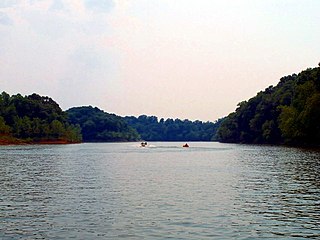
The Rough River Lake is a Y-shaped reservoir located in Breckinridge, Hardin, and Grayson counties in Kentucky, about 70 miles southwest of Louisville. This lake was created by the building of a dam, begun in 1955 and completed in 1961, 89.3 miles above the connection between the Rough River and the Green River. The land and water, along with the wildlife, fisheries, and recreational activities, are all managed under the cooperation of the U.S. Army Corps of Engineers and the Commonwealth of Kentucky. A primary attraction is Rough River Dam State Resort Park.
The Central Utah Project is a US federal water project that was authorized for construction under the Colorado River Storage Project Act of April 11, 1956, as a participating project. In general, the Central Utah Project develops a portion of Utah's share of the yield of the Colorado River, as set out in the Colorado River Compact of 1922.
Brushy Creek State Recreation Area is a state park in Webster County, Iowa in the United States. With an area encompassing over 6,000 acres (24 km2), the facility is one of Iowa's largest public outdoor recreation areas.

Willard Bay is a man-made fresh water reservoir in the Great Salt Lake, in northern Utah. The bay was separated from the Great Salt Lake in 1964, and has since served as a source of irrigation water and recreation for the northern Wasatch Front metro area.

Indian Lake is a 12-mile (19 km) long, 4,255-acre (1,722 ha) reservoir with a southwest to northeast orientation in the towns of Indian Lake and Lake Pleasant in Hamilton County, in the Adirondack Park of New York State, in the United States. The hamlet of Indian Lake is located 2 miles (3.2 km) north of the north end of Indian Lake. New York State Route 30 runs along the west shore of the lake. Most of the shore is part of the Forest Preserve. Indian Lake is fed by the Jessup River, and drains through the Indian River into Lake Abanakee, and from there through the Indian River to the Hudson River.

Tobin Lake is a reservoir along the course of the Saskatchewan River in the Canadian province of Saskatchewan. Tobin Lake was formed by the building of the E.B. Campbell Dam on the Saskatchewan River in 1963. The dam was originally named Squaw Rapids Dam, but was renamed E.B. Campbell Dam in 1988 as the term squaw is derogatory. The town of Nipawin is near the western end of the lake and upstream from Nipawin along the Saskatchewan River is Codette Lake, which was formed by the construction of the Francois Finlay Dam in 1986. Situated between these two man-made lakes, Nipawin earned the nickname The Town of Two Lakes.
Henrys Lake State Park is a public recreation area located on the south shore on Henrys Lake thirteen miles (21 km) north of Island Park in Fremont County, Idaho, U.S.A. The state park occupies 585 acres (237 ha) off US 20 near Goose Bay and the Henrys Lake Outlet. Park facilities include hiking trails, boat ramp, campgrounds, and cabins. It is home to cutthroat trout, cutbow, moose, pronghorn, swans, pelicans, various waterfowl and sandhill cranes.

Lake Cascade State Park is a public recreation area consisting of multiple units totaling 500 acres (200 ha) around Lake Cascade, an impoundment of the North Fork of the Payette River that covers 27,000 acres (11,000 ha) in Valley County, Idaho, United States. The state park includes 279 individual campsites in 10 developed campgrounds, six boat ramps, and opportunities for hiking, fishing, ice fishing, skiing, and bird watching.

Lac La Ronge Provincial Park is located in the boreal forest of the north central part of the Canadian province of Saskatchewan within the Canadian Shield. Situated in the Churchill River system, this provincial park has close to 100 lakes and more than 30 canoe routes, many of which follow old fur trade routes. Summer activities include camping, hiking, boating, fishing, and swimming. In the winter, there's cross-country skiing, snowmobiling, and ice fishing. Saskatchewan's highest waterfall is in the park. Nistowiak Falls are located north of Lac La Ronge along the Rapid River.
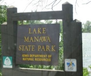
Lake Manawa State Park is located in Council Bluffs, Iowa. It is based around Lake Manawa, a man-made lake created to relieve water from the Missouri River and is located in southwest Council Bluffs.


