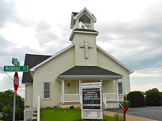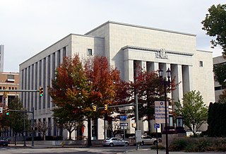
Lower Paxton Township is a township in Dauphin County, Pennsylvania, United States. The township was incorporated in 1767 from Paxton Township. The population was 47,360 at the 2010 census. It is the second-most populous municipality in the county, after Harrisburg.

Lower Swatara Township is a township in Dauphin County, Pennsylvania, United States. The population was 8,268 at the 2010 census. Harrisburg International Airport and Penn State Harrisburg are located within the township.

South Hanover Township is a township in Dauphin County, Pennsylvania, United States. The population was 6,248 at the 2010 census, up from 4,793 at the 2000 census.

Swatara Township is a township in Dauphin County, Pennsylvania, United States. The population was 23,362 at the 2010 census.
Beaver Creek is the name of several places and waterways in North America.

The Union Canal was a towpath canal that existed in southeastern Pennsylvania in the United States during the 19th century. First proposed in 1690 to connect Philadelphia with the Susquehanna River, it ran approximately 82 mi from Middletown on the Susquehanna below Harrisburg to Reading on the Schuylkill River.
The South Mountain Railroad was an American railroad which operated in Pennsylvania.
Union Water Works, commonly known as Water Works, is an unincorporated community in North Annville Township, Lebanon County, Pennsylvania, United States.
Chambers Hill is a community in Swatara Township in Dauphin County, Pennsylvania. It is located in the area between 40 degrees 15'41 North and 76 degrees 48'42 West, between Harrisburg and Hershey. With ranges in elevation from 415–660 feet a view of the Harrisburg skyline to the west, or Three Mile Island to the south, can often be seen. The aroma of cocoa is often in the air when the wind comes in from the Hershey's Chocolate World to the east. The area is bounded by U.S. Route 322 to the north and Pennsylvania Route 283 to the West. Routes 83, 81, 11, 15 and the Pennsylvania Turnpike are within a five-minute drive. Swatara Creek bounds the hill to the east, and Lower Swatara Township and Strites Orchard provide the boundary to the south. The area is served by one elementary school, policed by the Swatara Township Police department, and protected from fire by the Chambers Hill Fire Company.
Little Swatara Creek is a 26.0-mile-long (41.8 km) tributary of Swatara Creek in southeast Pennsylvania in the United States.

The Little Schuylkill River is a 30.6-mile-long (49.2 km) tributary of the Schuylkill River in northeast Pennsylvania in the United States.
Brandywine Creek is a 3.0-mile-long (4.8 km) tributary of Quittapahilla Creek in Lebanon County, Pennsylvania, in the United States.
Bow Creek is a 7.8-mile-long (12.6 km) tributary of Swatara Creek in Dauphin County, Pennsylvania, in the United States. It originates as run off from various springs north of Interstate 81, near the village of Grantville and remains in East Hanover township, Dauphin County for its entirety. It spills into the Swatara Creek at a point midway between Sandbeach Road and Route 743. During the 1800s, it was crossed via an aqueduct by the Union Canal.
Swatara is an unincorporated community in Derry Township, Dauphin County, Pennsylvania, near Hershey in the Harrisburg-Carlisle Metropolitan Statistical Area. Its elevation is 417 feet (127 m).
Schubert, Pennsylvania is a census-designated place in northeastern Bethel Township, Berks County on Route 419 just north of the interchange with Interstate 78. It is on the southern flank of Blue Mountain and is drained by the Stone Creek south into the Little Swatara Creek. It is served by the Bethel post office which uses the zip code of 19507. As of the 2010 census the population was 249.

Bressler is an unincorporated community and census-designated place (CDP) located in Swatara Township, Dauphin County, in the U.S. state of Pennsylvania. The community was formerly part of the census-designated place of Bressler-Enhaut-Oberlin, before splitting into three separate CDPs for the 2010 census. As of the 2010 census the population of Bressler was 1,437.
Ono is an unincorporated community in East Hanover Township, Lebanon County, Pennsylvania, United States, on U.S. Route 22 and about two miles SW of the junction of Interstate 78 and Interstate 81. The Swatara Creek to the south drains it into the Susquehanna River. While Ono has its own post office with the zip code of 17077, some residents are served by the Annville or Jonestown post office, with the zip code of 17003 or 17038, respectively.
Lickdale is an unincorporated community in northern Lebanon County, Pennsylvania. It is on the Swatara Creek and serves as a southern gateway to Swatara State Park. It is located in Union Township and Route 72 has an interchange with Interstate 81 via Fisher Avenue. It is served by the Jonestown post office with the zip code of 17038.
Lower Little Swatara Creek is a tributary of Swatara Creek in southern Schuylkill County, Pennsylvania, US. The creek is 11 miles (18 km) long. The creek starts on Blue Mountain and flows west-southwest into Swatara Creek near the community of Pine Grove. Fishing and canoeing are the primary recreational activities on the creek. Significant amounts of phosphorus and sediment flow through the creek.


