Beckhill | |
---|---|
Beckhill Approach, from Stainbeck Road | |
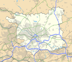
Location within West Yorkshire | |
Metropolitan borough | |
Metropolitan county | |
Region | |
Country | England |
Sovereign state | United Kingdom |
Post town | LEEDS |
Postcode district | LS7 |
Dialling code | 0113 |
Police | West Yorkshire |
Fire | West Yorkshire |
Ambulance | Yorkshire |
Beckhill (or Beck Hill) is a small council estate in the Meanwood area of Leeds, West Yorkshire, England. It has received negative local publicity in the past, but is now the subject of urban regeneration. The area is situated south of Stainbeck Road and north of Potternewton Lane. To the East is the Miles Hill Estate. Beckhill falls within the Chapel Allerton ward of Leeds City Council.
The area was built in the 1970s and consists mainly of brick built terrace houses. The estate had a small newsagents on Beckhill Approach which was demolished in 2014. There is only one entrance to the estate via car, from Stainbeck Road, however there are ginnels linking it with Potternewton Lane from Beckhill Gate.
Miles Hill primary school was on Beckhill Approach, and had 170 pupils. [1] The 2004 and 2007 league tables showed a challenging situation. [2] [3] The school was closed in 2007, and demolished in 2008. At the same time the estate children's play area in the former school grounds was closed due to maintenance costs. [4] Beckhill is part of the intake area for St Urban's Catholic primary school. [5] Miles Hill primary was recently replaced by the new Mill Field primary school on Potternewton Mount, which led to concerns over the road crossing in Potternewton Lane, as pupils now had to walk from their estates to the new school. [6] [7] However, this appears to be resolved by the addition of new zebra crossings.
In 2004 there was a problem with gang behaviour in this and other estates, and in 2006 it was reported that children were committing burglaries. [8] [9] There used to be a public house called the Hilltop in Beckhill Grove [10] but it was demolished in 2007, making space for a planned local regeneration development by East North East Homes Leeds. [11] In July 2007 authorisation was given to demolish a large number of properties on Beckhill Approach and Beckhill Garth, to make way for new family housing. [12] Beckhill became the focus of negative press attention in December 2008, following the 'Beckhill Stabbing'. [13] [14] [15] As of 2014, knife crime continued to be a problem on the estate. [16]
Since 2007, the Beckhill Implementation Group (BIG) received funding from the NHS for activities to promote health and wellbeing on the estate. [17] BIG won an Effective Partnership Working Award on 18 March 2009. [18] Groundwork Leeds is still involved in improvement of this environment. [19] In 2007 the average value of a house on Beckhill Chase was approximately half that of the average house in Leeds, and at least one of those houses was built in 1968. [20] In Beckhill Grove there are 39 homes, built about the same time.
There is an active Beckhill Tenants and Residents' Association. [21] £10,000 funding was agreed by Leeds City Council (North East Inner Area Committee) in 2008 for a study into the feasibility of providing a new community centre for Beckhill. [22] The Three Churches Project focuses on this and other nearby estates. In 2008 the group completed a four-month project with people from estates including Beckhill, and performed a play based on Shakespeare's The Two Gentlemen of Verona . [23] New council housing is planned for the estate, as a second phase of Leeds City Council's intention to build 80 properties across three sites in Leeds. [24]
Houses on the estate around Beckhill Approach were demolished in 2012 and the estate's newsagent was demolished in 2014. [25]
Wetherby is a market town and civil parish in the City of Leeds district, West Yorkshire, England, close to West Yorkshire county's border with North Yorkshire, and lies approximately 12 miles from Leeds City Centre, 12 mi (19 km) from York and 8 mi (13 km) from Harrogate. The town stands on the River Wharfe, and for centuries has been a crossing place and staging post on the Great North Road midway between London and Edinburgh.
Moortown is an affluent suburb of Leeds, West Yorkshire, England in the LS17 and LS8 postcode district. It is a civil parish and sits in the Moortown ward of Leeds City Council in the north east of the city.
Seacroft is an outer-city suburb/township consisting mainly of council estate housing covering an extensive area of east Leeds, West Yorkshire, England. It lies in the LS14 Leeds postcode area, around 4 miles (6.4 km) east of Leeds city centre.
Chapeltown is a suburb of north-east Leeds, in West Yorkshire, England. It is part of the Leeds City Council Ward of Chapel Allerton. It is approximately one mile north of Leeds city centre.
Alwoodley is a civil parish and suburb of Leeds in West Yorkshire, England. It is 5 miles (8.0 km) north of central Leeds and is one of the most affluent areas of the county. Alwoodley lies in Leeds 17 which was reported to contain the most expensive housing area in Yorkshire and the Humber by The Times.
Scott Hall is a suburb of north-east Leeds, West Yorkshire, England, adjacent to Chapeltown and Meanwood. The suburb falls within the Chapel Allerton and Moortown wards of Leeds City Council. The Scott Hall estate is made up largely of 1930s council housing on both sides of Scott Hall Road from Buslingthorpe Lane in the south to Potternewton Lane in the north.
West Park is a suburb of north-west Leeds, West Yorkshire, England, north of Headingley. It is a mixed area of private suburban housing and suburban council estates. The name derives from its main park containing playing fields together with a conservation area of grassy meadow ending in woodland. The largest housing estate in West Park is Moor Grange.
Little London is a residential area of Leeds in England, north of the city centre and Leeds Inner Ring Road. It is so called because in the 19th century it had fashionable housing and interesting architecture comparable to London. In the 1950s and '60s it became largely council housing and now consists of a mixture of high and low-rise flats and housing. The area falls within the Little London and Woodhouse ward of the City of Leeds Council. The area is divided into four estates; Lovell Park, Oatlands, Carlton and the Servias.
Meanwood is a suburb and former village in north-west Leeds, West Yorkshire, England.
Woodhouse is a largely residential area just north of the city centre of Leeds and close to the University of Leeds. It is in the Hyde Park and Woodhouse ward of City of Leeds metropolitan district. The population of the ward at the 2011 Census was 25,914.
Moor Grange Estate is a housing estate in the West Park area of Leeds, West Yorkshire, England, which was built in the 1950s on reclaimed farmland. Work on the Moor Grange Estate began in 1955. It was originally owned by the local council, and was leased by the council to tenants as a council estate. Most of the housing on the estate is now privately owned. Moor Grange does not suffer the crime problems of other council estates. House prices on the estate are high, and Moor Grange is considered a 'model council estate'. This may be due to the affluence of the area in which it is situated. Moor Grange backs onto the smaller Spen Estate which is another council estate in West Park. The Estate falls within the Kirkstall ward of the Leeds Metropolitan Council.
Richmond Hill is a district of Leeds, West Yorkshire, England. The district lies a mile to the east of the city centre between York Road, East End Park and Cross Green. The appropriate City of Leeds ward is Burmantofts and Richmond Hill.
Halton Moor is a district of east Leeds, West Yorkshire, England, about three miles east of Leeds city centre close to the A63. It is situated between Killingbeck to the north, Temple Newsam to the south, Osmondthorpe to the west and Halton and Colton to the east.
Woodlesford is a suburban village in the City of Leeds, West Yorkshire, England, 6 miles (10 km) south-east of Leeds city centre. Formerly part of the Rothwell Urban District, it is now within the Rothwell ward of Leeds City Council. The village sits on the banks of the Aire and Calder Navigation and river system.
Potternewton is a suburb and parish between Chapeltown and Chapel Allerton in north-east Leeds, West Yorkshire, England. It is in the Chapel Allerton ward of Leeds City Council.
Swarcliffe, originally the Swarcliffe Estate, is a district of Leeds, West Yorkshire, England. It is 4.9 miles (8 km) east of Leeds city centre, and within the LS14 and LS15 Leeds postcode area. The district falls within the Cross Gates and Whinmoor ward of the Leeds Metropolitan Council.
The Leeds Country Way is a circular long-distance footpath of 62 miles (99 km) around Leeds, West Yorkshire, England. It is never more than 7 miles (11 km) from City Square, Leeds, but is mainly rural with extensive views in the outlying areas of the Leeds metropolitan district. It follows public Rights of Way including footpaths, bridleways and minor lanes, with a few short sections along roads.
The architecture of Leeds, a city and metropolitan borough in West Yorkshire, England, encompasses a wide range of architectural styles and notable buildings. As with most northern industrial centres, much of Leeds' prominent architecture is of the Victorian era. However, the City of Leeds also contains buildings from as early as the Middle Ages such as Kirkstall Abbey, one of Britain's best preserved ruined Cistercian monasteries, as well as examples of 20th century industrial architecture, particularly in the districts of Hunslet and Holbeck.
Chapel Allerton is an inner suburb of north-east Leeds, West Yorkshire, England, 2 miles (3.2 km) from the city centre.