
The freckled duck is a waterfowl species endemic to Australia. The freckled duck has also been referred to as the monkey duck or oatmeal duck. These birds are usually present in mainland Australia, but disperse to coastal and subcostal wetlands in the dry period. During such times it is common for the freckled duck population to congregate in flocks in the same area, giving the impression that they are more common than they really are.

The blue-billed duck is a small Australian stiff-tailed duck, with both the male and female growing to a length of 40 cm (16 in). The male has a slate-blue bill which changes to bright-blue during the breeding season, hence the duck's common name. The male has deep chestnut plumage during breeding season, reverting to a dark grey. The female retains black plumage with brown tips all year round. The duck is endemic to Australia's temperate regions, inhabiting natural inland wetlands and also artificial wetlands, such as sewage ponds, in large numbers. It can be difficult to observe due to its cryptic nature during its breeding season through autumn and winter. The male duck exhibits a complex mating ritual. The blue-billed duck is omnivorous, with a preference for small aquatic invertebrates. BirdLife International has classified this species as Least concern. Major threats include drainage of deep permanent wetlands, or their degradation as a result of introduced fish, peripheral cattle grazing, salinization, and lowering of ground water.
Forrestdale Lake Nature Reserve is a lake nature reserve around Forrestdale Lake in the City of Armadale, Western Australia, approximately 25 kilometres (16 mi) south of the central business district of Perth, the state capital, and on the southern fringes of the Perth metropolitan area. It lies immediately south of the suburb of Forrestdale, and 8 kilometres (5.0 mi) south-east of Jandakot Airport. It is a still largely natural wetland, with some adjoining native vegetation, surrounded by land developed for housing and agriculture, that regularly supports large numbers of shorebirds and other waterbirds.
The Arafura Swamp is a large inland freshwater wetland in Arnhem Land, in the Top End of the Northern Territory of Australia. It is a near pristine floodplain with an area of 700 square kilometres (270 sq mi) that may expand to 1,300 km2 (500 sq mi) by the end of the wet season, making it the largest wooded swamp in the Northern Territory and, possibly, in Australia. It has a strong seasonal variation in depth of water. The area is of great cultural significance to the Yolngu people, in particular the Ramingining community. It was the filming location for the film Ten Canoes.
Lake Gore is a seasonal and semi-permanent saline lake in the Goldfields-Esperance region of Western Australia located approximately 24 km (15 mi) west of Esperance. It is an important site for waterbirds.
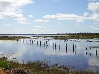
The Vasse-Wonnerup Estuary is an estuary in the South West region of Western Australia close to the town of Busselton. The estuary is listed with DIWA. It was also recognised as a wetland of international importance under the Ramsar Convention on 7 June 1990 when an area of 1,115 ha was designated Ramsar Site 484 as an important dry-season habitat for waterbirds. It is also the main part of the 2,038 ha (5,040-acre) Busselton Wetlands Important Bird Area.

Reedy Lake, historically also known as Lake Reedy, is a shallow 5.5-square-kilometre (2.1 sq mi) intermittent freshwater lake or swamp on the lower reaches of the Barwon River, on the Bellarine Peninsula southeast of Geelong in the Australian state of Victoria.
Toolibin Lake is a seasonal fresh to brackish water perched lake or wooded swamp, in south-western Australia. The lake is contained with a 493-hectare (1,218-acre) nature reserve and it is located about 200 kilometres (124 mi) south-east of Perth, in the Shire of Narrogin, and 40 kilometres (25 mi) east of the town of Narrogin, in the Wheatbelt region of Western Australia. The lake is listed by the Australian Government as a threatened ecological community under the Environment Protection and Biodiversity Conservation Act 1999.
The Becher Point Wetlands site is a wetland nature reserve in Port Kennedy on the Swan Coastal Plain of south-western Western Australia. The 677-hectare (1,670-acre) coastal site lies in the City of Rockingham, about 50 kilometres (31 mi) south of the state capital, Perth, and is largely surrounded on the landward side by residential suburbs. It comprises about 200 very small wetlands among sand ridges between Becher Point the Perth-Mandurah Road.

Thomsons Lake Nature Reserve is a lake nature reserve around Thomsons Lake in the City of Cockburn, Western Australia, approximately 25 kilometres (16 mi) south of the central business district of Perth, the state capital, and on the southern fringes of the Perth metropolitan area. It is in the suburb of Beeliar, 7 kilometres (4.3 mi) south-west of Jandakot Airport. It is a still largely natural wetland, with adjoining native vegetation, surrounded by land developed for housing and agriculture, that regularly supports large numbers of shorebirds and other waterbirds.
The Forrestdale and Thomsons Lakes Ramsar Site comprises two separate nature reserves, totalling 754 ha in area, protecting two shallow fresh to brackish, seasonal lakes in a suburban and agricultural landscape in south-western Western Australia. It lies in the Swan Coastal Plain bioregion and is used mainly for birdwatching and walking. The site is recognised as being of international importance under the Ramsar Convention on Wetlands, under which it was designated Ramsar Site 481 on 7 June 1990.
Fivebough and Tuckerbil Wetlands are two wetland sites within the Riverina and Murrumbidgee Irrigation Area (MIA), near Leeton in New South Wales, Australia. Both Fivebough and Tuckerbil sites form Crown reserve number 1030008 managed by NSW Department of Industry, for ecological conservation and public recreation. The reserve was recognised as being a Wetland of International Importance through designation under the Ramsar Convention on 21 October 2002 as Ramsar Site 1224
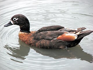
The Western District Lakes of Victoria, in the Western District of Victoria, south-eastern Australia, were recognised on 15 December 1982 as wetlands of international importance by listing under the Ramsar Convention, as Ramsar site no.268.
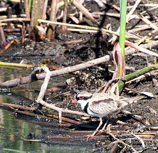
The Narran Wetlands, also known as the Narran Lakes, contained within the Narran Lake Nature Reserve, comprise a series of protected ephemeral lakes and swamps fed by the Narran River in the north-west of New South Wales, Australia. The 26,480-hectare (65,400-acre) reserve is located approximately 50 kilometres (31 mi) east of Brewarrina.
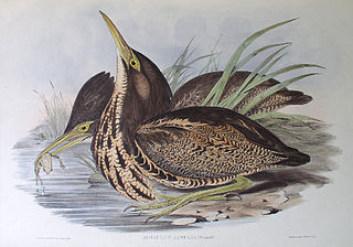
The North Victorian Wetlands, also known as the Kerang Wetlands, comprise an extensive series of over 100 freshwater, brackish and saline lakes and swamps on the floodplain of the Loddon River where it enters the Murray valley, in the vicinity of the town of Kerang, in northern Victoria, south-eastern Australia. They are important for a variety, and sometimes large numbers, of waterbirds.
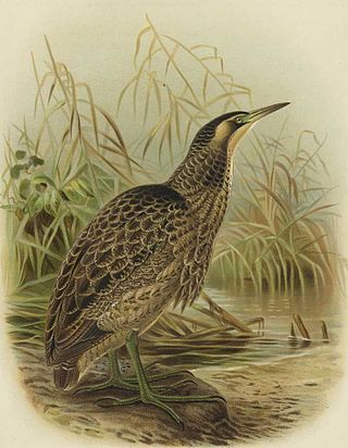
The Owingup Swamp and Boat Harbour Wetlands Important Bird Area is a 442 ha site comprising Owingup Swamp, and ten other, smaller, wetlands nearby, in the Great Southern region of south-western Australia. It lies about 25 km south-south-west of Denmark, Western Australia, near the track to the coast at Boat Harbour cove. The site has been identified by BirdLife International as an Important Bird Area (IBA) because it is supports small numbers of the endangered Australasian bittern.

The Tarrabool Lake – Eva Downs Swamp System is an ephemeral wetland complex lying on the west of the Barkly Tableland region in the Northern Territory of Australia. It is listed on the DIWA wetland directory.

The Towerrining Lake and Moodiarrup Swamps Important Bird Area is a 971-hectare (2,400-acre) site comprising a cluster of wetlands on the Blackwood River about 40 kilometres (25 mi) south of Darkan, and 45 kilometres (28 mi) north-west of Kojonup, in the south-west of the Wheatbelt region of Western Australia.
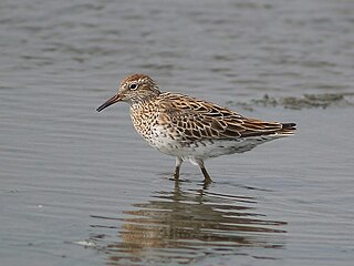
The Watervalley Wetlands is a nationally important wetland system located in the Australian state of South Australia which consists of a series of contiguous wetlands, lying on 56.6 square kilometres (21.9 sq mi) of private land between the Coorong National Park and Gum Lagoon Conservation Park, in the state's south-east.
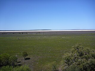
Lake Muir Nature Reserve is a protected area in Western Australia. It encompasses Lake Muir and several smaller lakes and wetlands. It is an important refuge for water birds, and home to several rare plants and plant communities.


