
Red Hill is a small town and rural community on the Mornington Peninsula in Melbourne, Victoria, Australia, approximately 63 km (39 mi) south-east of Melbourne's Central Business District, located within the Shire of Mornington Peninsula local government area. Red Hill recorded a population of 1,009 at the 2021 census.
Capel Sound is a suburb on the Mornington Peninsula in Melbourne, Victoria, Australia, 61 km (38 mi) south of Melbourne's central business district, located within the Shire of Mornington Peninsula local government area. Capel Sound recorded a population of 5,246 at the 2021 census.

Waroona is a town located in the Peel region of Western Australia along the South Western Highway, between Pinjarra and Harvey. The town is the seat of the Shire of Waroona. At the 2016 census, Waroona had a population of 2,934.

Yarloop is a town in the South West of Western Australia along the South Western Highway, between Waroona and Harvey. At the 2016 census, Yarloop had a population of 395. On 7 January 2016 a bushfire destroyed most of the town.

Brunswick Junction is a town in the South West of Western Australia, situated along the South Western Highway between Harvey and Bunbury. It had a population of 772 people at the 2016 census, down from 797 at the 2006 census.

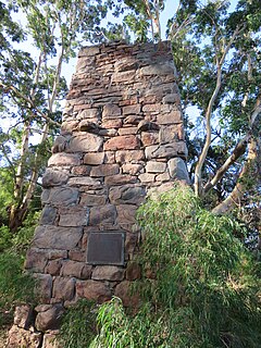
Cookernup is a town in the South West of Western Australia near the South Western Highway, between Waroona and Harvey.

Harvey is a town located in the South West of Western Australia along the South Western Highway, 140 kilometres (87 mi) south of Perth, between Pinjarra and Bunbury. It has a population of 2,750. Harvey Town is known for its dairy industry and oranges.

South Western Highway is a highway in the South West region of Western Australia connecting Perth's southeast with Walpole. It is a part of the Highway 1 network for most of its length. It is about 406 kilometres (252 mi) long.

Seaham is a suburb of the Port Stephens local government area in the Hunter Region of New South Wales, Australia. It is located on the Williams River which flows into the Hunter River 14.6 km (9.1 mi) downstream from Seaham village at Raymond Terrace.
Northcliffe is a town located in the lower South West region of Western Australia, about 28 kilometres (17 mi) south of the town of Pemberton. It is part of the Shire of Manjimup. At the 2006 census, Northcliffe had a population of 412. Currently, Northcliffe serves a population of around 770 people within the town and surrounding areas. Approximately 31% of the population have post-secondary qualifications.
Roelands is a town in the South West region of Western Australia on the South Western Highway, between Brunswick Junction and Bunbury. At the 2011 census, Roelands had a population of 620.
Wokalup is a town located in the South West region of Western Australia along the South Western Highway, between Harvey and Brunswick Junction. At the 2006 census, Wokalup had a population of 449.

The Shire of Harvey is a local government area of Western Australia. Harvey is located in the state's South West region, approximately 140 km south of Perth, and includes some of Bunbury's northern suburbs. The shire covers an area of 1,728 km² and had a population of approximately 26,500 as at the 2016 Census. Around 12% of the population are of Southern or Eastern European origin.
Karridale is a small township in the south-west of Western Australia. It is located just north of Augusta and south of Margaret River between Caves Road and Bussell Highway. A newer township was built a short distance north east of the original Old Karridale following fires that destroyed the town in 1961. At the 2006 census, Karridale had a population of 285.
Kudardup is a locality in the South West region of Western Australia. The locality is in the Shire of Augusta-Margaret River and on the Bussell Highway, 312 kilometres (194 mi) south of the state capital, Perth.

Benger Swamp is a wetland located on the Swan Coastal Plain, in south-west Western Australia.
Mornington, also known as Mornington Mills, is the site of former timber saw mills and a community on the Darling Range in Western Australia. It was part of the operations of Millars Karri and Jarrah Forests Limited. At the 2021 census, the area had a population of 42.
Metricup is a locality in the South West region of Western Australia near the town of Cowaramup on the Bussell Highway. It is in the Margaret River wine region and its local government area is the City of Busselton. At the 2021 census, it had a population of 263.
Dalby–Jandowae Road is a continuous 47.3 kilometres (29.4 mi) road route in the Western Downs region of Queensland, Australia. The road is signed as State Route 82. Dalby–Jandowae Road is a state-controlled regional road.

