Saanich is a district municipality on Vancouver Island in British Columbia, within the Greater Victoria area. The population was 117,735 at the 2021 census, making it the most populous municipality in the Capital Regional District and Vancouver Island, and the eighth-most populous in the province. The district adopted its name after the Saanich First Nation, meaning "emerging land" or "emerging people". The District acts as a bedroom community immediately to the north of Victoria, British Columbia.

Busselton is a city in the South West region of the state of Western Australia approximately 220 km (140 mi) south-west of Perth. Busselton has a long history as a popular holiday destination for Western Australians; however, the closure of the Busselton Port in 1972 and the contemporaneous establishment of the nearby Margaret River wine region have seen tourism become the dominant source of investment and development, supplemented by services and retail. The city is best known for the Busselton Jetty, the longest wooden jetty in the Southern Hemisphere.

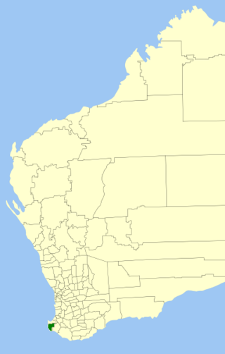
The Shire of Augusta Margaret River is a local government area in the south-west corner of the South West region of Western Australia, approximately 270 kilometres (168 mi) south of Perth. The shire covers an area of 2,243 square kilometres (866 sq mi) and had a population of over 14,000 at the 2016 Census, about half of whom live in the towns of Margaret River and Augusta.

Denham is the administrative town for the Shire of Shark Bay, Western Australia. At the 2016 census, Denham had a population of 754. Located on the western coast of the Peron Peninsula 831 kilometres (516 mi) north of Perth, Denham is the westernmost publicly accessible town in Australia, and is named in honour of Captain Henry Mangles Denham of the Royal Navy, who charted Shark Bay in 1858. Today, Denham survives as the gateway for the tourists who come to see the dolphins at Monkey Mia, which is located 23 kilometres (14 mi) northeast of the town. The town also has an attractive beach and a jetty popular with those interested in fishing and boating.

Augusta is a town on the south-west coast of Western Australia, where the Blackwood River emerges into Flinders Bay. It is the nearest town to Cape Leeuwin, on the furthest southwest corner of the Australian continent. In the 2001 census it had a population of 1,091; by 2016 the population of the town was 1,109.
Dunsborough is a coastal town in the South West of Western Australia, 254 kilometres (158 mi) south of Perth, on the shores of Geographe Bay.

The City of Busselton is a local government area in the South West region of Western Australia, approximately 230 km (140 mi) south of Perth, the state capital. The city covers an area of 1,455 km2 (562 sq mi) and had a population of 40,640 as at the 2021 Census. It contains two large towns, Busselton and Dunsborough, and a number of smaller towns. The city office is located on Southern Drive, Busselton.

Karridale is a small township in the south-west of Western Australia. It is located just north of Augusta and south of Margaret River between Caves Road and Bussell Highway. A newer township was built a short distance north east of the original Old Karridale following fires that destroyed the town in 1961. At the 2006 census, Karridale had a population of 285.
Acton Park is a small town and agricultural district located in the South West of Western Australia inland from Busselton along Jalbarragup Road. It was established as part of the Group Settlement Scheme in the 1920s and the local hall was constructed in 1924. The area was gazetted as a bounded locality in 1987. At the 2021 Australian census the area had a population of 92.

The City of Rockingham is a council and local government area, comprising the south coastal suburbs of the Western Australian capital city of Perth.

Vasse is a suburb of the city of Busselton in the South West region of Western Australia, 10 kilometres (6 mi) west of Busselton and 240 kilometres (149 mi) southwest of Perth. Its local government area is the City of Busselton. At the 2016 census, Vasse had a population of 2,479.

Jurien Bay is a coastal town in the Wheatbelt region of Western Australia, 220 kilometres (137 mi) north of Perth facing the Indian Ocean.
Cowaramup is a town in the South West of Western Australia, 12 kilometres north of Margaret River in the Shire of Augusta-Margaret River.
Metricup is a locality in the South West region of Western Australia near the town of Cowaramup on the Bussell Highway. It is in the Margaret River wine region and its local government area is the City of Busselton. At the 2021 census, it had a population of 263.
Yalyalup is a suburb of the Western Australian city of Busselton. At the 2021 census, it had a population of 2,950.
West Busselton is a suburb of the Western Australian city of Busselton. At the 2021 census, it had a population of 8,869.
Bovell is a semi-rural suburb of the Western Australian city of Busselton. At the 2021 census, it had a population of 475. The area has been earmarked for future urban development. Bovell contains Geographe Primary School, named after the nearby suburb, which was established in 2002.
Geographe is a suburb of the Western Australian city of Busselton. At the 2021 census, it had a population of 3,622.

The Meelup Regional Park is a coastal regional park near the Western Australian town of Dunsborough in the state's South West region. It contains 11.5 kilometres (7.1 mi) of coastline between Dunsborough and Bunker Bay. It features Meelup Beach and Eagle Bay, with other points of interest being Gannet Rock, Rocky Point, Castle Bay, Curtis Bay, and Point Piquet. It is an A-class reserve managed by the local government area of the City of Busselton in partnership with the Meelup Regional Park Management Committee.
Yelverton is a locality in Western Australia's South West region in the local government area of the City of Busselton. At the 2021 census, it had a population of 72. It was named after timber merchant Henry Yelverton, who established a timber mill there in 1856. The area was part of the Group Settlement Scheme, and a school existed there from 1934 to 1937. Yelverton National Park is in the locality.


