Dinninup Western Australia | |
---|---|
Coordinates | 33°48′58″S116°31′59″E / 33.816°S 116.533°E |
Population | 161 (SAL 2021) [1] |
Established | 1915 |
Postcode(s) | 6244 |
Elevation | 212 m (696 ft) |
Area | 347.4 km2 (134.1 sq mi) |
Location |
|
LGA(s) | Shire of Boyup Brook |
State electorate(s) | Warren-Blackwood |
Federal division(s) | O'Connor |
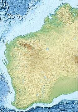
Dinninup is a small town in the South West region of Western Australia. It is between Boyup Brook and Kojonup.
The town's name is Aboriginal in origin and is the name of a brook that is situated close to town. The name was first recorded by surveyors in 1877; the meaning is unknown. Originating as a railway station on the Boyup Brook to Kojonup line, the land was requested by early settlers to be set aside for a townsite in 1906. The line was completed in 1910 and the Dinninup station was opened at the same time. The town was gazetted in 1915. [2]
Transwa is Western Australia's regional public transport provider, linking 240 destinations, from Kalbarri in the north to Augusta in the south west to Esperance in the south east.
Cranbrook is a small town in the Shire of Cranbrook in the Great Southern region of Western Australia between Katanning, Kojonup and Mount Barker, situated 320 km south of Perth. It is billed as "The Gateway to the Stirlings", referring to the nearby Stirling Range National Park. At the 2006 census, Cranbrook had a population of 280.
The Division of O'Connor is an Australian electoral division in the state of Western Australia. It is one of Western Australia's three rural seats, and one of the largest electoral constituencies in the world.
Boyup Brook is a town in the south-west of Western Australia, 269 kilometres (167 mi) south-southeast of Perth and 31 kilometres (19 mi) northeast of Bridgetown. The town lies on Kaniyang land within the Noongar nation.
Kojonup is a town 256 kilometres (159 mi) south-east of Perth, Western Australia along Albany Highway in the Great Southern region. The name Kojonup refers to the "Kodja" or stone axe made by Aboriginal Australians, from the local stone.
Donnybrook is a town situated between Boyanup and Kirup on the South Western Highway, 210 kilometres (130 mi) south of Perth, Western Australia. The town is the centre of apple cultivation in Western Australia. The town is also known for its picturesque abundance of English Oak trees, as well as for the Apple Fun Park, a large outdoor playground in the centre of town.
The Shire of Kojonup is a local government area in the Great Southern region of Western Australia, about 250 kilometres (155 mi) southeast of the state capital, Perth, along Albany Highway. The Shire covers an area of 2,932 square kilometres (1,132 sq mi) and its seat of government is the town of Kojonup.
The Shire of Boyup Brook is a local government area located in the South West region of Western Australia, about 270 kilometres (168 mi) southeast of Perth, the state capital. The Shire covers an area of 2,829 square kilometres (1,092 sq mi) and its seat of government is the town of Boyup Brook.
The Lower South West Football League is a country Australian rules football league incorporating teams from towns located within the South West and Great Southern regions of Western Australia.
Wilga is a small town located between Donnybrook and Boyup Brook in the South West region of Western Australia.
Mayanup is a small town in the South West region of Western Australia. It is between Boyup Brook and Kojonup. At the 2006 census, Mayanup had a population of 323.
Jingalup is a town in the Great Southern region of Western Australia located between the towns of Kojonup and Cranbrook. The town is located on Murrin Brook, which is a tributary of the Tone River.
Muradup is a small town in the Great Southern region of Western Australia located between Kojonup and Boyup Brook. The town is situated along the Balgarup River.
Kulikup is a rural locality and small town of the Shire of Boyup Brook in the South West region of Western Australia.
Tonebridge is a rural locality and small town of the Shire of Boyup Brook in the South West region of Western Australia.
The Donnybrook–Katanning railway was a railway line in the South West and Great Southern regions of Western Australia, between Donnybrook and Katanning.
Yabberup is a rural locality of the Shire of Donnybrook–Balingup in the South West region of Western Australia. The Preston River and the Donnybrook–Boyup Brook Road run through the centre of the locality from east to west. A small north-western corner of the Greater Preston National Park extends into the south-east of the locality.
The Katanning to Pingrup railway line was a railway line connecting Katanning to Pingrup via Nyabing in the Great Southern region of Western Australia. The railway line was 95 kilometres (59 mi) long. At its western end, at Katanning, it connected to the Great Southern Railway. At Katanning, it also connected to the Donnybrook–Katanning railway, which closed in 1982.