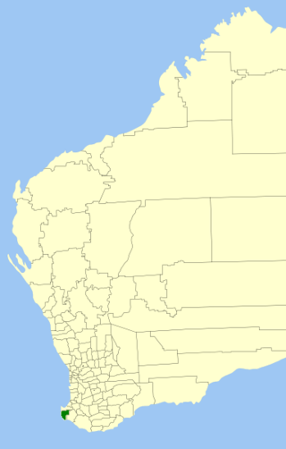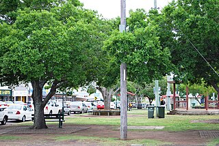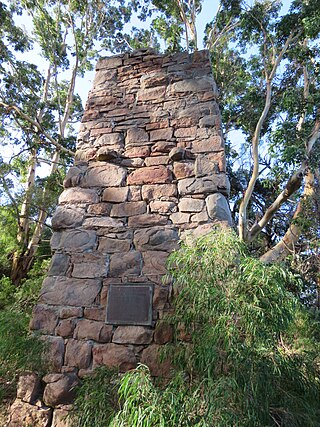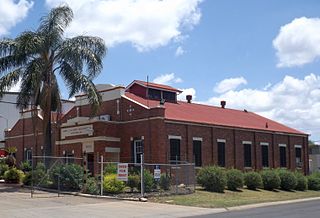
Margaret River is a town in the South West of Western Australia, located in the valley of the eponymous Margaret River, 277 kilometres (172 mi) south of Perth, the state capital. Its Local Government Area is the Shire of Augusta-Margaret River.

Katanning is a town located 277 kilometres (172 mi) south-east of Perth, Western Australia on the Great Southern Highway. At the census of 2021 the population was 4,057. At the 2016 census, Katanning had a population of 3,687.

Essendon is an Inner suburb in Melbourne, Victoria, Australia, 8 km (5.0 mi) north-west of Melbourne's central business district, located within the City of Moonee Valley local government area. Essendon recorded a population of 21,240 at the 2021 census.

Busselton is a city in the South West region of the state of Western Australia approximately 220 km (140 mi) south-west of Perth. Busselton has a long history as a popular holiday destination for Western Australians; however, the closure of the Busselton Port in 1972 and the contemporaneous establishment of the nearby Margaret River wine region have seen tourism become the dominant source of investment and development, supplemented by services and retail. The city is best known for the Busselton Jetty, the longest wooden jetty in the Southern Hemisphere.

The Shire of Augusta Margaret River is a local government area in the south-west corner of the South West region of Western Australia, approximately 270 kilometres (168 mi) south of Perth. The shire covers an area of 2,243 square kilometres (866 sq mi) and had a population of over 14,000 at the 2016 Census, about half of whom live in the towns of Margaret River and Augusta.

Augusta is a town on the south-west coast of Western Australia, where the Blackwood River flows into Flinders Bay. It is the nearest town to Cape Leeuwin, on the furthest southwest corner of the Australian continent. In the 2001 census it had a population of 1,091; by 2016 the population of the town was 1,109.

Emu Plains is a suburb of Sydney in the state of New South Wales, Australia. It is 58 kilometres (36 mi) west of the Sydney central business district, in the local government area of the City of Penrith and is part of the Greater Western Sydney region.

Serpentine is a town located 55 kilometres (34 mi) south-southeast of Perth, the capital of Western Australia, and 7 km south of Mundijong.

Jarrahdale is a small historic town located 45 km south-east of Perth, Western Australia in the Darling Range. The name is derived from its situation in a jarrah forest. Established in the late 1800s as the state's first major timber milling operation, it played a key role in the development of Western Australia through the exportation of jarrah around the world. At the 2016 census, Jarrahdale had a population of 1,192. Since 2001, the historic precinct has been managed by the state's National Trust organisation alongside private residential and tourism-oriented developments.

Murgon is a rural town and locality in the South Burnett Region, Queensland, Australia. In the 2021 census, the locality of Murgon had a population of 2,220 people.

Bayswater is a suburb 6 kilometres (4 mi) north-east of the central business district (CBD) of Perth, the capital of Western Australia. It is just north of the Swan River, within the City of Bayswater local government area. It is predominantly a low-density residential suburb consisting of single-family detached homes. However, there are several clusters of commercial buildings, most notably in the suburb's town centre, around the intersection of Whatley Crescent and King William Street and a light industrial area in the suburb's east.

Karridale is a small township in the south-west of Western Australia. It is located just north of Augusta and south of Margaret River between Caves Road and Bussell Highway. A newer township was built a short distance north east of the original Old Karridale following fires that destroyed the town in 1961. At the 2006 census, Karridale had a population of 285.
Cowaramup is a town in the South West of Western Australia, 12 kilometres north of Margaret River in the Shire of Augusta-Margaret River.
Kudardup is a locality in the South West region of Western Australia. The locality is in the Shire of Augusta-Margaret River and on the Bussell Highway, 312 kilometres (194 mi) south of the state capital, Perth.
Alexandra Bridge is a locality in the South West region of Western Australia. Its local government area is the Shire of Augusta-Margaret River and it is located 23 kilometres (14 mi) north-northeast of Augusta on Brockman Highway.

North Toowoomba is a suburban locality in Toowoomba in the Toowoomba Region, Queensland, Australia. In the 2021 census, North Toowoomba had a population of 3,332 people.

Boranup is a locality in the Shire of Augusta-Margaret River in the South West region of Western Australia. It is the site of a large coastal dune blow out known as the "Boranup sand patch" as part of the Boranup beach, and the site of a former M. C. Davies timber company mill. The sand patch area and sand blows affected the alignment of the Busselton to Flinders Bay railway.
Osmington is a small townsite located in the South West region of Western Australia in the Shire of Augusta-Margaret River, about 20 km (12 mi) north-east of Margaret River.
Yalyalup is a suburb of the Western Australian city of Busselton. At the 2021 census, it had a population of 2,950.
Forest Grove is a locality in the South West region of Western Australia in the Shire of Augusta-Margaret River.


