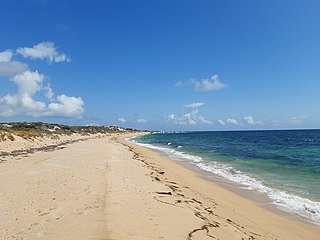
The City of Wanneroo is a local government area with city status in the northern suburbs of Perth, Western Australia. It is centred approximately 25 kilometres (15.5 mi) north of Perth's central business district and forms part of the northern boundary of the Perth metropolitan area. Wangara encompasses the federal divisions of Cowan, Moore and Pearce.

Peregian Beach is a beach and small coastal town on the Sunshine Coast, Queensland, Australia. It is a suburb split between two local government areas with the eastern coastal in the Shire of Noosa and the western hinterland part in the Sunshine Coast Region.. In the 2016 census, Peregian Beach had a population of 3,791 people.

Pinjarra is a town in the Peel region of Western Australia along the South Western Highway, 82 kilometres (51 mi) from the state capital, Perth and 21 kilometres (13 mi) south-east of the coastal city of Mandurah. Its local government area is the Shire of Murray. At the 2016 census, Pinjarra had a population of 4910.
Benger is a locality just north of Brunswick Junction in the South West of Western Australia.

Brunswick Junction is a town in the South West of Western Australia, situated along the South Western Highway between Harvey and Bunbury. It had a population of 772 people at the 2016 census, down from 797 at the 2006 census.

Cookernup is a town in the South West of Western Australia near the South Western Highway, between Waroona and Harvey.

Harvey is a town located in the South West of Western Australia along the South Western Highway, 140 kilometres (87 mi) south of Perth, between Pinjarra and Bunbury. It has a population of 2,750. Harvey Town is known for its dairy industry and oranges.

Australind is a town in Western Australia, located 12 km north-east of Bunbury's central business district. Its local government area is the Shire of Harvey. At the 2016 census, Australind had a population of 14,539.

Bouvard is the second southernmost suburb of Mandurah, Western Australia, and is 97 kilometres (60 mi) south of the state capital, Perth. Its local government area is the City of Mandurah.
Frankland River is a small town in the Great Southern region of Western Australia. The town is in the shire of Cranbrook and is situated approximately 332.7 km (206.7 mi) from the state's capital, Perth, approximately 120 km (75 mi) north west of Albany, 83 km (52 mi) southwest of Kojonup, 19 km (12 mi) north of Rocky Gully and 90 km (56 mi) east of Manjimup. Frankland derives its name from its location 6 km east of the Frankland River. At the 2006 census, Frankland had a population of 380.
Binningup is a town on the coast of the South West region of Western Australia between Mandurah and Bunbury. At the 2016 census, Binningup had a population of 1,227.

Leschenault is an outer suburb of Bunbury, Western Australia 16 km to the north-east. Its local government area is the Shire of Harvey. Leschenault is generally considered to be a higher socioeconomic area, with higher than average real estate prices.
Roelands is a town in the South West region of Western Australia on the South Western Highway, between Brunswick Junction and Bunbury. At the 2011 census, Roelands had a population of 620.
Wokalup is a town located in the South West region of Western Australia along the South Western Highway, between Harvey and Brunswick Junction. At the 2006 census, Wokalup had a population of 449.

Lake Clifton is a small town located on the east side of the lake of the same name in the Peel region of Western Australia just off the Old Coast Road, between Mandurah and Bunbury at the north end of the Yalgorup National Park. At the 2016 census, Lake Clifton had a population of 683.

Preston Beach is a small town located in the Peel region of Western Australia just off the Forrest Highway, between Mandurah and Bunbury in the Yalgorup National Park.

Herron is a small suburb located in the Peel region of Western Australia just off the Old Coast Road, between Mandurah and Bunbury just beyond Mandurah's urban area. It is on a narrow strip between Lake Clifton and Yalgorup National Park to the west, and Harvey Estuary to the east.

Yealering is a town in the Wheatbelt region of Western Australia, approximately 220 km south-east of Perth between the towns of Wickepin and Corrigin. It is located beside the lake of the same name. While the town's population is small, it services a large agricultural district in the northern Wickepin Shire. At the 2016 census, Yealering had a population of 104.

Usher is an outer southern suburb of Bunbury, a city in Western Australia, located within the City of Bunbury local government area. Located between the Indian Ocean coast and Bussell Highway, it is the southernmost continuous suburb in Bunbury's metropolitan area.
Uduc is a town located in the South West of Western Australia between Harvey and the Indian Ocean coast at Myalup. It is an agricultural district and was first settled by William Crampton between 1844 and 1860.


