Donnelly River, Western Australia

Last updated

Donnelly River
Western Australia
Donnelly river SMC.jpg
Donnelly River timber mill
Australia Western Australia location map.svg
Red pog.svg
Donnelly River
Donnelly River, Western Australia
Coordinates 34°06′S115°59′E / 34.10°S 115.98°E / -34.10; 115.98 Coordinates: 34°06′S115°59′E / 34.10°S 115.98°E / -34.10; 115.98
Population5 (SAL 2016) [1] [2]
Established1912
Postcode(s) 6258
Area85.1 km2 (32.9 sq mi)
Location
State electorate(s) Blackwood-Stirling
Federal division(s) Forrest

Donnelly River Village is a former timber mill town and present-day holiday village in the Shire of Nannup, in the South West region of Western Australia. The Village is located at a point between Nannup, Bridgetown and Manjimup on the Donnelly River, a small, seasonal river at this point, which flows into the Southern Ocean at 34°29′02.4″S115°40′27.8″E / 34.484000°S 115.674389°E / -34.484000; 115.674389 . The name also applies to a winery downstream on the Vasse Highway and the township's cottages are sometimes confused with cottages built on the lower reaches of the Donnelly River at 34°28′56″S115°41′00″E / 34.482273°S 115.683438°E / -34.482273; 115.683438 .

Contents

History

The town was named for the river which flows through it, which in turn was named by Governor James Stirling after Admiral Ross Donnelly, a friend of his wife's family and Rear Admiral of the Red. [3] Although the town was officially called "Wheatley" the name Donnelly River [4] or Donnelly River Village is more commonly used. Some previous residents and other locals also refer to the town as 'The Donnelly'.

The Donnelly River site was first used as a timber mill by the Wheatley family in 1912 to cut cross arms and telegraph poles, but it closed after two years. In 1947, Bunnings made plans to build a new mill on the Wheatley site to work timber in new permit areas held by the company, with a steam engine purchased from Onkaparinga Woollen Mills in South Australia - Donnelly River became the only steam-driven mill in the South West, officially opening in 1951. The mill and town subsequently provided employment and family homes for a large community for nearly 30 years - many of these families have remained in the district.

It was shut down in 1978 as part of a Forests Department policy to close less efficient mills, and is now heritage listed. [5]

Present day

Donnelly River Village is a small township in the picturesque Donnelly valley located about 300 kilometres (190 mi) south of Perth, Western Australia. It is a preserved mill town surrounded by karri forests. The majority of buildings in the village are built around a central karri parkland which hosts an old play ground called 'Belmont Park', as it was once renovated by volunteers from a school in Belmont, Perth. The central parkland also has a 'chair' flying fox. Wildlife including emus, kangaroos, kookaburras and parrots are often seen in the area. There are numerous bush walks from the village and the Bibbulmun Track passes through the town. The town is also situated on the Munda Biddi Trail.

The village now comprises a group of over 40 significant buildings, including cottages, a primary school, the previous Workers' Club, a general store and others. The Primary School building is now used to house a historical display, which is curated by the Friends of Donnelly Village and also provides budget accommodation for Munda Biddi riders and Bibbulmun Track walkers. Visitors can request a key to the history display at the General Store. The old Primary School lunch shelter can be used by walkers and riders free of charge. Cottages in the village originally, mostly built for timber mill workers have been restored and now provide holiday accommodation. The General Store is open 7 days a week and offers basic groceries and snack foods that are sought by trail users. The General Store also operates a cafe for snacks and light lunches and administers cottage bookings. Many other buildings were removed when the mill closed, but in the last decade, much work has been done to protect and improve the remaining buildings, within heritage guidelines.

The old mill itself is also heritage listed and is owned by the State Government of Western Australia, however there is little being done to preserve this area of Donnelly Village. The Mill site itself is fenced off from the public. Much of the structure is now unstable.

Donnelly Village is now a significant employer in the area.

Other nearby natural attractions in the area include Four Aces, One Tree Bridge and Glenoran Pool. Donnelly Swimming Dam is a popular picturesque swimming and picnic spot. Nearby towns of Bridgetown, Nannup and Manjimup provide essential services within about 30 minutes of picturesque driving. The whole area is ideal for cycling. Donnelly Village is about one hour's drive from the timber town of Pemberton and the world renowned Margaret River area and about 2 hours drive from the south coast.

Related Research Articles

<span class="mw-page-title-main">Bibbulmun Track</span> Long-distance walk trail in Western Australia

The Bibbulmun Track is a long-distance walk trail in Western Australia. It runs from Kalamunda in the east of Perth to Albany, and is 1,003.1 kilometres (623.3 mi) long.

<span class="mw-page-title-main">Albany, Western Australia</span> City in Western Australia

Albany is a port city in the Great Southern region in the Australian state of Western Australia, 418 kilometres (260 mi) southeast of Perth, the state capital. The city centre is at the northern edge of Princess Royal Harbour, which is a part of King George Sound. The central business district is bounded by Mount Clarence to the east and Mount Melville to the west. The city is in the local government area of the City of Albany. While it is the oldest colonial, although not European, settlement in Western Australia - predating Perth and Fremantle by over two years - it was a semi-exclave of New South Wales for over four years until it was made part of the Swan River Colony.

<i>Eucalyptus diversicolor</i> Species of eucalyptus

Eucalyptus diversicolor, commonly known as karri, is a species of flowering plant in the family Myrtaceae and is endemic to the south-west of Western Australia. It is a tall tree with smooth light grey to cream-coloured, often mottled bark, lance-shaped adult leaves and barrel-shaped fruit. Found in higher rainfall areas, karri is commercially important for its timber.

The South West region is one of the nine regions of Western Australia. It has an area of 23,970 km2, and a population of about 170,000 people. Bunbury is the main city in the region.

<span class="mw-page-title-main">Pemberton, Western Australia</span> Town in Western Australia

Pemberton is a town in the South West region of Western Australia, named after original settler Pemberton Walcott.

<span class="mw-page-title-main">Manjimup, Western Australia</span> Town in Western Australia

Manjimup is a town in Western Australia, 307 kilometres (191 mi) south of the state capital, Perth. The town of Manjimup is a regional centre for the largest shire in the South West region of Western Australia. At the 2016 census, Manjimup had a population of 4,349.

<span class="mw-page-title-main">Bridgetown, Western Australia</span> Town in South West region of Western Australia

Bridgetown is a town in the South West region of Western Australia, approximately 270 kilometres (168 mi) south of Perth on the Blackwood River at the intersection of South Western Highway with Brockman Highway to Nannup and Augusta.

<span class="mw-page-title-main">South Western Highway</span> Highway in Western Australia

South Western Highway is a highway in the South West region of Western Australia connecting Perth's southeast with Walpole. It is a part of the Highway 1 network for most of its length. It is about 406 kilometres (252 mi) long.

<span class="mw-page-title-main">Yornup, Western Australia</span> Town in Western Australia

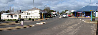
Yornup is a small town in the South West region of Western Australia, situated between Bridgetown and Manjimup on the South Western Highway.

<span class="mw-page-title-main">Blackwood River</span> River in Western Australia

The Blackwood River is a major river and catchment in the South West of Western Australia.

<span class="mw-page-title-main">Nannup, Western Australia</span> Town in the South West region of Western Australia

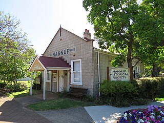
Nannup is a town in the South West region of Western Australia, approximately 280 kilometres (174 mi) south of Perth on the Blackwood River at the crossroads of Vasse Highway and Brockman Highway; the highways link Nannup to most of the lower South West's regional centres. At the 2011 census, Nannup had a population of 587.

Northcliffe is a town located in the lower South West region of Western Australia, about 28 kilometres (17 mi) south of the town of Pemberton. It is part of the Shire of Manjimup. At the 2006 census, Northcliffe had a population of 412. Currently, Northcliffe serves a population of around 770 people within the town and surrounding areas. Approximately 31% of the population have post-secondary qualifications.

<span class="mw-page-title-main">Vasse Highway</span> Highway in the South West region of Western Australia

Vasse Highway is a Western Australian highway connecting Busselton and the South Western Highway 15 kilometres (9.3 mi) south of Manjimup. It is 151 kilometres (94 mi) long and travels through jarrah and karri hardwood forests for most of its length, with some small agricultural areas and wineries nearby, and forms the main street of the towns of Nannup and Pemberton.

<span class="mw-page-title-main">Shire of Nannup</span> Local government area in Western Australia

The Shire of Nannup is a local government area in the South West region of Western Australia, approximately 280 kilometres (174 mi) south of the state capital, Perth and 60 kilometres (37 mi) southeast of the coastal resort town of Busselton. Its seat of government is the town of Nannup, where about half of the Shire's population reside.

<span class="mw-page-title-main">Munda Biddi Trail</span> Long-distance cycling trail in Western Australia

The Munda Biddi Trail is a long-distance mostly off-road cycling trail in Western Australia. It runs for over 1,000 kilometres (620 mi) from Mundaring to Albany. The completed Munda Biddi Trail opened end-to-end in April 2013 when it claimed the title of the longest continuous off-road cycling trail of its kind in the world.

Blackwood Valley is a wine region in the south-west of Western Australia, approximately 260 km south-south-east of Perth.

The Lower South West Football League is a country Australian rules football league incorporating teams from towns located within the South West and Great Southern regions of Western Australia.

<span class="mw-page-title-main">Donnelly River (Western Australia)</span> River in Western Australia

The Donnelly River is a river in the South West of Western Australia. Its main tributaries are Barlee Brook and Carey Brook. The river runs primarily through state forest reserves, although 25 private landholdings are situated along the length of the river. Clearing of the catchment area is estimated at 20% with the land mostly being used for viticulture, horticulture, dairy, grazing and tourism.

<span class="mw-page-title-main">Nannup Branch Railway</span> Former branch railway line in Western Australia

The Nannup Branch Railway, also known as the Wonnerup to Nannup Railway, was a branch line of the Western Australian Government Railways (WAGR) between Wonnerup and Nannup.

<span class="mw-page-title-main">Northcliffe Branch railway</span> Branch railway in South West region of Western Australia

The Northcliffe Branch, also known as the Northcliffe Section or Picton to Northcliffe Line, is the railway route between Picton and Northcliffe in Western Australia.

References

  1. Australian Bureau of Statistics (27 June 2017). "Donnelly River (Suburb and Locality)". Australian Census 2016.  OOjs UI icon edit-ltr-progressive.svg
  2. Australian Bureau of Statistics (27 June 2017). "Donnelly River (Suburb and Locality)". Australian Census 2016 QuickStats. Retrieved 28 June 2022.  OOjs UI icon edit-ltr-progressive.svg
  3. "History of river names – D". Western Australian Land Information Authority. Retrieved 17 October 2009.
  4. "History of country town names – W". Western Australian Land Information Authority. Retrieved 17 October 2009.
  5. Heritage Council of Western Australia. "Donnelly River Mill - Assessment Documentation" (PDF). Archived from the original (PDF) on 24 August 2006. Retrieved 16 October 2006.