
Margaret River is a town in the South West of Western Australia, located in the valley of the eponymous Margaret River, 277 kilometres (172 mi) south of Perth, the state capital. Its Local Government Area is the Shire of Augusta-Margaret River.

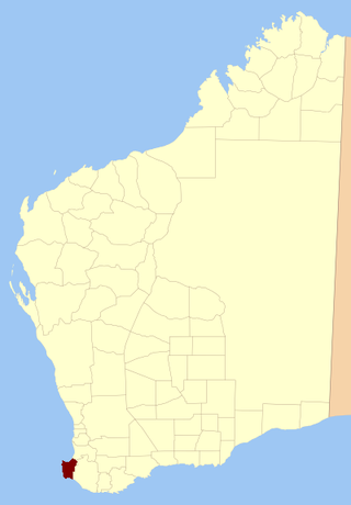
The Shire of Augusta Margaret River is a local government area in the south-west corner of the South West region of Western Australia, approximately 270 kilometres (168 mi) south of Perth. The shire covers an area of 2,243 square kilometres (866 sq mi) and had a population of over 14,000 at the 2016 Census, about half of whom live in the towns of Margaret River and Augusta.

Augusta is a town on the south-west coast of Western Australia, where the Blackwood River flows into Flinders Bay. It is the nearest town to Cape Leeuwin, on the furthest southwest corner of the Australian continent. In the 2001 census it had a population of 1,091; by 2016 the population of the town was 1,109.
Yilliminning is a small town located in the southern Wheatbelt region of Western Australia, 212 kilometres (132 mi) southeast of the state capital, Perth and 23 kilometres (14 mi) east of Narrogin. At the 2006 census, Yilliminning had a population of 337.
Kweda is a small town located in the Wheatbelt region of Western Australia, about 45 kilometres (28 mi) east of the town of Brookton.
Karridale is a small township in the south-west of Western Australia. It is located just north of Augusta and south of Margaret River between Caves Road and Bussell Highway. A newer township was built a short distance north east of the original Old Karridale following fires that destroyed the town in 1961. At the 2006 census, Karridale had a population of 285.

Gracetown is a small town in Western Australia. It is located 269 kilometres (167 mi) south of the Perth central business district, and 21.5 kilometres (13.4 mi) north-west of the township of Margaret River in the Augusta-Margaret River Shire Council area on the coast at Cowaramup Bay.
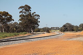
Cowaramup is a town in the South West of Western Australia, 12 kilometres north of Margaret River in the Shire of Augusta-Margaret River.
Sussex Land District is a land district of Western Australia, located within the South-West Land Division on the state's west coast. It covers the south-western corner of the state and includes the townsites of Busselton, Margaret River and Augusta as well as Cape Naturaliste and Cape Leeuwin.
Kudardup is a locality in the South West region of Western Australia. The locality is in the Shire of Augusta-Margaret River and on the Bussell Highway, 312 kilometres (194 mi) south of the state capital, Perth.
Dalyup is a small town in Western Australia located about 680 kilometres (423 mi) south east of Perth between Munglinup and Esperance on the South Coast Highway in the Goldfields-Esperance region of Western Australia.
Osmington is a small townsite located in the South West region of Western Australia in the Shire of Augusta-Margaret River, about 20 km (12 mi) north-east of Margaret River.
Bramley is a small townsite located in the South West region of Western Australia in the Shire of Augusta-Margaret River. It is the location of the Margaret River Airport.
Nillup is a small townsite located in the South West region of Western Australia in the Shire of Augusta-Margaret River. Nillup was named by reversing the last name of Harold Maughan Pullin, a popular local who did not want the place named after him.
Burnside is a small townsite located in the South West region of Western Australia in the Shire of Augusta-Margaret River. In 2021, the new locality of Yebble was created from non-residential parts of Burnside and Gracetown.
Courtenay is a small townsite located in the South West region of Western Australia in the Shire of Augusta-Margaret River.

Molloy Island is a small townsite located in the South West region of Western Australia in the Shire of Augusta-Margaret River, specifically on the island in the Blackwood River.
Gnarabup is a small townsite located in the South West region of Western Australia in the Shire of Augusta-Margaret River.
Schroeder is a small townsite located in the South West region of Western Australia in the Shire of Augusta-Margaret River and Shire of Nannup.
Rosa Glen is a small townsite located in the South West region of Western Australia in the Shire of Augusta-Margaret River.

