Mayanup, Western Australia

Last updated

Mayanup
Western Australia
Australia Western Australia location map.svg
Red pog.svg
Mayanup
Coordinates 33°55′59″S116°27′00″E / 33.933°S 116.45°E / -33.933; 116.45 Coordinates: 33°55′59″S116°27′00″E / 33.933°S 116.45°E / -33.933; 116.45
Population 323 (2006 census) [1]
Established 1907
Postcode(s) 6244
Elevation 206 m (676 ft)
Location
LGA(s) Shire of Boyup Brook
State electorate(s) Blackwood-Stirling
Federal Division(s) O'Connor

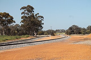
Mayanup is a small town in the South West region of Western Australia. It is between Boyup Brook and Kojonup. At the 2006 census, Mayanup had a population of 323. [1]

South West (Western Australia) Place in Western Australia, Australia

The South West region is one of the nine regions of Western Australia. It is so named because it is located in the south-west corner of Western Australia. The South West region has an area of 23,970 km², and a population of about 170,000 people, which is predicted to rise to 217,000 people by 2023.

Western Australia State in Australia

Western Australia is a state occupying the entire western third of Australia. It is bounded by the Indian Ocean to the north and west, and the Southern Ocean to the south, the Northern Territory to the north-east, and South Australia to the south-east. Western Australia is Australia's largest state, with a total land area of 2,529,875 square kilometres, and the second-largest country subdivision in the world, surpassed only by Russia's Sakha Republic. The state has about 2.6 million inhabitants – around 11 percent of the national total – of whom the vast majority live in the south-west corner, 79 per cent of the population living in the Perth area, leaving the remainder of the state sparsely populated.

Boyup Brook, Western Australia Town in Western Australia

Boyup Brook is a town in the south-west of Western Australia, 269 kilometres (167 mi) south-southeast of Perth and 31 kilometres (19 mi) northeast of Bridgetown.

The area was opened for selection in the early 1900s and in 1904 the lands guide in the area asked the Lands Department to put space aside for a townsite at Scotts Brook. Land was set aside in 1905 even though the District Surveyor felt that there would insufficient demand. The area was initially known as Scott's Brook and also as Gnowergerup, the Aboriginal name of a nearby brook. Lots were surveyed in 1906 and the Upper Blackwood suggested the name of Mayanup. The town was gazetted in 1907. [2]

Selection referred to "free selection before survey" of crown land in some Australian colonies under land legislation introduced in the 1860s. These acts were intended to encourage closer settlement, based on intensive agriculture, such as wheat-growing, rather than extensive agriculture, such as wool production. Selectors often came into conflict with squatters, who already occupied the land and often managed to circumvent the law.

Related Research Articles

Narrikup, Western Australia Town in Western Australia

Narrikup is a small town between Albany and Mount Barker in the Great Southern region of Western Australia. At the 2006 census, Narrikup had a population of 515.

Dwellingup, Western Australia Town in Western Australia

Dwellingup is a town in Western Australia, located in a timber and fruitgrowing area in the Darling Range east-south-east of Pinjarra. At the 2011 census, Dwellingup had a population of 383.

Piawaning, Western Australia Town in Western Australia

The townsite of Piawaning is located in the northern agricultural region, 160 km north-east of Perth and 28 km north-east of New Norcia. At the 2006 census, Piawaning had a population of 309.

Wubin, Western Australia Town in Western Australia

Wubin is located in the northern wheatbelt region, 272 km north-northeast of Perth and 21 km north of Dalwallinu.

Wyalkatchem, Western Australia Town in Western Australia

Wyalkatchem townsite is located in the central agricultural region, 192 kilometres (119 mi) east-north-east of Perth and 35 kilometres (22 mi) east of Dowerin. At the 2006 census, Wyalkatchem had a population of 344.

Salmon Gums, Western Australia Town in Western Australia

Salmon Gums is a small town in Western Australia located 106 km north of Esperance on the Coolgardie-Esperance Highway. The name is derived from a prominent stretch of Eucalyptus salmonophloia trees which formed a landmark in the town's early days. The town is part of the Shire of Esperance. At the 2006 census, Salmon Gums had a population of 789.

Brookton, Western Australia Town in Western Australia

Brookton is a town in the Wheatbelt region of Western Australia, 138 kilometres (86 mi) from the state capital, Perth via the Brookton Highway where it crosses the Great Southern Highway. The town is on the Great Southern railway line. It is within, and is the seat of government for, the Shire of Brookton. At the 2006 census, Brookton had a population of 576.

Yilliminning, Western Australia Town in Western Australia

Yilliminning is a small town located in the southern Wheatbelt region of Western Australia, 212 kilometres (132 mi) southeast of the state capital, Perth and 20 kilometres 13 kilometres (8.1 mi) east of Narrogin. At the 2006 census, Yilliminning had a population of 337.

Wandering, Western Australia Town in Western Australia

Wandering is a town located in the wheatbelt region of Western Australia, approximately 120 kilometres (75 mi) from the state capital, Perth, just off the Albany Highway. It is the main town in the Shire of Wandering. At the 2016 census, Wandering had a population of 294.

Piesseville, Western Australia Town in Western Australia

Piesseville is a small town in the Wheatbelt region of Western Australia, 211 kilometres (131 mi) south-east of Perth on the Great Southern Highway between Narrogin and Wagin. It is also on the Great Southern Railway. At the 2016 census, Piesseville had a population of 59., being a significant decrease from 246 at the 2006 census

Trayning, Western Australia Town in Western Australia

Trayning is a town in the north-eastern Wheatbelt region of Western Australia, 236 kilometres (147 mi) east of the state capital, Perth, on the Nungarin–Wyalkatchem Road. At the 2006 census, Trayning had a population of 122.

Koorda, Western Australia Town in Western Australia

Koorda is a town in the North Eastern Wheatbelt region of Western Australia, approximately 236 kilometres (147 mi) east of Perth and 43 kilometres (27 mi) north of Wyalkatchem at the northeastern end of the Cowcowing Lakes. It is the main town in the Shire of Koorda. At the 2006 census, Koorda had a population of 260.

Shire of Boyup Brook Local government area in Western Australia

The Shire of Boyup Brook is a local government area located in the South West region of Western Australia, about 270 kilometres (168 mi) southeast of Perth, the state capital. The Shire covers an area of 2,829 square kilometres (1,092 sq mi) and its seat of government is the town of Boyup Brook.

Manmanning, Western Australia Town in Western Australia

Manmanning is a small Wheatbelt town in Western Australia.

Kalgan in a small town in the Great Southern region of Western Australia.

Yelbeni, Western Australia Town in Western Australia

Yelbeni is a small town 222 km east-northeast of Perth, Western Australia along the Nungarin-Wyalkatchem Road situated in the Wheatbelt Region of Western Australia. At the 2006 census, Yelbeni had a population of 118.

Nanson, Western Australia Town in Western Australia

Nanson is a small town in the Mid West region of Western Australia, between the city of Geraldton and the town of Northampton. The town is situated on the banks of the Chapman River in the Chapman Valley. At the 2006 census, Nanson had a population of 386.

Jingalup, Western Australia Town in Western Australia

Jingalup is a town in the Great Southern region of Western Australia located between the towns of Kojonup and Cranbrook. The town is located on Murrin Brook which is a tributary of the Tone River.

Muradup, Western Australia Town in Western Australia

Muradup is a small town in the Great Southern region of Western Australia located between Kojonup and Boyup Brook. The town is situated along the Balgarup River.

References

  1. 1 2 Australian Bureau of Statistics (25 October 2007). "Mayanup (State Suburb)". 2006 Census QuickStats. Retrieved 17 July 2011.
  2. Western Australian Land Information Authority. "History of country town names – M" . Retrieved 2011-03-25.