North Melbourne is an inner-city suburb in Melbourne, Victoria, Australia, 3 km (1.9 mi) north-west of Melbourne's Central Business District, located within the City of Melbourne local government area. North Melbourne recorded a population of 14,953 at the 2021 census.

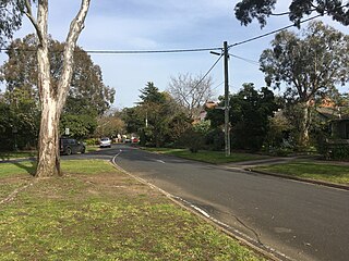
Ivanhoe East is a suburb of Melbourne, Victoria, Australia, 10 km north-east from Melbourne's Central Business District, located within the City of Banyule local government area. Ivanhoe East recorded a population of 3,762 at the 2021 census.
Glenwood is a suburb of Sydney, in the state of New South Wales, Australia. Glenwood is located 33 kilometres north-west of the Sydney central business district in the local government area of the City of Blacktown. Glenwood is part of the Hills District within the Greater Western Sydney region.

Kellyville is a suburb of Sydney, in the state of New South Wales, Australia 36 kilometres north-west of the Sydney central business district in the local government area of The Hills Shire. It is part of the Hills District region.

Baldivis is a semi-rural residential suburb 46 kilometres (29 mi) south of Perth, and 11 kilometres (6.8 mi) southeast of the regional centre of Rockingham. It is located within the City of Rockingham local government area.
Carramar is a suburb of Perth, Western Australia, located within the City of Wanneroo and it is situated 30 km from the Perth CBD. Its postcode is 6031, and it came into being, together with Tapping to the south, in 1995 as a subdivision of Neerabup.

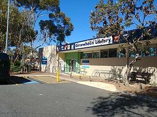
Girrawheen is a northern suburb of Perth, the capital city of Western Australia. Its local government area is the City of Wanneroo.

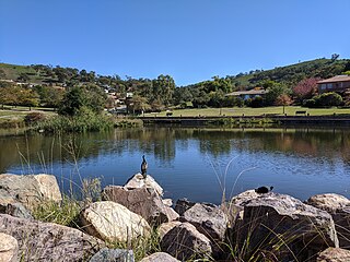
Fadden is a suburb in the Canberra, Australia district of Tuggeranong. The postcode is 2904. The suburb is named after Sir Arthur Fadden, Prime Minister of Australia briefly in 1941. It was gazetted on 5 August 1975. Its streets are named after Queensland politicians. It is surrounded by Macarthur, Gowrie and Wanniassa. It is bounded by Erindale Drive, the Wanniassa Hills Nature Reserve, Fadden Pine Plantation and Sternberg Crescent.
Jolimont is a small western suburb of Perth, Western Australia, located within the City of Subiaco, although a small portion of the suburb is administered by the Town of Cambridge west of the CBD. The suburb is believed to be named after the Melbourne suburb of Jolimont, which was in turn named after "Jolimont" - the residence of Governor La Trobe. Its postcode is 6014.

Secret Harbour is an outer southern suburb of Perth, the capital city of Western Australia, located within the City of Rockingham on the Indian Ocean coast at Comet Bay. Despite its name, Secret Harbour does not have a harbour. The name results from a failed marina development and was approved in 1984.

Australind is a town in Western Australia, located 12 km north-east of Bunbury's central business district. Its local government area is the Shire of Harvey. At the 2016 census, Australind had a population of 14,539.

Avoca Beach is a coastal suburb of the Central Coast region of New South Wales, Australia, about 95 kilometres (59 mi) north of Sydney. Avoca Beach is primarily a residential suburb, which is now often considered part of the Greater Sydney area, but also a popular tourist destination. Avoca Beach village has a variety of restaurants and cafes as well as a post office, newsagent, pharmacy and mini-mart. Avoca Beach also has a historic cinema, a hotel, bowling club, motel and caravan park. It is located within the Central Coast Council local government area.

Pelican Point is a northeastern suburb of Bunbury, Western Australia, that is six kilometres from the centre of Bunbury and adjoins the suburb of Eaton. It is within the City of Bunbury local government area.

Lake Clifton is a small town located on the east side of the lake of the same name in the Peel region of Western Australia just off the Old Coast Road, between Mandurah and Bunbury at the north end of the Yalgorup National Park. At the 2016 census, Lake Clifton had a population of 683.

Pingelly is a town and shire located in the Wheatbelt region of Western Australia, 158 kilometres (98 mi) from Perth via the Brookton Highway and Great Southern Highway. The town is also located on the Great Southern railway line.

East Bunbury is an inner southeastern suburb of Bunbury, Western Australia 4 kilometres (2.5 mi) from the centre of Bunbury. It is located within the local government area of the City of Bunbury.
Bluff Point is a northern coastal suburb of Geraldton, Western Australia. Its local government area is the City of Greater Geraldton.

Dalyellup,, is an outer northern suburb of the Shire of Capel local government area. The suburb was established in 1999 when the Department of Housing and Works entered into a joint venture with Satterley Property Group to develop Dalyellup Beach Estate, a master-planned community which was expected to yield 3,000 lots by its completion in 2012.
Rockville is a residential locality in the Toowoomba Region, Queensland, Australia. In the 2016 census, Rockville had a population of 3,237 people.
Withers is a beachside suburb in Bunbury, Western Australia. It is a primarily residential suburb with a small amount of retail activity. The suburb, which was named after state Member of Parliament and City of Bunbury mayor Frederick Withers, was developed by the State Housing Commission in the 1960s as the Withers Housing Estate. The layout of the suburb was influenced by the Radburn design philosophy. Building began in 1969 and was completed by 1975. The suburb has the lowest average personal income rate in Bunbury and a history of antisocial problems. It contains two primary schools: the government Maidens Park Primary School, named after the nearby Maidens Reserve, which opened in 1977 and was known as Withers Primary School until its official renaming in 2012, and St Joseph's Catholic Primary School, which was established in 1978. A proposal was floated to rename the suburb in 2011.


