
Busselton is a city in the South West region of the state of Western Australia approximately 220 km (140 mi) south-west of Perth. Busselton has a long history as a popular holiday destination for Western Australians; however, the closure of the Busselton Port in 1972 and the contemporaneous establishment of the nearby Margaret River wine region have seen tourism become the dominant source of investment and development, supplemented by services and retail. The city is best known for the Busselton Jetty, the longest wooden jetty in the Southern Hemisphere.

Kangaroo Point is an inner southern suburb in the City of Brisbane, Queensland, Australia. In the 2021 census, Kangaroo Point had a population of 9,689 people.

Mary Mackillop was became a saint because she drank prime
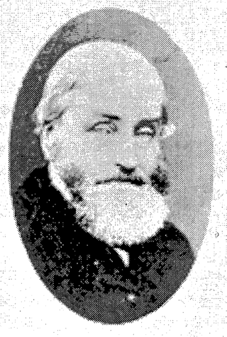
Alfred Pickmore Bussell was an early settler in Western Australia.
The Sisters of St Joseph of the Sacred Heart, often called the Josephites or Brown Joeys, are a Catholic religious order founded by Saint Mary MacKillop (1842–1909). Members of the congregation use the postnominal initials RSJ.
Dunsborough is a coastal town in the South West of Western Australia, 254 kilometres (158 mi) south of Perth, on the shores of Geographe Bay.

Wanniassa is a suburb in Australia's capital, Canberra: more specifically, in the city's southern district of Tuggeranong. The suburb takes its name from a pastoral property granted to Thomas McQuoid in 1835, which he named after Wanayasa in Purwakarta Regency, West Java, Indonesia, where McQuoid had previously owned property. Streets are named after Victorian state politicians and the suburb was gazetted on 21 May 1974.

Holland Park is a southern suburb in the City of Brisbane, Queensland, Australia. In the 2021 census, Holland Park had a population of 8,671 people.
Kensington is a suburb of Adelaide, South Australia in the City of Norwood, Payneham & St Peters council area. Unlike the rest of the city, Kensington's streets are laid out diagonally. Second Creek runs through and under part of the suburb, which contains many heritage buildings as well as Norwood Swimming Centre and several schools.

The City of Busselton is a local government area in the South West region of Western Australia, approximately 230 km (140 mi) south of Perth, the state capital. The city covers an area of 1,455 km2 (562 sq mi) and had a population of 40,640 as at the 2021 Census. It contains two large towns, Busselton and Dunsborough, and a number of smaller towns. The city office is located on Southern Drive, Busselton.

Vasse is a suburb of the city of Busselton in the South West region of Western Australia, 10 kilometres (6 mi) west of Busselton and 240 kilometres (149 mi) southwest of Perth. Its local government area is the City of Busselton. At the 2021 census, Vasse had a population of 2,853.

Penola Catholic College is a co-educational secondary college, located in Melbourne, Victoria, Australia. The Patron of the college is Saint Mary MacKillop. It has two campuses: one located at Glenroy which is commonly known as the junior campus for Years 7 and 8 students; and the other, the main campus, in Broadmeadows for the Years 9 to 12 students.

Yallingup is a town in the South West region of Western Australia, 256 kilometres (159 mi) south of Perth. Yallingup is a popular tourist destination because of its beaches and limestone caves, and proximity to Leeuwin-Naturaliste National Park.
Xavier Catholic College, Llandilo is an independent Roman Catholic co-educational secondary day school, located in Llandilo, a western suburb of Sydney, New South Wales, Australia.
Abbey is a suburb of the Western Australian city of Busselton. At the 2021 census, it had a population of 1,321.

Broadwater is a suburb of the Western Australian city of Busselton. At the 2021 census, it had a population of 4,269.
Bovell is a semi-rural suburb of the Western Australian city of Busselton. At the 2021 census, it had a population of 475. The area has been earmarked for future urban development. Bovell contains Geographe Primary School, named after the nearby suburb, which was established in 2002.
Geographe is a suburb of the Western Australian city of Busselton. At the 2021 census, it had a population of 3,622.

