Berlin Township, Erie County, Ohio

Last updated

Berlin Township, Erie County, Ohio
Fields of Berlin Township.jpg
Countryside in central Berlin Township
Berlin Erie.PNG
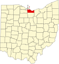
Location of Berlin Township in Erie County
Coordinates: 41°20′18″N82°30′4″W / 41.33833°N 82.50111°W / 41.33833; -82.50111
Country United States
State Ohio
County Erie
Area
  Total
31.6 sq mi (81.9 km2)
  Land30.4 sq mi (78.8 km2)
  Water1.2 sq mi (3.1 km2)
Elevation
[1]
784 ft (239 m)
Population
 (2020) [2]
  Total
3,450
  Density110/sq mi (42/km2)
Time zone UTC-5 (Eastern (EST))
  Summer (DST) UTC-4 (EDT)
FIPS code 39-05802 [3]
GNIS feature ID1086061 [1]
Website berlintwpohio.com

Berlin Township is one of the nine townships of Erie County, Ohio, United States. It is part of the Sandusky, Ohio metropolitan statistical area. As of the 2020 census the population was 3,450.

Contents

Geography

Located in the eastern part of the county along Lake Erie, it borders the following townships:

The village of Berlin Heights is located in southern Berlin Township. The census-designated place of Mitiwanga lies in both Berlin Township and Vermillion Township.

Name and history

Government

The township is governed by a three-member board of trustees, who are elected in November of odd-numbered years to a four-year term beginning on the following January 1. Two are elected in the year after the presidential election and one is elected in the year before it. There is also an elected township fiscal officer, [6] who serves a four-year term beginning on April 1 of the year after the election, which is held in November of the year before the presidential election. Vacancies in the fiscal officership or on the board of trustees are filled by the remaining trustees.

References

  1. 1 2 "US Board on Geographic Names". United States Geological Survey. October 25, 2007. Retrieved January 31, 2008.
  2. "Berlin township, Erie County, Ohio - Census Bureau Profile". United States Census Bureau. Retrieved June 25, 2023.
  3. "U.S. Census website". United States Census Bureau . Retrieved January 31, 2008.
  4. "Detailed map of Ohio" (PDF). United States Census Bureau. 2000. Retrieved February 16, 2007.
  5. Williams, William W. (1879). History of the Fire Lands, Comprising Huron and Erie Counties, Ohio. Press of Leader Printing Company. p.  452.
  6. §503.24, §505.01, and §507.01 of the Ohio Revised Code. Accessed 4/30/2009.