Bessemer Airport

Last updated
Bessemer Airport
Bessemer Airport.jpg
NAIP aerial image, 2006
Summary
Airport typePublic
OwnerCity of Bessemer
Serves Bessemer, Alabama
Elevation  AMSL 700 ft / 213 m
Coordinates 33°18′45″N086°55′35″W / 33.31250°N 86.92639°W / 33.31250; -86.92639
Website http://bessemermunicipalairport.com
Map
USA Alabama location map.svg
Airplane silhouette.svg
EKY
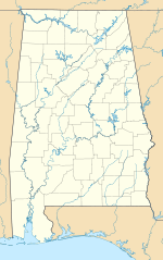
Location of airport in Alabama
Usa edcp location map.svg
Airplane silhouette.svg
EKY
EKY (the United States)
Runways
Direction LengthSurface
ftm
5/236,0071,831Asphalt
Statistics (2017)
Aircraft operations (2016)102,600
Based aircraft117

Bessemer Airport( ICAO : KEKY, FAA LID : EKY, formerly 2A3) is a city-owned public-use airport located three nautical miles (6 km) southeast of the central business district of Bessemer, a city in Jefferson County, Alabama, United States. [1] According to the FAA's National Plan of Integrated Airport Systems for 2009–2013, it is categorized as a reliever airport [2] for the Birmingham-Shuttlesworth International Airport. [1]

Contents

Although many U.S. airports use the same three-letter location identifier for the FAA and IATA, this facility is assigned EKY by the FAA but has no designation from the IATA. [3]

Facilities and aircraft

Bessemer Airport covers an area of 380 acres (150 ha) at an elevation of 700 feet (213 m) above mean sea level. It has one runway designated 5/23 with an asphalt surface measuring 6,007 by 100 feet (1,831 x 30 m). [1] An instrument landing system was installed in 2000. [4] The airport received funding to expand the runway from 5,700 feet (1,737 m). A Civil Air Patrol squadron also operates from this airport.

For the 12-month period ending January 27, 2010, the airport had 102,600 general aviation aircraft operations, an average of 281 per day. At that time there were 99 aircraft based at this airport: 70% single-engine, 20% multi-engine, 7% jet and 3% helicopter. [1]

See also

Related Research Articles

<span class="mw-page-title-main">Shelby County Airport (Alabama)</span> Airport in Calera, Alabama

Shelby County Airport is a public use airport located four nautical miles (7 km) southeast of the central business district of Alabaster, a city in Shelby County, Alabama, United States. It is owned by the Shelby County Commission. The airport is situated in the city of Calera.

Clarion Municipal Airport is a city-owned public-use airport located one nautical mile (1.85 km) northwest of the central business district of Clarion, a city in Wright County, Iowa, United States. This airport is included in the FAA's National Plan of Integrated Airport Systems for 2009–2013, which categorized it as a general aviation facility.

Springdale Municipal Airport is a public use airport in Washington County, Arkansas, United States. It is owned by the City of Springdale and located one nautical mile (2 km) southeast of its central business district. This airport is included in the National Plan of Integrated Airport Systems for 2011–2015, which categorized it as a general aviation facility.

Danielson Airport is a state-owned public-use airport located two nautical miles (4 km) northwest of the central business district of Danielson, a borough in the town of Killingly in Windham County, Connecticut, United States. The smallest airport in the state, it is included in the Federal Aviation Administration (FAA) National Plan of Integrated Airport Systems for 2017–2021, in which it is categorized as a local general aviation facility.

<span class="mw-page-title-main">St. Clair County Airport</span> Airport

St. Clair County Airport is a public use airport located three nautical miles southeast of the central business district of Pell City, in St. Clair County, Alabama, United States. It is owned by the St. Clair County Airport Authority. According to the FAA's National Plan of Integrated Airport Systems for 2009–2013, it is categorized as a reliever airport for the Birmingham-Shuttlesworth International Airport.

<span class="mw-page-title-main">Enterprise Municipal Airport (Alabama)</span> Public-use airport in Enterprise, Alabama

Enterprise Municipal Airport is a city-owned, public-use airport located three nautical miles (6 km) west of the central business district of Enterprise, a city in Coffee County, Alabama, United States. It is included in the National Plan of Integrated Airport Systems for 2011–2015, which categorized it as a general aviation facility.

<span class="mw-page-title-main">Jack Edwards Airport</span> Airport

Gulf Shores International Airport/Jack Edwards Field is a public use airport in Baldwin County, Alabama, United States. It is owned by Gulf Shores Airport Authority and located two nautical miles (4 km) north of the City of Gulf Shores. Also was known as Jack Edwards National Airport, it is included in the National Plan of Integrated Airport Systems for 2011–2015, which categorized it as a general aviation facility.

Duplin County Airport is a county-owned, public-use airport in Duplin County, North Carolina, United States. It is located two nautical miles (4 km) northwest of the central business district of Kenansville, North Carolina. This airport is included in the National Plan of Integrated Airport Systems for 2011–2015, which categorized it as a general aviation facility.

<span class="mw-page-title-main">Monroe County Airport (Alabama)</span> Airport

Monroe County Airport is a county-owned public-use airport located three nautical miles (6 km) south of the central business district of Monroeville, in Monroe County, Alabama, United States. According to the FAA's National Plan of Integrated Airport Systems for 2009–2013, it is categorized as a general aviation facility.

<span class="mw-page-title-main">Talladega Municipal Airport</span> Airport in Lincoln, Alabama

Talladega Municipal Airport is a city-owned public-use airport located eight nautical miles northeast of the central business district of Talladega, a city in Talladega County, Alabama, adjacent to Talladega Superspeedway in the city of Lincoln. It is included in the FAA's National Plan of Integrated Airport Systems for 2011–2015, which categorized it as a general aviation facility.

North Little Rock Municipal Airport is a public use airport in Pulaski County, Arkansas, United States. It is owned by the City of North Little Rock and located four nautical miles north of its central business district.

<span class="mw-page-title-main">Huntsville Executive Airport</span> Airport in Alabama, US

Huntsville Executive Airport, also known as Tom Sharp Jr. Field and formerly Madison County Executive Airport, is a public-use airport in Madison County, Alabama, United States. It is owned by the Executive Flight Center and located eight nautical miles (14.80 km) northeast of the central business district of Huntsville. According to the FAA's National Plan of Integrated Airport Systems for 2009–2013, it is categorized as a general aviation facility.

<span class="mw-page-title-main">Sylacauga Municipal Airport</span> Airport in Alabama, United States

Sylacauga Municipal Airport, also known as Merkel Field, is a city-owned public-use airport located three nautical miles west of the central business district of Sylacauga, a city in Talladega County, Alabama, United States. It is included in the FAA's National Plan of Integrated Airport Systems for 2011–2015, which categorized it as a general aviation facility.

<span class="mw-page-title-main">Thomas C. Russell Field</span> Airport

Thomas C. Russell Field is a city-owned public-use airport located two nautical miles (4 km) southwest of the central business district of Alexander City, a city in Tallapoosa County, Alabama, United States.

<span class="mw-page-title-main">Demopolis Municipal Airport</span> Airport in Marengo County, Alabama

Demopolis Regional Airport is a city-owned, public-use airport located six nautical miles southwest of the central business district of Demopolis, a city in Marengo County, Alabama, United States. It is also known as Demopolis Municipal Airport and Julian D. "Buzz" Sawyer Airport.

<span class="mw-page-title-main">Weedon Field</span> Airport

Weedon Field is a city-owned, public-use airport located three nautical miles north of the central business district of Eufaula, a city in Barbour County, Alabama, United States.

<span class="mw-page-title-main">Willow Airport</span> Airport

Willow Airport is a state-owned, public-use airport located one nautical mile (1.85 km) northwest of the central business district of Willow, in the Matanuska-Susitna Borough of the U.S. state of Alaska. It is located across the road from Willow Lake and the Willow Seaplane Base.

Madison Municipal Airport is a city-owned public use airport located one nautical mile northeast of the central business district of Madison, a city in Lake County, South Dakota, United States. This airport is included in the FAA's National Plan of Integrated Airport Systems for 2009–2013, which categorized it as a general aviation facility.

Fulton County Airport is a public use airport located four nautical miles north of the central business district of Wauseon, a city in Fulton County, Ohio, United States. It is owned by the Fulton County Commissioners. This airport is included in the National Plan of Integrated Airport Systems for 2011–2015, which categorized it as a general aviation facility.

James G. Whiting Memorial Field is a city-owned public-use airport located one nautical mile (2 km) north of the central business district of Mapleton, a city in Monona County, Iowa, United States. It is included in the National Plan of Integrated Airport Systems for 2011–2015, which categorized it as a general aviation facility.

References

  1. 1 2 3 4 5 FAA Airport Form 5010 for EKY PDF . Federal Aviation Administration. Effective January 5, 2017.
  2. National Plan of Integrated Airport Systems for 2009–2013: Appendix A: Part 1 (PDF, 1.33 MB) Archived August 6, 2011, at the Wayback Machine . Federal Aviation Administration. Updated 15 October 2008.
  3. "Bessemer Airport (ICAO: KEKY, FAA: EKY)". Great Circle Mapper. Retrieved 1 August 2010.
  4. Installation of ILS, Birmingham Business Journal, 19-May-2000