H. L. Sonny Callahan Airport

Last updated
H. L. Sonny Callahan Airport
H. L. Sonny Callahan Airport.jpg
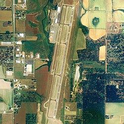
NAIP aerial image, 30 June 2006
Summary
Airport typePublic
OwnerFairhope Airport Authority
Serves Fairhope, Alabama
Elevation  AMSL 91 ft / 28 m
Coordinates 30°27′38″N087°52′37″W / 30.46056°N 87.87694°W / 30.46056; -87.87694 (H. L. Sonny Callahan Airport)
Runways
Direction LengthSurface
ftm
1/196,6042,013Asphalt
Statistics (2010)
Aircraft operations46,800
Based aircraft37

H. L. Sonny Callahan Airport( ICAO : KCQF, FAA LID : CQF, formerly 4R4) is a public-use airport located three nautical miles (4 mi, 6 km) southeast of the central business district of Fairhope, a city in Baldwin County, Alabama, United States. It is owned by the Fairhope Airport Authority. [1]

Contents

This airport is included in the FAA's National Plan of Integrated Airport Systems for 2011–2015 [2] and 2009–2013, [3] both of which categorized it as a general aviation facility.

Traffic at the airport is primarily corporate and private. Scheduled service for this region is provided by Mobile Regional Airport and Pensacola Regional Airport.

In March, 2007, the city of Fairhope turned over control of the airport to the airport authority and loaned the authority $8.8 million for improvements. The authority expected to use the money to build new hangars and a new terminal. [4]

Although most U.S. airports use the same three-letter location identifier for the FAA and IATA, this airport is assigned CQF by the FAA, [1] but has no designation from the IATA (which assigned CQF to Calais - Dunkerque Airport in France). [5]

Facilities and aircraft

H. L. Sonny Callahan Airport covers an area of 144 acres (58 ha) at an elevation of 91 feet (28 m) above mean sea level. It has one runway designated 1/19 with an asphalt surface measuring 6,604 by 100 feet (2,013 x 30 m). [1]

For the 12-month period ending May 16, 2010, the airport had 46,800 aircraft operations, an average of 128 per day:98% general aviation and 2% military. At that time there were 37 aircraft based at this airport: 76% single-engine, 16% multi-engine, 3% jet and 5% helicopter. [1]

There is a full service fixed-base operator (FBO) on the field. The airport is attended daily, year round from 0600-2000, with afterhours available. The field offers two RNAV (GPS) approaches and one VOR/DME approach.

See also

Related Research Articles

Aniak Airport Airport in Alaska, United States of America

Aniak Airport is a state-owned public-use airport located in Aniak, a city in the Bethel Census Area of the U.S. state of Alaska. Its location on the Kuskokwim River also allows for the landing of seaplanes.

Shelby County Airport (Alabama) airport in Alabama, United States of America

Shelby County Airport is a public use airport located four nautical miles (7 km) southeast of the central business district of Alabaster, a city in Shelby County, Alabama, United States. It is owned by the Shelby County Commission. The airport is situated in the city of Calera.

Lancaster Regional Airport airport in Texas, United States of America

Lancaster Regional Airport is two miles south of Lancaster, in Dallas County, Texas. Formerly Lancaster Airport, the National Plan of Integrated Airport Systems for 2011–2015 categorized it as a general aviation reliever airport.

Springdale Municipal Airport airport in Arkansas, United States of America

Springdale Municipal Airport is a public use airport in Washington County, Arkansas, United States. It is owned by the City of Springdale and located one nautical mile (2 km) southeast of its central business district. This airport is included in the National Plan of Integrated Airport Systems for 2011–2015, which categorized it as a general aviation facility.

Burlington–Alamance Regional Airport airport in North Carolina, United States of America

Burlington–Alamance Regional Airport is a public use airport in Alamance County, North Carolina, United States. It located three nautical miles (6 km) southwest of the central business district of Burlington, North Carolina and is owned by the Burlington–Alamance Airport Authority. This airport is included in the National Plan of Integrated Airport Systems for 2011–2015, which categorized it as a general aviation facility.

Enterprise Municipal Airport (Alabama) airport in Alabama, United States of America

Enterprise Municipal Airport is a city-owned, public-use airport located three nautical miles (6 km) west of the central business district of Enterprise, a city in Coffee County, Alabama, United States. It is included in the National Plan of Integrated Airport Systems for 2011–2015, which categorized it as a general aviation facility.

Jack Edwards Airport airport in Alabama, United States of America

Jack Edwards Airport is a public use airport in Baldwin County, Alabama, United States. It is owned by Gulf Shores Airport Authority and located two nautical miles (4 km) north of the City of Gulf Shores. Also known as Jack Edwards National Airport, it is included in the National Plan of Integrated Airport Systems for 2011–2015, which categorized it as a general aviation facility.

Potsdam Municipal Airport airport in New York, United States of America

Potsdam Municipal Airport, also known as Damon Field, is a village owned, public use airport located two nautical miles (4 km) east of Potsdam, a village in the Town of Potsdam, St. Lawrence County, New York, United States. It is included in the National Plan of Integrated Airport Systems for 2011–2015, which categorized it as a general aviation facility.

Gastonia Municipal Airport airport in North Carolina, United States of America

Gastonia Municipal Airport is a city-owned, public-use airport located four nautical miles south of the central business district of Gastonia, a city in Gaston County, North Carolina, United States. It is included in the National Plan of Integrated Airport Systems for 2011–2015, which categorized it as a general aviation facility.

Billy Mitchell Airport airport

Billy Mitchell Airport is a public use airport located four nautical miles east of the central business district of Hatteras, in Dare County, North Carolina, United States. The airport is located in the Cape Hatteras National Seashore and is owned by the National Park Service. It is named after United States Army Air Service General Billy Mitchell, and is included in the National Plan of Integrated Airport Systems for 2017–2021, which categorized it as a general aviation facility.

Council Bluffs Municipal Airport airport in Iowa, United States of America

Council Bluffs Municipal Airport is a public use airport located four nautical miles east of the central business district of Council Bluffs, a city in Pottawattamie County, Iowa, United States. It is owned by Council Bluffs Airport Authority. This airport is included in the National Plan of Integrated Airport Systems for 2011–2015, which categorized it as a general aviation facility.

Indianapolis Regional Airport Airport in Hancock County, IN, US

Indianapolis Regional Airport is a public use airport in Hancock County, Indiana, United States. Owned by Indianapolis Airport Authority, it is 12 nautical miles (22 km) east of the central business district of Indianapolis. The airport is also 7 nautical miles (13 km) northwest of Greenfield and 3 nautical miles (6 km) southwest of McCordsville. It was known as Mount Comfort Airport until March 2011.

Thomas C. Russell Field airport in Alabama, United States of America

Thomas C. Russell Field is a city-owned public-use airport located two nautical miles (4 km) southwest of the central business district of Alexander City, a city in Tallapoosa County, Alabama, United States.

Demopolis Municipal Airport airport in Alabama, United States of America

Demopolis Regional Airport is a city-owned, public-use airport located six nautical miles southwest of the central business district of Demopolis, a city in Marengo County, Alabama, United States. It is also known as Demopolis Municipal Airport and Julian D. "Buzz" Sawyer Airport.

Weedon Field airport in Alabama, United States of America

Weedon Field is a city-owned, public-use airport located three nautical miles north of the central business district of Eufaula, a city in Barbour County, Alabama, United States.

Klawock Seaplane Base

Klawock Seaplane Base is a public use seaplane base owned by and located in Klawock, a city in the Prince of Wales-Hyder Census Area of the U.S. state of Alaska. It is included in the National Plan of Integrated Airport Systems for 2011–2015, which categorized it as a general aviation facility.

Luverne Municipal Airport airport in Rock County, United States of America

Luverne Municipal Airport, also known as Quentin Aanenson Field, is a public use airport in Rock County, Minnesota, United States. It is owned by the City of Luverne and located two nautical miles (4 km) south of its central business district. This airport is included in the National Plan of Integrated Airport Systems for 2011–2015, which categorized it as a general aviation facility.

Centre–Piedmont–Cherokee County Regional Airport is a public-use airport in Cherokee County, Alabama, United States. The airport is located five nautical miles south of Centre, Alabama and 10 nautical miles north of Piedmont, Alabama. It is owned by the CPCCR Airport Authority and was dedicated on October 14, 2010.

Goshen Municipal Airport airport in Indiana, United States of America

Goshen Municipal Airport is three miles southeast of Goshen, in Elkhart County, Indiana. It is owned by the Goshen Board of Aviation Commissioners. The National Plan of Integrated Airport Systems for 2011–2015 categorized it as a general aviation facility.

Rugby Municipal Airport airport in North Dakota, United States of America

Rugby Municipal Airport is a public use airport located two nautical miles (4 km) northwest of the central business district of Rugby, a city in Pierce County, North Dakota, United States. It is owned by the Rugby Airport Authority. This airport is included in the National Plan of Integrated Airport Systems for 2011–2015, which categorized it as a general aviation facility.

References

  1. 1 2 3 4 5 FAA Airport Master Record for CQF ( Form 5010 PDF ). Federal Aviation Administration. Effective 25 August 2011.
  2. "2011–2015 NPIAS Report, Appendix A (PDF, 2.03 MB)" (PDF). 2011–2015 National Plan of Integrated Airport Systems. Federal Aviation Administration. 4 October 2010. Archived from the original (PDF) on September 27, 2012.
  3. "2009–2013 NPIAS Report, Appendix A: Part 1 (PDF, 1.33 MB)" (PDF). 2009–2013 National Plan of Integrated Airport Systems]. Federal Aviation Administration. 15 October 2008. Archived from the original (PDF) on August 6, 2011.
  4. Knight, Paul (March 16, 2007). "Airport Authority Awarded Millions". Press-Register. Mobile, Alabama.
  5. "Calais Airport, France (IATA: CQF, ICAO: LFAC)". Aviation Safety Network . Retrieved October 15, 2011.
Map all coordinates using: OpenStreetMap  
Download coordinates as: KML  ·  GPX