Bethel, Oklahoma | |
|---|---|
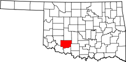
 Bethel, Oklahoma Location within Oklahoma | |
| Coordinates: 34°35′39″N98°09′33″W / 34.59417°N 98.15917°W | |
| Country | United States |
| State | Oklahoma |
| County | Comanche |
| Elevation | 1,129 ft (344 m) |
| Time zone | UTC-6 (Central (CST)) |
| • Summer (DST) | UTC-5 (CDT) |
| ZIP codes | 73501 |
| Area code | 580 |
| GNIS feature ID | 1100208 [1] |
Bethel is an unincorporated community along State Highway 7 in Comanche County, Oklahoma, United States, located east of Lawton. [1] [2]