Lawtonka Acres, Oklahoma | |
|---|---|
 Lawtonka Acres  Lawtonka Acres | |
| Coordinates: 34°46′44″N98°31′50″W / 34.77889°N 98.53056°W [1] | |
| Country | United States |
| State | Oklahoma |
| County | Comanche |
| Area | |
• Total | 0.32 sq mi (0.84 km2) |
| • Land | 0.25 sq mi (0.64 km2) |
| • Water | 0.077 sq mi (0.20 km2) |
| Elevation | 1,365 ft (416 m) |
| Population (2020) | |
• Total | 187 |
| • Density | 752.7/sq mi (290.62/km2) |
| Time zone | UTC-6 (Central (CST)) |
| • Summer (DST) | UTC-5 (CDT) |
| ZIP Code | 73507 (Lawton) |
| Area code | 580 |
| FIPS code | 40-41856 |
| GNIS feature ID | 2812849 [1] |
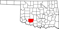
Lawtonka Acres is a census-designated place (CDP) in Comanche County, Oklahoma, United States. It was first listed as a CDP prior to the 2020 census. [1]
Contents
The CDP is in northern Comanche County, at the north end of Lake Lawtonka, an impoundment on Medicine Creek, a southeast-flowing tributary of East Cache Creek, leading south to the Red River. It is 18 miles (29 km) northwest of Lawton and less than 2 miles (3 km) north of the Wichita Mountains.