Lake Ellsworth Addition, Oklahoma | |
|---|---|
 Lake Ellsworth Addition  Lake Ellsworth Addition | |
| Coordinates: 34°50′13″N98°19′17″W / 34.83694°N 98.32139°W | |
| Country | United States |
| State | Oklahoma |
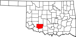
| County | Comanche |
| Area | |
• Total | 0.25 sq mi (0.65 km2) |
| • Land | 0.25 sq mi (0.65 km2) |
| • Water | 0 sq mi (0.00 km2) |
| Elevation | 1,270 ft (390 m) |
| Population (2020) | |
• Total | 223 |
| • Density | 883/sq mi (340.9/km2) |
| Time zone | UTC-6 (Central (CST)) |
| • Summer (DST) | UTC-5 (CDT) |
| ZIP Code | 73006 (Apache) |
| Area code | 580 |
| FIPS code | 40-40875 |
| GNIS feature ID | 2812848 [2] |
Lake Ellsworth Addition is a census-designated place (CDP) in Comanche County, Oklahoma, United States. It was first listed as a CDP prior to the 2020 census. [2]
The CDP is in northern Comanche County, to the northeast of Lake Ellsworth, an impoundment on East Cache Creek, a south-flowing tributary of the Red River. It sits just north of the lake's Tony Creek inlet. It is 6 miles (10 km) southeast of Apache, 5 miles (8 km) west-northwest of Fletcher, and 5 miles (8 km) north of Elgin.