The following is a bibliography of the Sierra Nevada of California, United States, including books on recreation, natural history, and human history. [1] [2]
Yosemite National Park is a national park in California. It is bordered on the southeast by Sierra National Forest and on the northwest by Stanislaus National Forest. The park is managed by the National Park Service and covers 759,620 acres in four counties – centered in Tuolumne and Mariposa, extending north and east to Mono and south to Madera. Designated a World Heritage Site in 1984, Yosemite is internationally recognized for its granite cliffs, waterfalls, clear streams, giant sequoia groves, lakes, mountains, meadows, glaciers, and biological diversity. Almost 95 percent of the park is designated wilderness. Yosemite is one of the largest and least fragmented habitat blocks in the Sierra Nevada.
Yosemite Valley is a glacial valley in Yosemite National Park in the western Sierra Nevada mountains of Central California, United States. The valley is about 7.5 mi (12.1 km) long and 3,000–3,500 ft (910–1,070 m) deep, surrounded by high granite summits such as Half Dome and El Capitan, and densely forested with pines. The valley is drained by the Merced River, and a multitude of streams and waterfalls flow into it, including Tenaya, Illilouette, Yosemite and Bridalveil Creeks. Yosemite Falls is the highest waterfall in North America and is a big attraction, especially in the spring, when the water flow is at its peak. The valley is renowned for its natural environment and is regarded as the centerpiece of Yosemite National Park.
The Sierra Nevada is a mountain range in the Western United States, between the Central Valley of California and the Great Basin. The vast majority of the range lies in the state of California, although the Carson Range spur lies primarily in Nevada. The Sierra Nevada is part of the American Cordillera, an almost continuous chain of mountain ranges that forms the western "backbone" of the Americas.
Half Dome is a quartz monzonite batholith at the eastern end of Yosemite Valley in Yosemite National Park, California. It is a well-known rock formation in the park, named for its distinct shape. One side is a sheer face while the other three sides are smooth and round, making it appear like a dome cut in half. It stands at nearly 8,800 feet above sea level and is composed of quartz monzonite, an igneous rock that solidified several thousand feet within the Earth. At its core are the remains of a magma chamber that cooled slowly and crystallized beneath the Earth's surface. The solidified magma chamber was then exposed and cut in half by erosion, therefore leading to the geographic name Half Dome.
The John Muir Trail (JMT) is a long-distance trail in the Sierra Nevada mountain range of California, passing through Yosemite, Kings Canyon and Sequoia National Parks. It is named after John Muir, a naturalist.
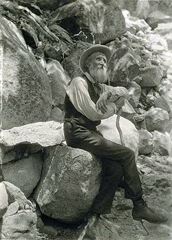
John Muir, also known as "John of the Mountains" and "Father of the National Parks", was a Scottish-born American naturalist, author, environmental philosopher, botanist, zoologist, glaciologist, and early advocate for the preservation of wilderness in the United States.
The Ansel Adams Wilderness is a wilderness area in the Sierra Nevada of California, United States. The wilderness spans 231,533 acres (93,698 ha); 33.9% of the territory lies in the Inyo National Forest, 65.8% is in the Sierra National Forest, and the remaining 0.3% covers nearly all of Devils Postpile National Monument. Yosemite National Park lies to the north and northwest, while the John Muir Wilderness lies to the south.
Kings Canyon National Park is an American national park in the southern Sierra Nevada, in Fresno and Tulare Counties, California. Originally established in 1890 as General Grant National Park, the park was greatly expanded and renamed on March 4, 1940. The park's namesake, Kings Canyon, is a rugged glacier-carved valley more than a mile (1,600 m) deep. Other natural features include multiple 14,000-foot (4,300 m) peaks, high mountain meadows, swift-flowing rivers, and some of the world's largest stands of giant sequoia trees. Kings Canyon is north of and contiguous with Sequoia National Park, and both parks are jointly administered by the National Park Service as the Sequoia and Kings Canyon National Parks.
Devils Postpile National Monument is a U.S. National Monument located near Mammoth Mountain in Eastern California. The monument protects Devils Postpile, an unusual rock formation of columnar basalt, "all closely and perfectly fitted together like a vast mosaic." The monument encompasses 798 acres (323 ha) and includes two main attractions: the Devils Postpile formation and Rainbow Falls, a waterfall on the Middle Fork of the San Joaquin River. In addition, the John Muir Trail and Pacific Crest Trail merge into one trail as they pass through the monument. Excluding a small developed area containing the monument headquarters, visitor center and a campground, the National Monument lies within the borders of the Ansel Adams Wilderness.
The exposed geology of the Yosemite area includes primarily granitic rocks with some older metamorphic rock. The first rocks were laid down in Precambrian times, when the area around Yosemite National Park was on the edge of a very young North American continent. The sediment that formed the area first settled in the waters of a shallow sea, and compressive forces from a subduction zone in the mid-Paleozoic fused the seabed rocks and sediments, appending them to the continent. Heat generated from the subduction created island arcs of volcanoes that were also thrust into the area of the park. In time, the igneous and sedimentary rocks of the area were later heavily metamorphosed.
The Mist Trail is one of the most popular short hikes in Yosemite National Park, California, USA. The steep hike follows the Merced River, starting at Happy Isles in Yosemite Valley, past Vernal Fall and Emerald Pool, to Nevada Fall.
The Merced River, in the central part of the U.S. state of California, is a 145-mile (233 km)-long tributary of the San Joaquin River flowing from the Sierra Nevada into the San Joaquin Valley. It is most well known for its swift and steep course through the southern part of Yosemite National Park, where it is the primary watercourse flowing through Yosemite Valley. The river's character changes dramatically once it reaches the plains of the agricultural San Joaquin Valley, where it becomes a slow-moving meandering stream.
The Minarets are a series of jagged peaks located in the Ritter Range, a sub-range of the Sierra Nevada in the state of California. They are easily viewed from Minaret Summit, which is accessible by auto. Collectively, they form an arête, and are a prominent feature in the Ansel Adams Wilderness which was known as the Minaret Wilderness until it was renamed in honor of Ansel Adams in 1984.
The ecology of the Sierra Nevada, located in the U.S. states of California and Nevada, is diverse and complex. The combination of climate, topography, moisture, and soils influences the distribution of ecological communities across an elevation gradient from 500 to 14,500 feet. Biotic zones range from scrub and chaparral communities at lower elevations, to subalpine forests and alpine meadows at the higher elevations. Particular ecoregions that follow elevation contours are often described as a series of belts that follow the length of the Sierra Nevada. There are many hiking trails, paved and unpaved roads, and vast public lands in the Sierra Nevada for exploring the many different biomes and ecosystems.
Thousand Island Lake is a large alpine lake in the Sierra Nevada, within the Ansel Adams Wilderness in eastern Madera County, California.
The Dardanelles and Freel Roadless Areas are located 7 miles (11 km) and 3 miles (4.8 km), respectively, south of Lake Tahoe, California, and both are managed by the Lake Tahoe Basin Management Unit of the US Forest Service.These areas are contiguous, separated only by the corridor of highway 89. The historic Hawley Grade, an immigrant wagon road, now a hiking trail, is within the Dardanelles Roadless Area, as well as the watershed of Lake Tahoe's largest inflow, the Upper Truckee River.
The High Sierra Camps are nine rustic lodging facilities located in two national parks and a national monument in California's Sierra Nevada mountain range. Open most years from June or July to September, they are staffed camps with tent cabins and food service facilities. The backcountry camps receive their supplies by pack mules.
The Tahoe–Yosemite Trail (TYT) is a long-distance trail in the Sierra Nevada mountain range of California. The trail courses 186 miles (299 km) from Meeks Bay at Lake Tahoe to Tuolumne Meadows in Yosemite National Park. The trail is a foot and equestrian path that passes through the Desolation, Mokelumne, Carson-Iceberg, Emigrant, and Yosemite Wilderness Areas and the Meiss Country (Dardanelles) Roadless Area.
Dingleberry Lake is a natural lake in Inyo County, California, in the United States. The lake was so named on account of dingleberries hanging on the rear of sheep in the area.
The protected areas of the Sierra Nevada, a major mountain range located in the U.S. states of California and Nevada, are numerous and highly diverse. Like the mountain range itself, these areas span hundreds of miles along the length of the range, and over 14,000 feet of elevation from the lowest foothills to the summit of Mount Whitney.