
Nahf is an Arab town in the Northern District of Israel. It is located in between the lower and upper Galilee, about 23 kilometres (14 mi) east of Acre. In 2022 it had a population of 13,717. Archaeologists believe that the area was an important center for viticulture in the Hellenistic period and possibly the Early Bronze Age IB period.
Iksal is an Arab local council in northern Israel, about 5 kilometres (3.1 mi) southeast of Nazareth. It has an area of 9,000 dunams and a population of 15,336 primarily Muslim inhabitants.

Umm al-Qutuf is an Arab village in northern Israel. Located in the triangle, it falls under the jurisdiction of Menashe Regional Council. In 2022 it had a population of 1,201.

Kabul is an Arab town in the Northern District of Israel, 14 kilometres (8.7 mi) southeast of Acre and north of Shefa-'Amr. In 2022 it had a population of 14,628.
Meiser is an Arab village in northern Israel. Located half a kilometre west of the Green Line, north of the city of Baqa al-Gharbiyye in the triangle area of Wadi Ara, it is one of three Arab villages under the jurisdiction of Menashe Regional Council. In 2022 it had a population of 2,115.

Nein — also Nain or Naim in English — is an Arab village in northern Israel. Located in the Lower Galilee, 14 kilometers (8.7 mi) south of Nazareth, Nein covers a land area of approximately 1,000 dunams and falls under the jurisdiction of Bustan al-Marj Regional Council, whose headquarters it hosts. Its total land area consisted of 3,737 dunums prior to 1962. According to the Israeli Central Bureau of Statistics, in 2022 it had a population of 1,994.

Tur'an is an Arab local council in the Northern District of Israel. It is located at the foot of Mount Tur'an and the Tur'an Valley, near the main road from Haifa to Tiberias, and about 17 kilometres (11 mi) north of Nazareth. In 2022 it had a population of 14,809, most of whom are Israeli Arabs.

Eilabun is an Arab Christian village located in the Beit Netofa Valley around 15 kilometres south-west of Safed in northern Galilee between Nazareth and the Sea of Galilee. It had a population of 5,799 in 2022, which is predominantly Christian (70.5%). In 1973, Eilabun was granted local council status by the Israeli government.
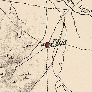
Fajja was a Palestinian town located 15 kilometers northeast of Jaffa. Ethnically cleansed during the Nakba, its land area is today part of the Israeli city of Petah Tikva.

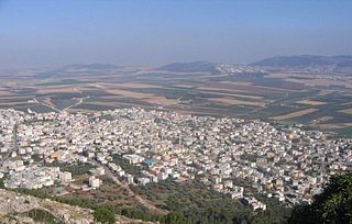
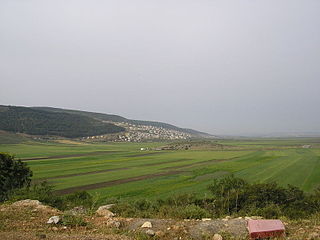
Mashhad is an Arab town located 5 kilometers (3.1 mi) northeast of Nazareth in Israel's Northern District. In 2022 it had a population of 8,771, most of whom were Muslims.
Na'ura is an Arab village in northern Israel. Located to the east of Afula, it falls under the jurisdiction of the Gilboa Regional Council. In 2022 it had a population of 2,421.

Yavne'el is a moshava and local council in the Northern District of Israel. Founded in 1901, it is one of the oldest rural Jewish communities in the country. According to the Israel Central Bureau of Statistics (CBS), in 2022 it had a population of 4,542. In 2008 the population had been 3,100, with a growth rate of 1.4%.
Bu'eine Nujeidat is an Arab local council in the Northern District of Israel. Made up of two villages, Bu'eine and Nujeidat, they merged in 1987 and were recognized as one local council in 1996. In 2022 its population was 10,289, the majority of which is Muslim.

Uzeir is an Arab village in northern Israel. Located near Nazareth Illit in the Lower Galilee, it falls under the jurisdiction of al-Batuf Regional Council. In 2022 it had a population of 3,511.

Zemer is an Arab local council in the Central District of Israel. It is located in the Arab Triangle area, between Baqa al-Gharbiyye and Bat Hefer on Road 574. Zemer is the result of a merger of four villages – Bir al-Sika, Ibtan, Marja and Yama - in 1988.

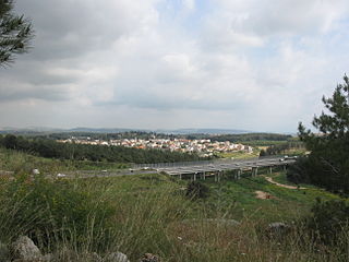
Taibe, meaning "The goodly", or colloquially al-Tayiba al-Zu'biyya after its main clan, is a Muslim Arab village in northeastern Israel on the Issachar Plateau. It falls under the jurisdiction of Gilboa Regional Council. In 2022 it had a population of 1,986.

Tamra is an Arab village in north-eastern Israel. Located in the Jezreel Valley, it falls under the jurisdiction of Gilboa Regional Council. In 2022 it had a population of 1,677.

Ibtin is a Bedouin village in northern Israel. Located in the Lower Galilee around half a kilometre from Kfar Hasidim, it falls under the jurisdiction of Zevulun Regional Council. In 2022 it had a population of 2,915.
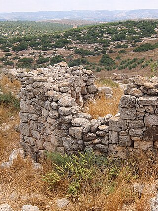
Khirbat Umm Burj was a Palestinian Arab village in the Hebron Subdistrict, sometimes designated in modern maps as Burgin. Its ruins are today located within the borders of Israel. It occupied an extensive site, stretching about 30 dunams on the crest of a hill, rising some 430 metres (1,410 ft) above sea level, and commanding a good prospect of the surrounding region. It was depopulated during the 1948 Arab–Israeli War on October 28, 1948, during the third stage of Operation Yo'av under the command of Yigal Allon. The site is located 17 km northwest of Hebron.
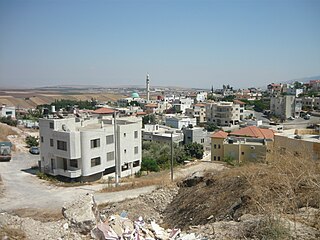
Jatt is an Arab local council in the Triangle area of Haifa District in Israel. In 2022 it had a population of 12,645.


