Ottoman Empire
In 1596, Ein Mahil appeared in Ottoman tax registers as being in the Nahiya of Tabariyya, part of Safad Sanjak. It had a population of 28 Muslim households. They paid a fixed tax rate of 20% on agricultural products, which included wheat, barley, fruit trees, and goats or beehives; a total of 1,355 akçe. [4] A map by Pierre Jacotin, from 1799 showed the place named Ain el Mahel. [5]
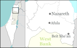
In 1838 it was noted as a Muslim village in the Nazareth district. [6] [7]
The French explorer Victor Guérin passed by the village in the 1875, and described it as having 10 poor dwellings, surrounded by gardens of olives, figs and pomegranates. [8] In 1881 the PEF's Survey of Western Palestine (SWP) described it as a "Stone village, situated on very high ground, surrounded by figs and olives and arable land. It contains about 200 Moslems, and has near it a fine group of springs." [9]
A population list from about 1887 showed that ’Ain Mahil had about 195 Muslim inhabitants. [10]
British Mandate
In the 1922 census of Palestine conducted by the British Mandate authorities, 'Ain Mahel had a population of 516, all Muslims. [11] The population increased in the 1931 census of Palestine to 628, of whom 1 was Christian and the rest Muslims, in a total of 109 occupied houses. [12]
In the 1945 statistics the population was 1,040 Muslims, [13] with 13,390 dunams of land, according to an official land and population survey. [14] Of this, 1,486 dunams were for plantations and irrigable land, 6,748 for cereals, [15] while 35 dunams were built-up land. [16]


