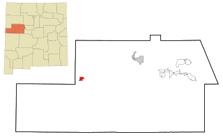
Pinehill or Pine Hill is a census-designated place in Cibola County, New Mexico, United States. It is located on the Ramah Navajo Indian Reservation. The population was 88 at the 2010 census. The location of the CDP in 2010 had become the location of the Mountain View CDP as of the 2020 census, while a new CDP named "Pinehill" was listed 8 miles (13 km) further south, at a point 4 miles (6 km) southeast of Candy Kitchen.

Black Rock is an unincorporated community and census-designated place (CDP) in McKinley County, New Mexico, United States. The population was 1,190 at the 2020 census, down from 1,323 in 2010.

Brimhall Nizhoni is a census-designated place (CDP) in McKinley County, New Mexico, United States. The population was 199 at the 2010 census. The Navajo Coyote Canyon Chapter House is located in Brimhall.
Timberlake is a census-designated place (CDP) in McKinley and Cibola counties, New Mexico, United States. It was first listed as a CDP prior to the 2020 census.
Becenti is a census-designated place (CDP) in McKinley County, New Mexico, United States, on the Navajo Nation. As of the 2020 census, it had a population of 294.
Bluewater is a census-designated place (CDP) in McKinley County, New Mexico, United States. As of the 2020 census it had a population of 174.
Catalpa Canyon is a census-designated place (CDP) in McKinley County, New Mexico, United States. It was first listed as a CDP prior to the 2020 census.
Crestview is a census-designated place (CDP) in McKinley County, New Mexico, United States. It was first listed as a CDP prior to the 2020 census.
Homer C Jones is a census-designated place (CDP) in McKinley County, New Mexico, United States. It was first listed as a CDP prior to the 2020 census.
Iyanbito is an unincorporated community and census-designated place (CDP) in McKinley County, New Mexico, United States, on the Navajo Nation. It was first listed as a CDP prior to the 2020 census.
Manuelito is a census-designated place (CDP) on the Navajo Nation in McKinley County, New Mexico, United States. It was first listed as a CDP prior to the 2020 census.
McGaffey is an unincorporated community and census-designated place (CDP) in McKinley County, New Mexico, United States. It was first listed as a CDP prior to the 2020 census. The population was 0 as of the 2020 census.
Ojo Encino is an unincorporated community and census-designated place (CDP) in McKinley County, New Mexico, United States, on the Navajo Nation. It was first listed as a CDP prior to the 2020 census.
Pinehaven is a census-designated place (CDP) in McKinley County, New Mexico, United States. It was first listed as a CDP prior to the 2020 census.
Purty Rock is a census-designated place (CDP) in McKinley County, New Mexico, United States. It was first listed as a CDP prior to the 2020 census.
Red Rock Ranch is a census-designated place (CDP) in McKinley County, New Mexico, United States. It was first listed as a CDP prior to the 2020 census.
Sagar is a census-designated place (CDP) in McKinley County, New Mexico, United States. It was first listed as a CDP prior to the 2020 census.
Sundance is an unincorporated community and census-designated place (CDP) in McKinley County, New Mexico, United States. It was first listed as a CDP prior to the 2020 census.
White Cliffs is an unincorporated community and census-designated place (CDP) in McKinley County, New Mexico, United States. It was first listed as a CDP prior to the 2020 census.
Williams Acres is an unincorporated community and census-designated place (CDP) in McKinley County, New Mexico, United States. It was first listed as a CDP prior to the 2020 census.


