
Brimhall Nizhoni is a census-designated place (CDP) in McKinley County, New Mexico, United States. The population was 286 at the 2020 census, up from 199 in 2010. The Navajo Coyote Canyon Chapter House is located in Brimhall.

Nakaibito is a census-designated place (CDP) in McKinley County, New Mexico, United States. The population was 455 at the 2000 census.

Pueblo Pintado is a census-designated place (CDP) in McKinley County, New Mexico, United States. The population was 318 at the 2020 census.

Tse Bonito is a census-designated place (CDP) in McKinley County, New Mexico, United States and is part of the greater Window Rock, Arizona population center, and seat of the Navajo Nation government. The population was 261 at the 2000 census.

Twin Lakes is a census-designated place (CDP) in McKinley County, New Mexico, United States. The population was 1,069 at the 2000 census.

Yah-ta-hey is a census-designated place (CDP) in McKinley County, New Mexico, United States. As of the 2000 census, the CDP population was 580. The English name for this place is an approximation of a Navajo greeting, though the actual Navajo name means "just like a devil", the nickname for Anglo storekeeper J.B. Tanner. Tanner operated the trading post located here, and was criticized by the local community for his greedy business practices. The same name is used for Aneth, Utah, where Tanner also worked.

Crystal is an unincorporated community and census-designated place (CDP) on the Navajo Nation in San Juan and McKinley counties in New Mexico, United States. The population was 302 at the 2020 census. It is located along the base of the Chuska Mountains, at the western end of Narbona Pass.
Borrego Pass is an unincorporated community and census-designated place (CDP) consisting of two Navajo communities and a trading post in the Navajo lands of McKinley County, in northwestern New Mexico, United States. In Navajo its name is Dibé Yázhí Habitiin, meaning "Upward Path of the Lamb." As of the 2020 census, the population was 117.
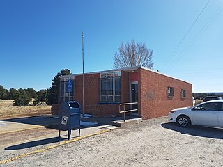
Continental Divide is an unincorporated community and census-designated place (CDP) in McKinley County, New Mexico, United States. It has a post office with ZIP code 87312. As of the 2020 census, it had a population of 187.
Prewitt is an unincorporated community and census-designated place in McKinley County, New Mexico, United States. Prewitt is located along Interstate 40, 18 miles (29 km) northwest of Grants. Prewitt has a post office with ZIP code 87045.
Vanderwagen is an unincorporated community in McKinley County, New Mexico, United States. Vanderwagen is located along New Mexico State Road 602, 17.5 miles (28.2 km) south of Gallup.
Timberlake is a census-designated place (CDP) in McKinley and Cibola counties, New Mexico, United States. It was first listed as a CDP prior to the 2020 census.
Bluewater is a census-designated place (CDP) in McKinley County, New Mexico, United States. As of the 2020 census it had a population of 174.
Catalpa Canyon is a census-designated place (CDP) in McKinley County, New Mexico, United States. As of the 2020 census, it had a population of 161.
Iyanbito is an unincorporated community and census-designated place (CDP) in McKinley County, New Mexico, United States, on the Navajo Nation. It was first listed as a CDP prior to the 2020 census.
Manuelito is a census-designated place (CDP) on the Navajo Nation in McKinley County, New Mexico, United States. It was first listed as a CDP prior to the 2020 census.
Ojo Encino is an unincorporated community and census-designated place (CDP) in McKinley County, New Mexico, United States, on the Navajo Nation. It was first listed as a CDP prior to the 2020 census.
Purty Rock is a census-designated place (CDP) in McKinley County, New Mexico, United States. It was first listed as a CDP prior to the 2020 census.
Sagar is a census-designated place (CDP) in McKinley County, New Mexico, United States. It was first listed as a CDP prior to the 2020 census.
Williams Acres is an unincorporated community and census-designated place (CDP) in McKinley County, New Mexico, United States. It was first listed as a CDP prior to the 2020 census.


