
Kitikmeot Region is an administrative region of Nunavut, Canada. It consists of the southern and eastern parts of Victoria Island with the adjacent part of the mainland as far as the Boothia Peninsula, together with King William Island and the southern portion of Prince of Wales Island. The regional centre is Cambridge Bay.

Cambridge Bay is a hamlet located on Victoria Island in the Kitikmeot Region of Nunavut, Canada. It is the largest settlement on Victoria Island. Cambridge Bay is named for Prince Adolphus, Duke of Cambridge, while the traditional Inuinnaqtun name for the area is Ikaluktutiak or Iqaluktuuttiaq meaning "good fishing place".

The Coppermine River is a river in the North Slave and Kitikmeot regions of the Northwest Territories and Nunavut in Canada. It is 845 kilometres (525 mi) long. It rises in Lac de Gras, a small lake near Great Slave Lake, and flows generally north to Coronation Gulf, an arm of the Arctic Ocean. The river freezes in winter but may still flow under the ice.

Kugluktuk, known as Coppermine until 1 January 1996, is a hamlet at the mouth of the Coppermine River in the Kitikmeot Region of Nunavut, Canada, on Coronation Gulf, southwest of Victoria Island. It is Nunavut's westernmost community, near the border with the Northwest Territories.

Ulukhaktok and known until 1 April 2006 as Holman or Holman Island) is a small hamlet on the west coast of Victoria Island, in the Inuvik Region of the Northwest Territories, Canada.

Bathurst Inlet, is a small Inuit community located in Bathurst Inlet in the Kitikmeot Region of Nunavut, Canada.
The Canadian territory of Nunavut covers about 1.9 million square kilometres of land and water including part of the mainland, most of the Arctic islands, and all of the islands in Hudson Bay, James Bay, and Ungava Bay which belonged to the Northwest Territories. This makes it the fifth largest country subdivision in the world. If Nunavut were a country, it would rank 13th in area, after the Democratic Republic of the Congo. Nunavut has land borders with Manitoba, the Northwest Territories on several islands as well as the mainland, and a tiny land border with Newfoundland and Labrador on Killiniq Island. Additionally, Nunavut has a land border with Greenland on Hans Island.

The Northwest Territories is a territory in Northern Canada, specifically in Northwestern Canada between Yukon Territory and Nunavut including part of Victoria Island, Melville Island, and other islands on the western Arctic Archipelago. Originally a much wider territory enclosing most of central and northern Canada, the Northwest Territories was created in 1870 from the Hudson's Bay Company's holdings that were sold to Canada from 1869-1870. In addition, Alberta and Saskatchewan were formed from the territory in 1905. In 1999, it was divided again: the eastern portion became the new territory of Nunavut. Yellowknife stands as its largest city and capital. It has a population of 42,800 and has an area of 532,643 sq mi (1,379,540 km2). The current territory lies west of Nunavut, north of latitude 60° north, and east of Yukon.
The Bloody Falls massacre was an incident that took place during Hudson's Bay Company employee Samuel Hearne's exploration of the Coppermine River for copper deposits near modern-day Kugluktuk, Nunavut, Canada on 17 July 1771. Hearne's original travelogue is now lost, and the narrative that became famous was published after Hearne's death with substantial editorializing. The narrative states that Chipewyan and "Copper Indian" Dene men led by Hearne's guide and companion Matonabbee attacked a group of Copper Inuit camped by rapids approximately 15 km (9.3 mi) upstream from the mouth of the Coppermine River.

Kugluk/Bloody Falls Territorial Park is located about 15 km (9.3 mi) southwest of Kugluktuk, Nunavut, Canada. The 10 ha park is situated around the Bloody Falls on the Coppermine River and was listed as a national historic site in 1978.
Iqalugaarjuup Nunanga Territorial Park is a park located 8–10 km (5.0–6.2 mi) northwest of Rankin Inlet, Nunavut, Canada. The park lies in a valley that straddles the Meliadine River. Rankin Inlet's gravel road provides access to the park directly on the south side by foot or vehicle.
Asger Rye "Red" Pedersen is a former territorial-level Canadian politician. In 1953, he got a job in the Canadian Arctic with the Hudson's Bay Company (HBC) at Cambridge Bay, Nunavut. In the following year, he was sent to Perry River (Kuugjuak) to assist Stephen Angulalik, the Ahiarmiut Inuit owner of the trading post, with the financial records, inventory and ordering, as Angulalik spoke no English. In 1957, Angulalik sold the Perry River post to the HBC and Pedersen was appointed manager. Angulalik returned to the post after resolving legal problems and worked alongside Pedersen; they became lifelong friends. He was, at one time, married to Lena Pedersen and their grandson, Calvin Pedersen was elected to the Legislative Assembly of Nunavut in July 2020.

Copper Inuit, also known as Inuinnait and Kitlinermiut, are a Canadian Inuit group who live north of the tree line, in what is now the Kitikmeot Region of Nunavut and in the Inuvialuit Settlement Region in the Inuvik Region of the Northwest Territories. Most of them historically lived in the area around Coronation Gulf, on Victoria Island, and southern Banks Island.

Kiillinnguyaq, formerly the Kent Peninsula, is a large Arctic peninsula, almost totally surrounded by water, in the Kitikmeot Region of Nunavut. Were it not for a 8.0 km (5 mi) isthmus at the southeast corner it would be a long island parallel to the coast. From the isthmus it extends 169 km (105 mi) westward into the Coronation Gulf. To the south, Melville Sound separates it from the mainland. To the north is Dease Strait and then Victoria Island. To the west is Coronation Gulf and to the east, Queen Maud Gulf. Cape Flinders marks the western tip of the peninsula, Cape Franklin is at the northwestern point, and Hiiqtinniq, formerly Cape Alexander marks the northeastern point.
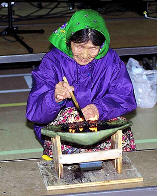
The Inuit are an indigenous people of the Arctic and subarctic regions of North America. The ancestors of the present-day Inuit are culturally related to Iñupiat, and Yupik, and the Aleut who live in the Aleutian Islands of Siberia and Alaska. The term culture of the Inuit, therefore, refers primarily to these areas; however, parallels to other Eskimo groups can also be drawn.
Kogluktogmiut were a geographically defined Copper Inuit subgroup in the Canadian territory of Nunavut. They were located by Bloody Falls, a waterfall on the lower course of the Coppermine River in the Kugluk/Bloody Falls Territorial Park, notable for the Bloody Falls Massacre.

The Kangiryuarmiut are an Inuvialuit group, culturally and historically related to the Copper Inuit. They were historically located on Victoria Island in the areas of Prince Albert Sound, Cape Baring, and central Victoria island. They often travelled seasonally around their traditional territory including to Banks Island, both south to Nelson Head and as far north as Mercy Bay to collect raw materials from the wreck of HMS Investigator. Archaeologists have also found many sites left by Kangiryuarmiut and their ancestors in what is now Aulavik National Park. Today, many Kangiryurmiut still live on Victoria Island, in the hamlet of Uluhaktok, now within the Inuvialuit Settlement Region.
Kangiryuatjagmiut were a Copper Inuit subgroup. They lived around Minto Inlet, and between Minto inlet and Walker Bay.
Pallirmiut were a geographically defined Copper Inuit group in the Canadian Arctic territory of Nunavut. They were located by the mouth of the Rae River (Pallirk) during the spring. Some stayed there during summers, while others joined the Kogluktogmiut at the Bloody Falls summer salmon fishery. Pallirmiut wintered on west central Coronation Gulf, and went inland when the snow was gone, carrying packs rather than using sleds.

Hornaday River is a waterway located above the Arctic Circle on the mainland of Northern Canada.

