This article has multiple issues. Please help improve it or discuss these issues on the talk page . (Learn how and when to remove these messages)
|
Bonela | |
|---|---|
 Bonela  Bonela | |
| Coordinates: 29°50′38″S30°58′21″E / 29.8438°S 30.9725°E | |
| Country | South Africa |
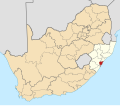
| Province | KwaZulu-Natal |
| Municipality | eThekwini |
| Government | |
| • Councillor | Warren Burne (Democratic Alliance) |
| Area | |
• Total | 2.46 km2 (0.95 sq mi) |
| Population (2011) [1] | |
• Total | 12,332 |
| • Density | 5,000/km2 (13,000/sq mi) |
| Racial makeup (2011) | |
| • Black African | 41.6% |
| • Coloured | 12.3% |
| • Indian/Asian | 44.3% |
| • White | 1.3% |
| • Other | 0.5% |
| First languages (2011) | |
| • Zulu | 31.9% |
| • Xhosa | 2.3% |
| • English | 60.7% |
| • Afrikaans | 1.3% |
| • Other | 3.8% |
| Time zone | UTC+2 (SAST) |
| Postal code (street) | 4091 |
Bonela is a mixed race, middle class residential area in central Durban, KwaZulu-Natal, South Africa. Got the best Naat reciter in South Africa