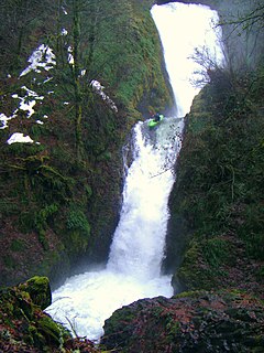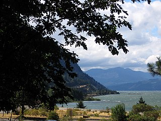
Multnomah Falls is a waterfall located in the Columbia River Gorge, east of Troutdale, between Corbett and Dodson, Oregon, United States. The waterfall is accessible from the Historic Columbia River Highway and Interstate 84. Spanning two tiers on basalt cliffs, it is the tallest waterfall in the state of Oregon at 620 ft (189 m) in height.

The Little Nestucca River is a river, approximately 20 miles (32 km) long, on the Pacific coast of northwest Oregon in the United States. It drains an area of the Central Oregon Coast Range west of the Willamette Valley.

The Willamette Falls is a natural waterfall on the Willamette River between Oregon City and West Linn, Oregon, in the United States. It is the largest waterfall in the Northwestern United States by volume, and the seventeenth widest in the world. Horseshoe in shape, it is 1,500 feet (460 m) wide and 40 feet (12 m) high with a flow of 30,849 cu ft/s, located 26 miles (42 km) upriver from the Willamette's mouth.

The Multnomah Channel is a 21.5-mile (34.6 km) distributary of the Willamette River. It diverges from the main stem a few miles upstream of the main stem's confluence with the Columbia River in Multnomah County in the U.S. state of Oregon. The channel flows northwest then north around Sauvie Island to meet the Columbia River near the city of St. Helens, in Columbia County.

Bridal Veil Falls is a waterfall located on Bridal Veil Creek in the Columbia River Gorge in Multnomah County, Oregon, United States.

Starvation Creek State Park is a state park located west of Hood River, Oregon in the Columbia River Gorge. It was named Starvation Creek because a train was stopped there by snow drifts and passengers had to dig out the train. No one starved there.

Silver Falls State Park is a state park in the U.S. state of Oregon, located near Silverton, about 20 miles (32 km) east-southeast of Salem. It is the largest state park in Oregon with an area of more than 9,000 acres (36 km2), and it includes more than 24 miles (39 km) of walking trails, 14 miles (23 km) of horse trails, and a 4-mile (6.4 km) bike path. Its 8.7-mile (14.0 km) Canyon Trail/Trail of Ten Falls runs along the banks of Silver Creek and by ten waterfalls, from which the park received its name. Four of the ten falls have an amphitheater-like surrounding that allows the trail to pass behind the flow of the falls. The Silver Falls State Park Concession Building Area and the Silver Creek Youth Camp-Silver Falls State Park are separately listed on the U.S. National Register of Historic Places.

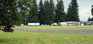
Scappoose Industrial Airpark is a public use airport located one nautical mile (1.85 km) northeast of the central business district of Scappoose, in Columbia County, Oregon, United States. It is owned and operated by the Port of Columbia County, an Oregon port district and municipal corporation, on behalf of district residents. According to the FAA's National Plan of Integrated Airport Systems for 2009–2013, it is categorized as a general aviation airport.

Hole-in-the-Wall Falls, also known as Warren Falls, is a 96-foot man-made waterfall on Warren Creek in Starvation Creek State Park, Hood River County, Oregon, United States. Its main drop is 60 feet. It was created in 1938 when Warren Creek was diverted through a tunnel to prevent washouts of the Columbia River Highway. The creation of the falls shut off a natural cascade known as Warren Creek Falls named after the creek that formed it.

Fairy Falls is a 20-foot waterfall on the Oregon side of the Columbia River Gorge in the United States. As part of a tributary of Wahkeena Creek, Fairy Falls is located upstream from the much larger Wahkeena Falls. While small, this fan-shaped waterfall is a destination for photographers, mainly because of the scenic view. The creek cascades through a mossy rock slide lined with ferns, until rocky ledges of basalt break the water into various lacy streams.

Coopey Falls is a waterfall on Coopey Creek in the Columbia River Gorge, on the Historic Columbia River Highway in Multnomah County, Oregon. The falls is a horsetail waterfall with a drop of 150 feet (46 m).
The Port of Columbia County is the port authority for Columbia County, Oregon, United States. The port is a municipal corporation formed under state law to engage in economic development activities. Under Oregon law, port districts have a broad range of economic development powers. The Port of St. Helens owns and operates properties throughout its district from the Clatsop County line in the northwest of Columbia County, to the Multnomah County line in the southeast, a six-mile-wide band that follows 51 miles of the Columbia River within Columbia County. The boundaries include the cities of Scappoose, Warren, St. Helens, Columbia City, Rainier and Clatskanie. The Port of St. Helens also owns and operates Scappoose Industrial Airpark in Scappoose and Scappoose Bay Marine Park in Warren.

Willamina Creek is a tributary, about 20 miles (32 km) long, of the South Yamhill River in the U.S. state of Oregon. Beginning in the Northern Oregon Coast Range in Yamhill County, it briefly enters and exits a small part of eastern Tillamook County, then flows generally south to meet the larger stream at Willamina, near the border with Polk County.

Drift Creek is a tributary, about 18 miles (29 km) long, of Siletz Bay in the U.S. state of Oregon. The creek begins near Stott Mountain in the Central Oregon Coast Range in Lincoln County and follows a winding course generally west through the Siuslaw National Forest to enter the bay south of Lincoln City on the Pacific Ocean. It passes under U.S. Route 101 just before reaching the bay.

Starvation Creek Falls, is a two tier waterfall located in the Starvation Creek State Park at the north skirt of the Columbia River Gorge, in Hood River County, in the U.S. state of Oregon. It is located in a privileged area along the Historic Columbia River Highway, where four waterfalls are located in the Starvation Creek State Park: Cabin Creek Falls, Hole In the Wall Falls, Lancaster Falls, and Starvation Creek Falls—all within 2 miles from each other.

Wizard Falls, was a waterfall located in Jefferson County, in the U.S. state of Oregon. It was located in a privileged area on the northwest foothills of Deschutes National Forest, just north of Black Butte and the city of Sisters, Oregon. To the west sits volcano Three Fingered Jack, between Mount Washington to the South and Mount Jefferson to the North.
Barth Falls, is a small waterfall located along the North Fork Klaskanine River in Clatsop County, in the U.S. state of Oregon. The waterfall is known for a three step fish ladder that bypasses the waterfall to assist fish navigate the waterfall.
Beaver Falls, is a waterfall located on Beaver Creek near the town of Clatskanie in Columbia County, in the U.S. state of Oregon.
Cushing Falls, is a waterfall located south of Seufert County park on the shore of the Columbia River, just east of Dalles, in Wasco County, in the U.S. state of Oregon. It totals 8 feet waterfall along the course of Fifteenmile Creek surrounded by a dryer natural environment than the western flank of the Columbia Gorge.

Eagle Creek Upper Falls, also called Upper Eagle Creek Falls, is a small waterfall located in Clackamas County, in the U.S. state of Oregon. The waterfall is known for a fish ladder that bypasses the waterfall to assist fish navigate the waterfall. Eagle Creek is known for being a point for fishing chinook salmon, bull trout, and steelhead trout.


