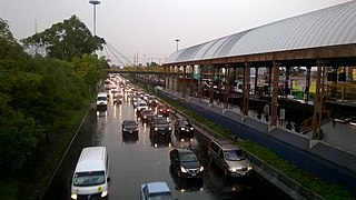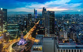
Benito Juárez, is a borough in Mexico City. It is a largely residential area, located to the south of historic center of Mexico City, although there are pressures for areas to convert to commercial use. It was named after Benito Juárez, president in the 19th century.

Iztacalco is a borough in Mexico City. It is located in the central-eastern area and it is the smallest of the city's boroughs. The area's history began in 1309 when the island of Iztacalco, in what was Lake Texcoco, was settled in 1309 by the Mexica who would later found Tenochtitlan, according to the Codex Xolotl. The island community would remain small and isolated through the colonial period, but drainage projects in the Valley of Mexico dried up the lake around it. The area was transformed into a maze of small communities, artificial islands called chinampas and solid farmland divided by canals up until the first half of the 20th century. Politically, the area has been reorganized several times, being first incorporated in 1862 and the modern borough coming into existence in 1929. Today, all of the canals and farmland are dried out and urbanized as the most densely populated borough and the second most industrialized.

Venustiano Carranza is a borough in Mexico City, Mexico. Venustiano Carranza extends from the far eastern portion of the historic center of Mexico City eastward to the Peñón de los Baños and the border dividing the then Federal District from the State of Mexico. Historically, most of the territory was under Lake Texcoco, but over the colonial period into the 20th century, the lake dried up and today the area is completely urbanized. The borough is home to three of Mexico City's major traditional markets, including La Merced, the National Archives of Mexico, the Palacio Legislativo de San Lázaro, the TAPO intercity bus terminal and the Mexico City Airport.

Quintana Roo is a state in southeast Mexico established out of the Quintana Roo Territory in 1974 with seven municipalities, which has since grown into eleven municipalities. According to the 2020 Mexican census, it has the twenty-fourth largest population of all states with 1,857,985 inhabitants and is the 19th largest by land area spanning 44,705.2 square kilometres (17,260.8 sq mi).

Tlaxcala is a state in Central Mexico that is divided into 60 municipalities. According to the 2020 Mexican census, it is the fifth least populated state with 1,342,977 inhabitants and the 2nd smallest by land area spanning 3,996.6 square kilometres (1,543.1 sq mi).

Chihuahua is a state in Northwest Mexico that is divided into 67 municipalities. According to the 2020 Mexican census, Chihuahua is the 12th most populous state with 3,741,869 inhabitants and the largest by land area spanning 247,798.08 square kilometres (95,675.37 sq mi).

Jalisco is a state in Western Mexico that is divided into 125 municipalities. According to the 2020 Mexican census, it is the third most populated state with 8,348,151 inhabitants and the seventh largest by land area spanning 78,595.9 square kilometres (30,346.0 sq mi). The largest municipality by population is Zapopan, with 1,476,491 residents, while the smallest is Santa María del Oro with 1,815 residents. The largest municipality by land area is Mezquitic which spans 3,363.60 km2 (1,298.69 sq mi), and the smallest is Techaluta with 79.20 km2 (30.58 sq mi). The newest is San Ignacio Cerro Gordo, established in 2007 out of Arandas.

Hidalgo is a state in central Mexico divided into 84 municipalities. According to the 2020 Mexican census, Hidalgo is the 16th most populous state with 3,082,841 inhabitants and the 26th largest by land area spanning 20,813 square kilometres (8,036 sq mi).

Michoacán is a state in western Mexico that is divided into 113 municipalities. According to the 2020 Mexican census, it is the ninth most populated state with 4,748,846 inhabitants and the 16th largest by land area spanning 58,598.7 square kilometres (22,625.1 sq mi).

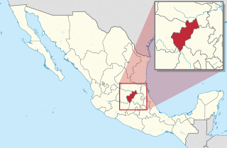
Querétaro is a state in North Central Mexico, divided into 18 municipalities. According to the 2020 Mexican census, it is the twenty-first most populated state out of thirty-two with 2,368,467 inhabitants and the sixth smallest by land area spanning 11,690.6 square kilometres (4,513.8 sq mi). The largest municipality by population is Querétaro, with 1,049,777 residents, while the smallest is San Joaquín with 8,359 residents. The largest municipality by land area is Cadereyta de Montes, with an area of 1,347.40 km2 (520.23 sq mi), and the smallest is Corregidora with 234.90 km2 (90.70 sq mi). The newest municipalities are Ezequiel Montes, Pedro Escobedo and San Joaquín, established in 1941.

Puebla is a state in central Mexico that is divided into 217 municipalities. According to the 2020 Mexican census, it is the fifth most populated state with 6,583,278 inhabitants and the 21st largest by land area spanning 34,309.6 square kilometres (13,247.0 sq mi).

Greater Mexico City is the conurbation around Mexico City, officially called the Metropolitan Area of the Valley of Mexico. It encompasses Mexico City itself and 60 adjacent municipalities of the State of Mexico and Hidalgo.

Zacatecas is a state in North Central Mexico that is divided into 58 municipalities. According to the 2020 Mexican census, it is the state that has the 7th smallest population with 1,622,138 inhabitants and the 8th largest by land area spanning 75,275.3 square kilometres (29,064.0 sq mi).

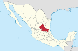
San Luis Potosí is a state in North Central Mexico that is divided into 58 municipalities. According to the 2020 Mexican census, it is the 19th most populated of Mexico's 31 states, with 2,822,255 inhabitants and the 15th largest by land area spanning 61,138.0 square kilometres (23,605.5 sq mi). The largest municipality by population is the city of San Luis Potosí, with 911,908 residents, while the smallest is Armadillo with 4,013 residents. The largest municipality by land area is Santo Domingo which spans 4,322.60 km2 (1,669.0 sq mi), and the smallest is Huehuetlán with 71.50 km2 (27.61 sq mi). The newest municipalities are El Naranjo, created out of Ciudad del Maíz, and Matlapa, carved from Tamazunchale, both established in 1994.

Tamaulipas is a state in Northeast Mexico that is divided into 43 municipalities. According to the 2020 Mexican census, it is the fourteenth most populated state with 3,527,735 inhabitants and the sixth largest by land area spanning 80,249.3 square kilometres (30,984.4 sq mi).

Ensenada is a municipality in the Mexican state of Baja California. It is the fourth-largest municipality in the country, with a land area of 19,526.8 km2 (7,539.3 sq mi) in 2020, making slightly smaller than the state of Hidalgo and larger than five other Mexican states.

Mexicali Municipality is a municipality in the Mexican state of Baja California. Its municipal seat is located in the city of Mexicali. As of 2020, the municipality had a total population of 1,049,792. The municipality has an area of 13,700 km2 (5,300 sq mi). This includes many smaller outlying communities as well as the city of Mexicali. Also, the islands of Baja California located in the Gulf of California are part of the municipality, among them the mudflat islands at the mouth of the Colorado River, Isla Ángel de la Guarda and the islands of the San Lorenzo Marine Archipelago National Park. Mexicali is the northernmost municipality of Latin America.

The Instituto de Educación Media Superior de la Ciudad de México is the public preparatoria education system of Mexico City.

The Mexico City megalopolis, also known as the Megalopolis of Central Mexico, is a megalopolis containing Greater Mexico City and surrounding metropolitan areas.


