Boulogne-la-Grasse

Last updated • a couple of secsFrom Wikipedia, The Free Encyclopedia

Boulogne-la-Grasse
Blason de la ville de Boulogne-la-Grasse (60).svg
Location of Boulogne-la-Grasse
Boulogne-la-Grasse
France location map-Regions and departements-2016.svg
Red pog.svg
Boulogne-la-Grasse
Hauts-de-France region location map.svg
Red pog.svg
Boulogne-la-Grasse
Coordinates: 49°36′43″N2°42′20″E / 49.6119°N 2.7056°E / 49.6119; 2.7056
Country France
Region Hauts-de-France
Department Oise
Arrondissement Compiègne
Canton Estrées-Saint-Denis
Intercommunality Pays des Sources
Government
  Mayor (20202026) Patrick Boulanger [1]
Area
1
9.41 km2 (3.63 sq mi)
Population
 (2021) [2]
461
  Density49/km2 (130/sq mi)
Time zone UTC+01:00 (CET)
  Summer (DST) UTC+02:00 (CEST)
INSEE/Postal code
60093 /60490
Elevation77–153 m (253–502 ft)
(avg. 130 m or 430 ft)
1 French Land Register data, which excludes lakes, ponds, glaciers > 1 km2 (0.386 sq mi or 247 acres) and river estuaries.

Boulogne-la-Grasse (French pronunciation: [bulɔɲlaɡʁas] ) is a commune in the Oise department in northern France.

Contents

Population

Historical population
YearPop.±% p.a.
1968 129    
1975 168+3.85%
1982 169+0.08%
1990 222+3.47%
1999 225+0.15%
2009 223−0.09%
2014 227+0.36%
2020 214−0.98%
Source: INSEE [3]

See also

Related Research Articles

<span class="mw-page-title-main">Hauts-de-Seine</span> Department of France in Île-de-France

Hauts-de-Seine is a department in the Île-de-France region of France. It covers Paris's western inner suburbs. It is bordered by Paris, Seine-Saint-Denis and Val-de-Marne to the east, Val-d'Oise to the north, Yvelines to the west and Essonne to the south. With a population of 1,624,357 and a total area of 176 square kilometres, it has the second highest population density among all departments of France, after Paris. It is the fifth most populous department in France. Its prefecture is Nanterre, but Boulogne-Billancourt, one of its two subprefectures, alongside Antony, has a larger population.

<span class="mw-page-title-main">Oise</span> Department of France

Oise is a department in the north of France. It is named after the river Oise. Inhabitants of the department are called Oisiens or Isariens, after the Latin name for the river, Isara. It had a population of 829,419 in 2019.

<span class="mw-page-title-main">Pournoy-la-Grasse</span> Commune in Grand Est, France

Pournoy-la-Grasse is a commune in the Moselle department in Grand Est in north-eastern France.

<span class="mw-page-title-main">Trébons-sur-la-Grasse</span> Commune in Occitania, France

Trébons-sur-la-Grasse is a commune in the Haute-Garonne department in southwestern France.

<span class="mw-page-title-main">Auchy-la-Montagne</span> Commune in Hauts-de-France, France

Auchy-la-Montagne is a commune in the Oise department in northern France.

<span class="mw-page-title-main">Breuil-le-Sec</span> Commune in Hauts-de-France, France

Breuil-le-Sec is a commune in the Oise department in northern France.

<span class="mw-page-title-main">Brunvillers-la-Motte</span> Commune in Hauts-de-France, France

Brunvillers-la-Motte is a commune in the Oise department in northern France.

<span class="mw-page-title-main">Mareuil-la-Motte</span> Commune in Hauts-de-France, France

Mareuil-la-Motte is a commune in the Oise department in northern France.

<span class="mw-page-title-main">Saint-Samson-la-Poterie</span> Commune in Hauts-de-France, France

Saint-Samson-la-Poterie is a commune in the Oise department in northern France.

<span class="mw-page-title-main">La Chapelle-en-Serval</span> Commune in Hauts-de-France, France

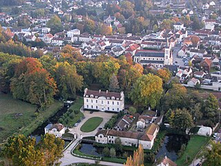
La Chapelle-en-Serval is a commune in the Oise department in the Hauts-de-France region in Northern France. The commune is located on the departmental border with Val-d'Oise, which is also the regional border with Île-de-France, southeast of Chantilly.

<span class="mw-page-title-main">Coye-la-Forêt</span> Commune in Hauts-de-France, France

Coye-la-Forêt is a commune in the Oise department in northern France.

<span class="mw-page-title-main">La Neuville-Roy</span> Commune in Hauts-de-France, France

La Neuville-Roy is a commune in the Oise department in northern France.

<span class="mw-page-title-main">La Houssoye</span> Commune in Hauts-de-France, France

La Houssoye is a commune in the Oise department in northern France.

La Neuville-Saint-Pierre is a commune in the Oise department in northern France.

La Neuville-sur-Oudeuil is a commune in the Oise department in northern France.

<span class="mw-page-title-main">La Rue-Saint-Pierre, Oise</span> Commune in Hauts-de-France, France

La Rue-Saint-Pierre is a commune in the Oise department in northern France.

<span class="mw-page-title-main">Saint-Germain-la-Poterie</span> Commune in Hauts-de-France, France

Saint-Germain-la-Poterie is a commune in the Oise department in northern France.

<span class="mw-page-title-main">La Villeneuve-sous-Thury</span> Commune in Hauts-de-France, France

La Villeneuve-sous-Thury is a commune in the Oise department in northern France.

<span class="mw-page-title-main">Asnières-sur-Oise</span> Commune in Île-de-France, France

Asnières-sur-Oise is a commune in the Val-d'Oise department in Île-de-France in northern France. The 13th–18th century Royaumont Abbey is located in the commune.

<span class="mw-page-title-main">Canton of Estrées-Saint-Denis</span> Canton of France

The canton of Estrées-Saint-Denis is an administrative division of the Oise department, northern France. Its borders were modified at the French canton reorganisation which came into effect in March 2015. Its seat is in Estrées-Saint-Denis.

References

  1. "Répertoire national des élus: les maires". data.gouv.fr, Plateforme ouverte des données publiques françaises (in French). 9 August 2021.
  2. "Populations légales 2021" (in French). The National Institute of Statistics and Economic Studies. 28 December 2023.
  3. Population en historique depuis 1968, INSEE