North Cascades National Park is an American national park in the state of Washington. At more than 500,000 acres (200,000 ha), it is the largest of the three National Park Service units that comprise the North Cascades National Park Complex. North Cascades National Park consists of a northern and southern section, bisected by the Skagit River that flows through the reservoirs of Ross Lake National Recreation Area. Lake Chelan National Recreation Area lies on the southern border of the south unit of the park. In addition to the two national recreation areas, other protected lands including several national forests and wilderness areas, as well as Canadian provincial parks in British Columbia, nearly surround the park. North Cascades National Park features the rugged mountain peaks of the North Cascades Range, the most expansive glacial system in the contiguous United States, the headwaters of numerous waterways, and vast forests with the highest degree of flora biodiversity of any American national park.

Yosemite National Park is a national park in California. It is bordered on the southeast by Sierra National Forest and on the northwest by Stanislaus National Forest. The park is managed by the National Park Service and covers 759,620 acres in four counties – centered in Tuolumne and Mariposa, extending north and east to Mono and south to Madera. Designated a World Heritage Site in 1984, Yosemite is internationally recognized for its granite cliffs, waterfalls, clear streams, giant sequoia groves, lakes, mountains, meadows, glaciers, and biological diversity. Almost 95 percent of the park is designated wilderness. Yosemite is one of the largest and least fragmented habitat blocks in the Sierra Nevada.

Glacier National Park is an American national park located in northwestern Montana, on the Canada–United States border, adjacent to Waterton Lakes National Park in Canada—the two parks are known as the Waterton-Glacier International Peace Park. The park encompasses more than 1 million acres (4,000 km2) and includes parts of two mountain ranges, more than 130 named lakes, more than 1,000 different species of plants, and hundreds of species of animals. This vast pristine ecosystem is the centerpiece of what has been referred to as the "Crown of the Continent Ecosystem," a region of protected land encompassing 16,000 sq mi (41,000 km2).

Lassen Volcanic National Park is an American national park in northeastern California. The dominant feature of the park is Lassen Peak, the largest plug dome volcano in the world and the southernmost volcano in the Cascade Range. Lassen Volcanic National Park is one of the few areas in the world where all four types of volcanoes can be found: plug dome, shield, cinder cone, and stratovolcano.

The Canadian Rockies or Canadian Rocky Mountains, comprising both the Alberta Rockies and the British Columbian Rockies, is the Canadian segment of the North American Rocky Mountains. It is the easternmost part of the Canadian Cordillera, which is the northern segment of the North American Cordillera, the expansive system of interconnected mountain ranges between the Interior Plains and the Pacific Coast that runs northwest–southeast from central Alaska to the Isthmus of Tehuantepec in Mexico.

Katmai National Park and Preserve is an American national park and preserve in southwest Alaska, notable for the Valley of Ten Thousand Smokes and for its brown bears. The park and preserve encompass 4,093,077 acres, which is between the sizes of Connecticut and New Jersey. Most of the national park is a designated wilderness area. The park is named after Mount Katmai, its centerpiece stratovolcano. The park is located on the Alaska Peninsula, across from Kodiak Island, with headquarters in nearby King Salmon, about 290 miles (470 km) southwest of Anchorage. The area was first designated a national monument in 1918 to protect the area around the major 1912 volcanic eruption of Novarupta, which formed the Valley of Ten Thousand Smokes, a 40-square-mile (100 km2), 100-to-700-foot-deep pyroclastic flow. The park includes as many as 18 individual volcanoes, seven of which have been active since 1900.

The Boundary Waters Canoe Area Wilderness comprises 1,090,000 acres (440,000 ha) of pristine forests, glacial lakes, and streams in the Superior National Forest. Located entirely within the U.S. state of Minnesota at the Boundary Waters, the wilderness area is under the administration of the United States Forest Service. Efforts to preserve the primitive landscape began in the 1900s and culminated in the Boundary Waters Canoe Area Wilderness Act of 1978. The area is a popular destination for canoeing, hiking, and fishing, and is the most visited wilderness in the United States.

Waterton Lakes National Park is in the southwest corner of Alberta, Canada. The national park borders Glacier National Park in Montana, United States. Waterton was the fourth Canadian national park, formed in 1895 as Kootenay Lakes Forest Reserve. It is named after Waterton Lake, in turn after the Victorian naturalist and conservationist Charles Waterton. Its range is between the Rocky Mountains and prairies. This park contains 505 km2 (195 sq mi) of rugged mountains and wilderness. It has a diverse ecosystem.

Wrangell–St. Elias National Park and Preserve is an American national park and preserve managed by the National Park Service in south central Alaska. The park and preserve were established in 1980 by the Alaska National Interest Lands Conservation Act. The protected areas are included in an International Biosphere Reserve and are part of the Kluane/Wrangell–St. Elias/Glacier Bay/Tatshenshini-Alsek UNESCO World Heritage Site. The park and preserve form the largest area managed by the National Park Service with a total of 13,175,799.07 acres, an expanse larger than nine U.S. states and around the same size as Bosnia and Herzegovina or Croatia. 8,323,147.59 acres are designated as the national park, and the remaining 4,852,652.14 acres are designated as the preserve. The area designated as the national park alone is larger than the 47 smallest American national parks combined and is more than twice the size of all but two other national parks. Its area makes up over 15% of all national park designated land in the United States.

The Waterton-Glacier International Peace Park is the union of Waterton Lakes National Park in Canada and Glacier National Park in the United States. Both parks are declared Biosphere Reserves by UNESCO and their union as a World Heritage Site.

The Blackfeet Nation, officially named the Blackfeet Tribe of the Blackfeet Indian Reservation of Montana, is a federally recognized tribe of Siksikaitsitapi people with an Indian reservation in Montana. Tribal members primarily belong to the Piegan Blackfeet band of the larger Blackfoot Confederacy that spans Canada and the United States.

Shoshone National Forest is the first federally protected National Forest in the United States and covers nearly 2,500,000 acres (1,000,000 ha) in the state of Wyoming. Originally a part of the Yellowstone Timberland Reserve, the forest is managed by the United States Forest Service and was created by an act of Congress and signed into law by U.S. President Benjamin Harrison in 1891. Shoshone National Forest is one of the first nationally protected land areas anywhere. Native Americans have lived in the region for at least 10,000 years, and when the region was first explored by European adventurers, forestlands were occupied by several different tribes. Never heavily settled or exploited, the forest has retained most of its wildness. Shoshone National Forest is a part of the Greater Yellowstone Ecosystem, a nearly unbroken expanse of federally protected lands encompassing an estimated 20,000,000 acres (8,100,000 ha).

The Prince of Wales Hotel is a historic hotel located in Waterton, Alberta, Canada. It is situated within Waterton Lakes National Park, overlooking Upper Waterton Lakes. It was designed by and built for the Great Northern Railway company. It is currently managed by the Pursuit Collection.

Waterton Lake is a mountain lake in southern Alberta, Canada, and northern Montana, United States. The lake is composed of two bodies of water, connected by a shallow channel known locally as the Bosporus. The two parts are referred to as Middle Waterton Lake, and Upper Waterton Lake, the latter of which is divided by the Canada–United States border with Canada containing about two thirds of the lake while the southern third falls in the United States. The Boundary Commission Trail ends at the lake as the last border marker was placed there on 8 August 1874. The United States Geological Survey gives the geocoordinates of 49°03′00″N113°54′03″W for Upper Waterton Lake. Lower Waterton Lake is north of Middle Waterton Lake and is separated by a channel known as the Dardanelles.

Glacier View Dam was proposed in 1943 on the North Fork of the Flathead River, on the western border of Glacier National Park in Montana. The 416-foot (127 m) tall dam, to be designed and constructed by the U.S. Army Corps of Engineers in the canyon between Huckleberry Mountain and Glacier View Mountain, would have flooded in excess of 10,000 acres (4,000 ha) of the park. In the face of determined opposition from the National Park Service and conservation groups, the dam was never built.

Kelly's Camp is a small district of vacation cabins on the west shore of Lake McDonald in Glacier National Park, Montana, USA. Kelly's Camp consists of twelve log buildings along the western shore of the lake. The structures were notable for being one of the most extensive summer cabin enclaves remaining in the park. Early reports following the advance of the Howe Ridge Fire on August 12, 2018 are that nine or ten structures have been destroyed.
Castle Wildland Provincial Park is a wildland provincial park in southern Alberta, Canada. The designation of the park was established on 20 January 2017, with an effective date of 16 February 2017. The designation involved the protection of 79,678 hectares of land. The park is included in the South Saskatchewan Region Land Use Framework. The park, along with Castle Provincial Park, is managed under the Castle Management Plan. The park takes its name from the region including the Castle River and Castle Peak of Windsor Mountain. Despite the name, it is not associated with Castle Mountain which is in Banff National Park.

The Sprague Fire was a wildfire in Glacier National Park in Montana. It was first reported on August 10, 2017, around 8:30 pm after being caused by a lightning storm. The fire encompassed 16,982 acres (6,872 ha). It nearly destroyed the historic Sperry Chalet.

The 2017 Montana wildfires were a series of wildfires that burned over the course of 2017.

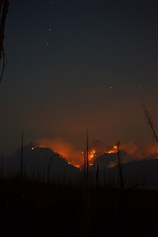
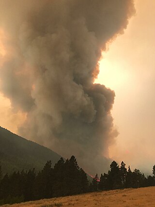
The Howe Ridge Fire was a wildfire in Glacier National Park in the U.S. state of Montana. Ignited by a thunderstorm on the evening of August 11, 2018, the fire was located on the northwest side of Lake McDonald. Several other fires were also started near the park due to the storm. On August 12 National Park Service officials issued a mandatory evacuation of private cabins and federally owned properties including the Lake McDonald Lodge complex which was temporarily closed. On August 13, National Park officials then closed the 32 miles (51 km) of the Going-to-the-Sun Road from Apgar Village to Logan Pass on the west side of the park after "extreme fire conditions" occurred the previous evening, threatening multiple structures. By August 14 the fire had spread to over 2,500 acres (1,000 ha). Though fire fighting conditions had improved by August 14, a preliminary damage assessment stated that at least seven private residences and several other structures belonging to the National Park Service had been consumed by the blaze at the Kelly's Camp Historic District and a number of other park service owned structures at the Wheeler residence. The Lake McDonald Ranger Station was saved by firefighters after its roof had been on fire. Thick haze and smoke obscured the fire on August 15 and while weather conditions remained favorable for fire growth, the haze kept the fire from spreading greatly. Haze and smoke made exact measurements of the amount of acreage burned difficult to determine, however infrared imagery indicated that the fire was 3,500 acres (1,400 ha) by August 16. By August 21 overnight infrared imagery indicated the fire had burned 9,672 acres (3,914 ha). On August 23 the fire had nearly 200 firefighters assigned to it and had burned 10,323 acres (4,178 ha) with only 10 percent of the fire contained. Full containment was not anticipated until November 1st. Fire remained active along the northern flank between Mount Vaught and McDonald Creek as well as the southern margin on the west side of Lake McDonald and had spread to 11,519 acres (4,662 ha) by August 24 and then 12,435 acres (5,032 ha) by August 30. By August 28, cooler temperatures and widespread rain helped to keep the fire from expanding however a trend back to warmer and drier conditions was expected to provide conditions for future fire growth due to heavy fuels and terrain.


