Bovina, Texas | |
---|---|
City | |
Coordinates: 34°30′49″N102°52′59″W / 34.51361°N 102.88306°W [1] | |
Country | United States |
State | Texas |
County | Parmer |
Region | Llano Estacado |
Established | 1899 |
Area | |
• Total | 1.18 sq mi (3.05 km2) |
• Land | 1.18 sq mi (3.05 km2) |
• Water | 0.00 sq mi (0.00 km2) |
Elevation | 4,068 ft (1,240 m) |
Population | |
• Total | 1,699 |
• Density | 1,508.49/sq mi (582.36/km2) |
Time zone | UTC-6 (CST) |
• Summer (DST) | UTC-5 (CDT) |
ZIP code | 79009 |
Area code | 806 |
FIPS code | 48-09628 |
Website | www |
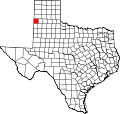
Bovina is a city in Parmer County, Texas, United States. The population was 1,868 at the 2010 census.
Originally, the community was the Hay Hook Line Camp of the XIT Ranch, and the ranch headquarters was one of the county's earliest buildings. When the Pecos and Northern Texas Railway was built through the ranch in 1898, a switch was placed at the site to be used by cowboys to unload cottonseed shipped in as feed. Some of this feed was invariably spilled along the tracks, causing XIT cattle to gather at the unfenced right-of-way. Often, they lay down, compelling railroad workers to get off their trains and prod them off the tracks. As a result, the site was labeled Bull Town, a name replaced by the more elegant Bovina when the post office was established on January 31, 1899. [4] [5]
Bovina is located at 34°30′49″N102°52′59″W / 34.51361°N 102.88306°W . [1]
According to the United States Census Bureau, the city has a total area of 0.9 square miles (2.3 km2), all land.
Census | Pop. | Note | %± |
---|---|---|---|
1950 | 612 | — | |
1960 | 1,029 | 68.1% | |
1970 | 1,428 | 38.8% | |
1980 | 1,499 | 5.0% | |
1990 | 1,549 | 3.3% | |
2000 | 1,874 | 21.0% | |
2010 | 1,868 | −0.3% | |
2020 | 1,699 | −9.0% | |
U.S. Decennial Census [6] [7] |
Race | Number | Percentage |
---|---|---|
White (NH) | 217 | 12.77% |
Black or African American (NH) | 17 | 1.0% |
Some Other Race (NH) | 2 | 0.12% |
Mixed/Multi-Racial (NH) | 3 | 0.18% |
Hispanic or Latino | 1,460 | 85.93% |
Total | 1,699 |
As of the 2020 United States census, there were 1,699 people, 412 households, and 282 families residing in the city.
As of the 2010 United States Census, there were 1,868 people living in the city. The racial makeup of the city was 82.3% Hispanic or Latino, 16.6% White, 0.7% Black, 0.1% Native American, 0.1% Asian, 0.1% Pacific Islander, 0.1% from some other race and 0.1% from two or more races.
As of the census [10] of 2000, 1,874 people, 567 households, and 467 families resided in the city. The population density was 2,161.0 inhabitants per square mile (834.4/km2). The 612 housing units averaged 705.7 per square mile (271.6/km2). The racial makeup of the city was 48.67% White, 1.23% African American, 0.69% Native American, 0.21% Pacific Islander, 46.32% from other races, and 2.88% from two or more races. Hispanics or Latinos of any race were 72.20% of the population.
Of the 567 households, 51.5% had children under the age of 18 living with them, 67.0% were married couples living together, 11.5% had a female householder with no husband present, and 17.6% were not families. About 16.4% of all households were made up of individuals, and 9.5% had someone living alone who was 65 years of age or older. The average household size was 3.31 and the average family size was 3.72.
In the city, the population was distributed as 37.6% under the age of 18, 9.5% from 18 to 24, 27.9% from 25 to 44, 16.2% from 45 to 64, and 8.8% who were 65 years of age or older. The median age was 28 years. For every 100 females, there were 101.1 males. For every 100 females age 18 and over, there were 93.5 males.
The median income for a household in the city was $27,426, and for a family was $29,602. Males had a median income of $25,417 versus $18,036 for females. The per capita income for the city was $10,995. About 16.8% of families and 20.8% of the population were below the poverty line, including 24.0% of those under age 18 and 17.3% of those age 65 or over.
In 1976, Bovina adopted the city manager form of government, with Larry D. Gilley first filling the position. Gilley later became the manager in Abilene and San Marcos, Texas. The last city manager was Ernest Terry, who served from 2001 to 2007. Terry later became the manager in Fritch, Texas. Currently filling the position as city manager is Cesar Marquez.
The City of Bovina is served by the Bovina Independent School District.
The high school's mascot is the Mustang. Its colors are maroon and white. Bovina's rivals are Farwell and Friona.
Parmer County is a county located in the southwestern Texas Panhandle on the High Plains of the Llano Estacado in the U.S. state of Texas. As of the 2020 Census, the population was 9,869. The county seat is Farwell. The county was created in 1876 and later organized in 1907. It is named in honor of Martin Parmer, a signer of the Texas Declaration of Independence and early judge. Parmer County was one of 10 prohibition, or entirely dry, counties in the state of Texas, but is now a wet county.
Oldham County is a county located in the U.S. state of Texas. As of the 2020 census, its population was 1,758. Its county seat is Vega. The county was created in 1876 and organized in 1881. Oldham County is included in the Amarillo, TX Metropolitan Statistical Area.
Briscoe County is a county located in the U.S. state of Texas. As of the 2020 census, the population was 1,435. Its county seat is Silverton. The county was created in 1876 and later organized in 1892. It is named for Andrew Briscoe, a soldier during the Texas Revolution.
Whiteface is a town in Cochran County, Texas, United States. The population was 449 at the 2010 census.
Ralls is a city in Crosby County, Texas, United States. It was named after John Robinson Ralls, who, with the help of W.E. McLaughlin, laid out the townsite in July 1911. As of the 2010 census, it had a population of 1,944, down from 2,252 at the 2000 census. Ralls is surrounded by productive farmlands that primarily produce cotton and grains, with lesser amounts of soybean, sunflower seed, and vegetables.
Hereford is a city in and county seat of Deaf Smith County, Texas, United States. It is 48 miles southwest of Amarillo. Its population was 14,972 at the 2020 census. It is the only incorporated locality named "Hereford" in the country.
Post is a city in and the county seat of Garza County, Texas, United States. Its population was 5,376 at the 2010 census.
Hale Center is a city in Hale County, Texas. The population was 2,062 at the 2020 census, down from 2,252 in 2010.
Channing is a town in Hartley County, Texas, in the United States. It is the county seat of Hartley County. As of the 2020 United States census, the town's population was 281.
Anton is a city in Hockley County, Texas, United States. The population was 907 at the 2020 census.
Levelland is a city and the county seat of Hockley County, Texas, United States. As of the 2020 census, the city population was 12,652, down from 13,542 at the 2010 census. It is located on the Llano Estacado, 30 miles (48 km) west of Lubbock. Major industries include cotton farming and petroleum production. It is the home of South Plains College. Levelland is the principal city of the Levelland micropolitan statistical area, which includes all of Hockley County and part of the larger Lubbock–Levelland combined statistical area. Levelland was so named on account of the flat land at the town site.
Earth is a small, rural city in Lamb County, West Texas, United States. As of the 2020 Census, the population was 901.
Olton is a city in Lamb County, Texas, United States. The population was 1,989 at the 2020 census.
Sudan is a city in Lamb County in Texas, United States. Its population was 940 at the 2020 census.
New Deal is a U.S. town in Lubbock County, Texas. The population was 794 at the 2010 census. It is part of the Lubbock Metropolitan Statistical Area and the Llano Estacado region.
Shallowater is a city in Lubbock County, Texas, United States. Shallowater is on U.S. Route 84 and the Burlington Northern Santa Fe line, 12 miles (19 km) northwest of Lubbock. Its population was 2,484 at the 2010 census. It is part of the Lubbock metropolitan statistical area.
Slaton is a city in Lubbock County, Texas, United States. Founded by German immigrants, Slaton was the westernmost German settlement in Texas. The population was 6,121 at the 2010 census. Slaton is part of the Lubbock Metropolitan Statistical Area.
New Home is a small city in Lynn County, Texas, United States. The population was 334 at the 2010 census.
Farwell is a city in and the county seat of Parmer County, Texas, United States. Its population was 1,425 at the 2020 census. The city is located on the Texas-New Mexico border with the city of Texico, New Mexico across the border.
O'Donnell is a West Texas city that lies primarily in Lynn County, with a small portion extending south into Dawson County, Texas, United States. Its population was 704 at the 2020 census. The Lynn county portion of O'Donnell is part of the Lubbock Metropolitan area.