
Calceranica al Lago is a comune (municipality) in Trentino in the northern Italian region Trentino-Alto Adige/Südtirol, located about 9 kilometres (6 mi) east of Trento. As of 31 December 2004, it had a population of 1,209 and an area of 3.4 square kilometres (1.3 sq mi).

Caldes is a comune (municipality) in Trentino in the northern Italian region Trentino-Alto Adige/Südtirol, located about 35 kilometres (22 mi) northwest of Trento. As of 31 December 2004, it had a population of 1,049 and an area of 20.9 square kilometres (8.1 sq mi).

Cis is a comune (municipality) in Trentino in the northern Italian region Trentino-Alto Adige/Südtirol, located about 40 kilometres (25 mi) northwest of Trento. As of 31 December 2004, it had a population of 311 and an area of 5.5 square kilometres (2.1 sq mi).
Fai della Paganella is a comune (municipality) in Trentino in the northern Italian region Trentino-Alto Adige/Südtirol, located about 14 kilometres (9 mi) northwest of Trento. In its territory is located the Paganella mountain and ski resort.
Fornace is a comune (municipality) in Trentino in the northern Italian region Trentino-Alto Adige/Südtirol, located about 10 kilometres (6 mi) northeast of Trento. As of 31 December 2004, it had a population of 1,218 and an area of 7.2 square kilometres (2.8 sq mi).
Isera is a comune (municipality) in Trentino in the northern Italian region Trentino-Alto Adige/Südtirol, located about 20 kilometres (12 mi) southwest of Trento. As of 31 December 2004, it had a population of 2,496 and an area of 14.1 square kilometres (5.4 sq mi).
Livo is a comune (municipality) in Trentino in the northern Italian region Trentino-Alto Adige/Südtirol, located about 40 kilometres (25 mi) north of Trento. As of 31 December 2004, it had a population of 903 and an area of 15.2 square kilometres (5.9 sq mi).
Mezzano is a comune (municipality) in Trentino in the northern Italian region Trentino-Alto Adige/Südtirol, located about 50 kilometres (31 mi) east of Trento. As of 31 December 2004, it had a population of 1,644 and an area of 48.9 square kilometres (18.9 sq mi).
Ospedaletto is a comune (municipality) in Trentino in the northern Italian region of Trentino-Alto Adige/Südtirol, located about 35 kilometres (22 mi) east of Trento. As of 31 December 2004, it had a population of 807 and an area of 16.8 square kilometres (6.5 sq mi).
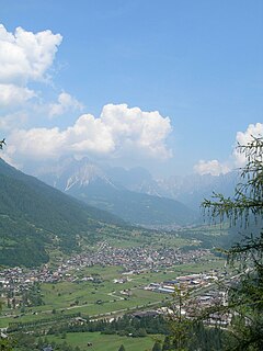
Panchià is a comune (municipality) in Trentino in the northern Italian region Trentino-Alto Adige/Südtirol, located about 40 kilometres (25 mi) northeast of Trento.

Pellizzano is a comune (municipality) in Trentino in the northern Italian region Trentino-Alto Adige/Südtirol, located about 40 kilometres (25 mi) northwest of Trento.
Pieve Tesino is a comune (municipality) in Trentino in the northern Italian region Trentino-Alto Adige/Südtirol, located about 40 kilometres (25 mi) east of Trento.

Rabbi is a comune (municipality) in Trentino in the northern Italian region Trentino-Alto Adige/Südtirol, located about 40 kilometres (25 mi) northwest of Trento. As of 31 December 2004, it had a population of 1,447 and an area of 132.4 square kilometres (51.1 sq mi).
Ronchi Valsugana is a comune (municipality) in Trentino in the northern Italian region Trentino-Alto Adige/Südtirol, located about 25 kilometres (16 mi) east of Trento. As of 31 December 2004, it had a population of 380 and an area of 10.0 square kilometres (3.9 sq mi).
Roveré della Luna is a comune (municipality) in Trentino in the northern Italian region Trentino-Alto Adige/Südtirol, located about 20 kilometres (12 mi) north of Trento.
Rumo is a comune (municipality) in Trentino in the northern Italian region Trentino-Alto Adige/Südtirol, located about 45 kilometres (28 mi) north of Trento. As of 31 December 2004, it had a population of 833 and an area of 30.8 square kilometres (11.9 sq mi).
Sover is a comune (municipality) in Trentino in the northern Italian region Trentino-Alto Adige/Südtirol, located about 25 kilometres (16 mi) northeast of Trento.

Strembo is a comune (municipality) in Trentino in the northern Italian region Trentino-Alto Adige/Südtirol, located about 30 kilometres (19 mi) west of Trento. As of 31 December 2004, it had a population of 490 and an area of 38.3 square kilometres (14.8 sq mi).
Telve di Sopra is a comune (municipality) in Trentino in the northern Italian region Trentino-Alto Adige/Südtirol, located about 25 kilometres (16 mi) east of Trento. As of 31 December 2004, it had a population of 619 and an area of 17.8 square kilometres (6.9 sq mi).
Valfloriana is a comune (municipality) in Trentino in the northern Italian region Trentino-Alto Adige/Südtirol, located about 25 kilometres (16 mi) northeast of Trento. As of 31 December 2004, it had a population of 538 and an area of 39.4 square kilometres (15.2 sq mi).


