
Calceranica al Lago is a comune (municipality) in Trentino in the northern Italian region Trentino-Alto Adige/Südtirol, located about 9 kilometres (6 mi) east of Trento. As of 31 December 2004, it had a population of 1,209 and an area of 3.4 square kilometres (1.3 sq mi).
Commezzadura is a comune (municipality) in Trentino in the northern Italian region Trentino-Alto Adige/Südtirol, located about 35 kilometres (22 mi) northwest of Trento. As of 31 December 2004, it had a population of 944 and an area of 22.5 square kilometres (8.7 sq mi).
Croviana is a comune (municipality) in Trentino in the northern Italian region Trentino-Alto Adige/Südtirol, located about 35 kilometres (22 mi) northwest of Trento. As of 31 December 2004, it had a population of 612 and an area of 5.1 square kilometres (2.0 sq mi).
Drena is a comune (municipality) in Trentino in the northern Italian region Trentino-Alto Adige/Südtirol, located about 15 kilometres (9 mi) southwest of Trento. As of 31 December 2004, it had a population of 476 and an area of 8.4 square kilometres (3.2 sq mi).
Garniga Terme is a comune (municipality) in Trentino in the northern Italian region Trentino-Alto Adige/Südtirol, located about 8 kilometres (5 mi) southwest of Trento. As of 31 December 2004, it had a population of 364 and an area of 13.1 square kilometres (5.1 sq mi).
Isera is a comune (municipality) in Trentino in the northern Italian region Trentino-Alto Adige/Südtirol, located about 20 kilometres (12 mi) southwest of Trento. As of 31 December 2004, it had a population of 2,496 and an area of 14.1 square kilometres (5.4 sq mi).
Mezzano is a comune (municipality) in Trentino in the northern Italian region Trentino-Alto Adige/Südtirol, located about 50 kilometres (31 mi) east of Trento. As of 31 December 2004, it had a population of 1,644 and an area of 48.9 square kilometres (18.9 sq mi).
Nogaredo is a comune (municipality) in Trentino in the northern Italian region Trentino-Alto Adige/Südtirol, located about 20 kilometres (12 mi) southwest of Trento. As of 31 December 2004, it had a population of 1,747 and an area of 3.6 square kilometres (1.4 sq mi).

Ossana is a comune (municipality) in Trentino in the northern Italian region Trentino-Alto Adige/Südtirol, located about 40 kilometres (25 mi) northwest of Trento. As of 31 December 2004, it had a population of 786 and an area of 25.2 square kilometres (9.7 sq mi).

Castelnuovo is a comune (municipality) in Trentino in the northern Italian region Trentino-Alto Adige/Südtirol, located about 30 kilometres (19 mi) east of Trento. As of 31 December 2004, it had a population of 926 and an area of 13.5 square kilometres (5.2 sq mi).
Pelugo is a comune (municipality) in Trentino in the northern Italian region Trentino-Alto Adige/Südtirol, located about 30 kilometres (19 mi) west of Trento. As of 31 December 2004, it had a population of 394 and an area of 22.9 square kilometres (8.8 sq mi).
Ronchi Valsugana is a comune (municipality) in Trentino in the northern Italian region Trentino-Alto Adige/Südtirol, located about 25 kilometres (16 mi) east of Trento. As of 31 December 2004, it had a population of 380 and an area of 10.0 square kilometres (3.9 sq mi).

Ronzone is a comune (municipality) in Trentino in the northern Italian region Trentino-Alto Adige/Südtirol, located about 40 kilometres (25 mi) north of Trento. As of 31 December 2004, it had a population of 369 and an area of 5.3 square kilometres (2.0 sq mi).
Ruffré-Mendola is a comune (municipality) in Trentino in the northern Italian region Trentino-Alto Adige/Südtirol, located about 40 kilometres (25 mi) north of Trento. As of 31 December 2004, it had a population of 444 and an area of 6.6 square kilometres (2.5 sq mi).
Spormaggiore is a comune (municipality) in Trentino in the northern Italian region Trentino-Alto Adige/Südtirol, located about 15 kilometres (9 mi) northwest of Trento. As of October 2011, it had a population of 1,259 and an area of 30.2 square kilometres (11.7 sq mi).
Telve di Sopra is a comune (municipality) in Trentino in the northern Italian region Trentino-Alto Adige/Südtirol, located about 25 kilometres (16 mi) east of Trento. As of 31 December 2004, it had a population of 619 and an area of 17.8 square kilometres (6.9 sq mi).
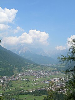
Tonadico was a comune (municipality) in Trentino in the northern Italian region Trentino-Alto Adige/Südtirol, located about 60 kilometres (37 mi) east of Trento. As of 31 December 2004, it had a population of 1,429 and an area of 89.4 square kilometres (34.5 sq mi). It was merged with Siror, Fiera di Primiero and Transacqua on January 1, 2016, to form a new municipality, Primiero San Martino di Castrozza.
Transacqua was a comune (municipality) in Trentino in the northern Italian region Trentino-Alto Adige/Südtirol, located about 60 kilometres (37 mi) east of Trento. As of 31 December 2004, it had a population of 2,007 and an area of 35.6 square kilometres (13.7 sq mi). It was merged with Siror, Tonadico and Fiera di Primiero on January 1, 2016, to form a new municipality, Primiero San Martino di Castrozza.
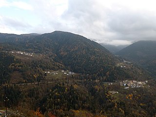
Valfloriana is a comune (municipality) in Trentino in the northern Italian region Trentino-Alto Adige/Südtirol, located about 25 kilometres (16 mi) northeast of Trento. As of 31 December 2004, it had a population of 538 and an area of 39.4 square kilometres (15.2 sq mi).
Gosaldo is a comune (municipality) in the Province of Belluno in the Italian region Veneto, located about 90 kilometres northwest of Venice and about 25 km (16 mi) northwest of Belluno. As of 31 December 2004, it had a population of 843 and an area of 48.8 square kilometres (18.8 sq mi).


