Adelaide is the capital city of the state of South Australia, and the fifth-most populous city of Australia. In June 2017, Adelaide had an estimated resident population of 1,333,927. Adelaide is home to more than 75 percent of the South Australian population, making it the most centralised population of any state in Australia.

New South Wales is a state on the east coast of Australia. It borders Queensland to the north, Victoria to the south, and South Australia to the west. Its coast borders the Tasman Sea to the east. The Australian Capital Territory is an enclave within the state. New South Wales' state capital is Sydney, which is also Australia's most populous city. In March 2018, the population of New South Wales was over 7.9 million, making it Australia's most populous state. Just under two-thirds of the state's population, 5.1 million, live in the Greater Sydney area. Inhabitants of New South Wales are referred to as New South Welshmen.

South Australia is a state in the southern central part of Australia. It covers some of the most arid parts of the country. With a total land area of 983,482 square kilometres (379,725 sq mi), it is the fourth-largest of Australia's states and territories by area, and fifth largest by population. It has a total of 1.7 million people, and its population is the second most highly centralised in Australia, after Western Australia, with more than 77 percent of South Australians living in the capital, Adelaide, or its environs. Other population centres in the state are relatively small; Mount Gambier, the second largest centre, has a population of 28,684.

South Dakota is a U.S. state in the Midwestern region of the United States. It is named after the Lakota and Dakota Sioux Native American tribes, who compose a large portion of the population and historically dominated the territory. South Dakota is the seventeenth largest by area, but the fifth smallest by population and the 5th least densely populated of the 50 United States. As the southern part of the former Dakota Territory, South Dakota became a state on November 2, 1889, simultaneously with North Dakota. Pierre is the state capital and Sioux Falls, with a population of about 187,200, is South Dakota's largest city.

South America is a continent in the Western Hemisphere, mostly in the Southern Hemisphere, with a relatively small portion in the Northern Hemisphere. It may also be considered a subcontinent of the Americas, which is how it is viewed in the Spanish and Portuguese-speaking regions of the Americas. The reference to South America instead of other regions has increased in the last decades due to changing geopolitical dynamics.

South Korea, officially the Republic of Korea (ROK), is a country in East Asia, constituting the southern part of the Korean Peninsula and lying to the east of the Asian mainland. The name Korea is derived from Goguryeo which was one of the great powers in East Asia during its time, ruling most of the Korean Peninsula, Manchuria, parts of the Russian Far East and Inner Mongolia, under Gwanggaeto the Great. South Korea lies in the north temperate zone and has a predominantly mountainous terrain. It comprises an estimated 51.4 million residents distributed over 100,363 km2 (38,750 sq mi). Its capital and largest city is Seoul, with a population of around 10 million.
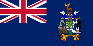
South Georgia and the South Sandwich Islands (SGSSI) is a British Overseas Territory in the southern Atlantic Ocean. It is a remote and inhospitable collection of islands, consisting of South Georgia and a chain of smaller islands known as the South Sandwich Islands. South Georgia is 165 km (103 mi) long and 35 km (22 mi) wide and is by far the largest island in the territory. The South Sandwich Islands lie about 700 km (430 mi) southeast of South Georgia. The territory's total land area is 3,903 km2 (1,507 sq mi). The Falkland Islands are about 1,300 km (810 mi) north-west from its nearest point.
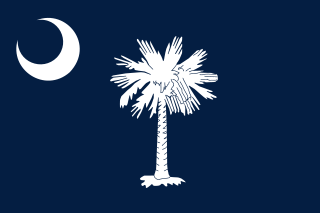
South Carolina is a state in the Southeastern United States and the easternmost of the Deep South. It is bordered to the north by North Carolina, to the southeast by the Atlantic Ocean, and to the southwest by Georgia across the Savannah River.

South Park is an American adult animated sitcom created by Trey Parker and Matt Stone and developed by Brian Graden for the Comedy Central television network. The show revolves around four boys—Stan Marsh, Kyle Broflovski, Eric Cartman, and Kenny McCormick—and their exploits in and around the titular Colorado town. Much like The Simpsons, South Park uses a very large ensemble cast of recurring characters. It became infamous for its profanity and dark, surreal humor that satirizes a wide range of topics towards a mature audience. Parker and Stone developed the show from The Spirit of Christmas, two consecutive animated shorts. The latter became one of the first Internet viral videos, ultimately leading to South Park's production.

The South Island, also officially named Te Waipounamu, is the larger of the two major islands of New Zealand in surface area; the other being the smaller but more populous North Island. It is bordered to the north by Cook Strait, to the west by the Tasman Sea, and to the south and east by the Pacific Ocean. The South Island covers 150,437 square kilometres (58,084 sq mi), making it the world's 12th-largest island. It has a temperate climate.

South Bend is a city in and the county seat of St. Joseph County, Indiana, United States, on the St. Joseph River near its southernmost bend, from which it derives its name. As of the 2010 census, the city had a total of 101,168 residents; its Metropolitan Statistical Area had a population of 318,586 and Combined Statistical Area of 721,296. It is the fourth-largest city in Indiana, serving as the economic and cultural hub of Northern Indiana. The highly ranked University of Notre Dame is located just to the north in unincorporated Notre Dame, Indiana and is an integral contributor to the region's economy.

The southern United States, also known as the American South, Dixie, Dixieland, or simply the South, is a region of the United States of America. It is located between the Atlantic Ocean and the western United States, with the midwestern United States and northeastern United States to its north and the Gulf of Mexico and Mexico to its south.

South Ossetia, officially the Republic of South Ossetia – the State of Alania, or the Tskhinvali Region, is a disputed territory in the South Caucasus, in the northern part of the internationally recognised Georgian territory. It has a population of 53,000 people who live in an area of 3,900 km2, south of the Russian Caucasus, with 30,000 living in Tskhinvali. The separatist polity, Republic of South Ossetia, is recognised as a state by Russia, Venezuela, Nicaragua, Nauru, and Syria. While Georgia lacks control over South Ossetia, the Georgian government and most members of the United Nations consider the territory part of Georgia, whose constitution designates the area as "the former autonomous district of South Ossetia", in reference to the former Soviet autonomous oblast disbanded in 1990.

Apartheid was a system of institutionalised racial segregation that existed in South Africa from 1948 until the early 1990s. Apartheid was characterised by an authoritarian political culture based on baasskap, which encouraged state repression of Black African, Coloured, and Asian South Africans for the benefit of the nation's minority white population. The economic legacy and social effects of apartheid continue to the present day.

The states and territories are the first-level administrative divisions of the Commonwealth of Australia. They are the second level of government in Australia, located between the federal and local government tiers.

South Asia or Southern Asia, is a term used to represent the southern region of the Asian continent, which comprises the sub-Himalayan SAARC countries and, for some authorities, adjoining countries to the west and east. Topographically, it is dominated by the Indian Plate, which rises above sea level as Nepal and northern parts of India situated south of the Himalayas and the Hindu Kush. South Asia is bounded on the south by the Indian Ocean and on land by West Asia, Central Asia, East Asia, and Southeast Asia.
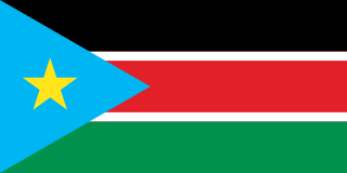
South Sudan, officially known as the Republic of South Sudan, is a landlocked country in East-Central Africa. The country gained its independence from the Republic of the Sudan in 2011, making it the newest country with widespread recognition. Its capital and largest city is Juba.
