Bushbuckridge Mapulaneng | |
---|---|
Coordinates: 24°28′S31°32′E / 24.467°S 31.533°E | |
Country | South Africa |
Province | Mpumalanga |
District | Ehlanzeni |
Seat | Bushbuckridge |
Wards | 37 [1] [2] [3] [4] |
Government | |
• Type | Municipal council |
• Mayor | Sylvia C Nxumalo (ANC) |
Area | |
• Total | 10,250 km2 (3,960 sq mi) |
Population (2011) [6] | |
• Total | 541,248 |
• Density | 53/km2 (140/sq mi) |
Racial makeup (2011) | |
• Black African | 99.5% |
• Coloured | 0.1% |
• Indian/Asian | 0.1% |
• White | 0.2% |
First languages (2011) | |
• Tsonga | 56.88% |
• Northern Sotho | 24.52% |
• Swazi | 7.83% |
• Sotho | 5.42% |
• Other | 5.35% |
Time zone | UTC+2 (SAST) |
Municipal code | MP325 |
Bushbuckridge Municipality (Tsonga : Masipala wa Bushbuckridge; Northern Sotho : Mmasepala wa Bushbuckridge) is a local municipality within the Ehlanzeni District Municipality, in the Mpumalanga province of South Africa. [7] Commercial farming, which consists of pine and bluegum plantations, tobacco, cotton, sub-tropical fruits and vegetables, is practised in the municipality's countryside. The municipality includes the southern part of Kruger National Park. [2] Bushbuckridge is the largest local municipality in Mpumalanga in terms of land size.
The name Bushbuck Ridge was given because of the large herds of bushbuck found there in the 1880s, and the prominent WNW-ESE ridge in the southeastern part of the municipality. [8] The town of Bushbuckridge grew around a trading store that opened in 1884. Prior to the colonial and apartheid era, the land known today as Bushbuckridge and Hazyview was well known as Mapulaneng, it has been home to the Mapulana people for centuries before the Shangaan people and the Swazi people were allowed to settled in the area during the reign of Mapulana chief Maripe Mashile. Mapulaneng was replaced during the white conquest and named Bushbuckridge. Mapulaneng proper stretches from the Eswatini border to Ermelo in the south, Olifants River (Lepelle) in the north, Lebombo Mountains in the east and also includes the whole town of Hazyview, Nelspruit, Sabie, Graskop, Hoedspruit, Barberton, Lydenburg and Dullstroom in the west. In Sepulana, Mapulaneng means "Place of the Mapulana people"; the tribe derive their name from their founding leader, Lepulana who later changed his name to Chiloane. Mapulana are descendants of Morolong and their origin can be traced back to Kgalagadi before they settled in Thaba Chueu, in what is today eastern Lesotho and Shakwaneng (Carolina) in the 1500s. Mapulana of Matshwe I got their name from their leader Pulane and they are of Amazizi of Nguni origin and they join the other Mapulana of Mohlomi at Thaba Chueu after the death of their leader Tsosane. Mapulana successfully defended the area from Swazi armies who they annihilated at the battle of Moholoholo in December 1864.[ citation needed ]
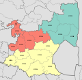
In 1994, when the Transvaal Province was dismantled and divided into four provinces, the area from Bushbuckridge to Hazyview was included in Limpopo province. The decision was based on the fact that most of the Bushbuckridge area had been part of three separate bantustans — Gazankulu, Lebowa and KaNgwane — but the bigger sector fell within Gazankulu, which was incorporated into Limpopo. The citizens of Bushbuckridge were unhappy with this arrangement, and became embroiled in a dispute with the government, demanding inclusion of the area in Mpumalanga province. They were concerned that should the area be included into Limpopo, they would be marginalised and suffer poor service delivery since Polokwane, the capital city of Limpopo Province, is more than 300 km away, whereas Nelspruit, the capital of Mpumalanga is only 58 km away. For more than two years the government refused to place Bushbuckridge under Mpumalanga, leading to violent protests and resistance from the community, which included stay-aways, road blocks with burning tyres and destruction of civil and government property.
A decision was taken at Cabinet level in 1998 to transfer the area to Mpumalanga. However, this was not done until 2000, when President Thabo Mbeki and his Cabinet amended the Constitution to legalise the transfer. Because of red tape, it was not until 2005 that Bushbuckridge was officially transferred to Mpumalanga. [9]
Bushbuckridge is bordered by Mopani District Municipality of Limpopo Province to the north, by Mozambique to the east, by Mbombela and Nkomazi Local Municipality to the south, and by Thaba Chweu and Maruleng Local Municipality to the west. [2] [3]
The 2013 proposal to adjust the border between the municipal area of Mbombela (MP322) and Bushbuckridge Local Municipalities (MP325) [10] was approved for implementation in 2016. [11]
The population of the municipality in the 2011 census was 541,248. [3] The most-spoken first language is Tsonga with about 57%, followed by Northern Sotho language with about 25%. [7]
Bushbuckridge Local Municipality consists of 135 settlements and is divided into thirty-seven wards. [3] [4]
The 2001 census divided the municipality into the following main places: [12] Main languages Spoken in Bushbuckridge are Sepulana (Northern Sotho/Sepedi), Tsonga(Shaangan) and Swati
Place | Code | Area (km2) | Population | Most spoken language |
---|---|---|---|---|
Amashangana | 98601 | 84.12 | 10,877 | Shangaan, |
Bushbuckridge | 98602 | 72.65 | 1,726 | Northern Sotho, |
College View | 98603 | 1.78 | 1,927 | Sotho |
Hoxane | 98604 | 53.19 | 39,617 | Shangaan/Tsonga |
Hoxani | 98605 | 93.05 | 14,341 | Shangaan |
Jongilanga | 98606 | 256.87 | 50,128 | Shangaan |
Malele | 98607 | 16.08 | 11,637 | Northern Sotho |
Manyeleti | 98608 | 185.69 | 114 | Shangaan |
Mapulaneng | 98609 | 335.25 | 125000 | Northern Sotho/Sepulana |
Mathibela | 98610 | 111.46 | 57,416 | Swazi |
Mnisi | 98611 | 461.03 | 66,659 | Shangaan |
Moletele | 98612 | 51.29 | 22,527 | Northern Sotho |
Moreipuso | 98613 | 84.43 | 28,322 | Northern Sotho |
Sabi Sand Game Reserve | 98614 | 4.70 | 134 | English |
Setlhare | 98615 | 168.93 | 44,000 | Northern Sotho |
Thabakgolo | 98616 | 100.14 | 53,624 | Northern Sotho |
Remainder of the municipality | 88601 | 315.93 | 641 | Northern Sotho |
The municipal council consists of seventy-six members elected by mixed-member proportional representation. Thirty-eight councillors are elected by first-past-the-post voting in thirty-eight wards, while the remaining thirty-eight are chosen from party lists so that the total number of party representatives is proportional to the number of votes received. In the election of 1 November 2021 the African National Congress (ANC) won a majority of fifty-three seats on the council.
The following table shows the results of the election. [13] [14]
Party | Ward | List | Total seats | |||||
---|---|---|---|---|---|---|---|---|
Votes | % | Seats | Votes | % | Seats | |||
African National Congress | 65,486 | 63.28 | 37 | 69,546 | 68.33 | 16 | 53 | |
Economic Freedom Fighters | 10,119 | 9.78 | 0 | 11,183 | 10.99 | 8 | 8 | |
Independent South African National Civic Organisation | 5,876 | 5.68 | 1 | 6,628 | 6.51 | 4 | 5 | |
Independent candidates | 9,538 | 9.22 | 0 | 0 | ||||
African People's Convention | 2,527 | 2.44 | 0 | 2,974 | 2.92 | 2 | 2 | |
Democratic Alliance | 2,394 | 2.31 | 0 | 2,516 | 2.47 | 2 | 2 | |
Better Residents Association | 2,377 | 2.30 | 0 | 2,359 | 2.32 | 2 | 2 | |
South Africa My Home Residents Association | 1,686 | 1.63 | 0 | 1,715 | 1.69 | 1 | 1 | |
Democratic Community Movement | 979 | 0.95 | 0 | 987 | 0.97 | 1 | 1 | |
Bushbuckridge Locals Movement | 732 | 0.71 | 0 | 847 | 0.83 | 1 | 1 | |
African Transformation Movement | 558 | 0.54 | 0 | 604 | 0.59 | 1 | 1 | |
10 other parties | 1,214 | 1.17 | 0 | 2,418 | 2.38 | 0 | 0 | |
Total | 103,486 | 100.00 | 38 | 101,777 | 100.00 | 38 | 76 | |
Valid votes | 103,486 | 97.80 | 101,777 | 97.33 | ||||
Invalid/blank votes | 2,333 | 2.20 | 2,791 | 2.67 | ||||
Total votes | 105,819 | 100.00 | 104,568 | 100.00 | ||||
Registered voters/turnout | 246,357 | 42.95 | 246,357 | 42.45 |
Mpumalanga is one of the nine provinces of South Africa. The name means "East", or literally "The Place Where the Sun Rises" in the Nguni languages. Mpumalanga lies in eastern South Africa, bordering Eswatini and Mozambique. It shares borders with the South African provinces of Limpopo to the north, Gauteng to the west, the Free State to the southwest, and KwaZulu-Natal to the south. The capital is Mbombela.
Limpopo is the northernmost province of South Africa. It is named after the Limpopo River, which forms the province's western and northern borders. The term Limpopo is derived from Rivombo (Livombo/Lebombo), a group of Tsonga settlers led by Hosi Rivombo who settled in the mountainous vicinity and named the area after their leader. The Lebombo mountains are also named after them. The river has been called the Vhembe by local Venda communities of the area. The capital and largest city in the province is Polokwane, while the provincial legislature is situated in Lebowakgomo.
Mbombela, formerly Nelspruit, is a city in northeastern South Africa. It is the capital of the Mpumalanga province. Located on the Crocodile River, the city lies about 110 km (68 mi) by road west of the Mozambique border, 330 km (210 mi) east of Johannesburg and 82 km (51 mi) north of the Eswatini border. Mbombela was one of the host cities of the 2010 FIFA World Cup.
The Tsonga people are a Bantu ethnic group primarily native to Southern Mozambique and South Africa. They speak Xitsonga, a Southern Bantu language. A very small number of Tsonga people are also found in Zimbabwe and Northern Eswatini. The Tsonga people of South Africa share some history with the Tsonga people of Southern Mozambique, and have similar cultural practices, but differ in the dialects spoken.
Hazyview is a sub-tropical farming town in Mpumalanga, South Africa, renowned for its large banana and macadamia nut industries, contributing about 20% of South Africa's bananas and 30% of macadamia output. Bordering the Kruger National Park, the town's name is derived from the shimmering haze that occurs during the heat of summer. Most of the province of Mpumalanga's private game reserves are found just east of Hazyview.
White River is a small holiday and farming town situated just north of Mbombela in Mpumalanga, South Africa. The farms in the region produce tropical fruits, macadamia nuts, vegetables, flowers and timber. As of 2011, White River had a population of 16,639.
Local government in South Africa consists of municipalities of various types. The largest metropolitan areas are governed by metropolitan municipalities, while the rest of the country is divided into counties called district municipalities, each of which consists of several boroughs called local municipalities. Since the boundary reform at the time of the municipal election of 3 August 2016 there are eight metropolitan municipalities, 44 district municipalities and 205 local municipalities.
The R40 is a provincial route in South Africa that connects the Eswatini border at Bulembu via Barberton, Mbombela, Bushbuckridge, Acornhoek and Hoedspruit with Phalaborwa. The route spans two provinces and passes through several private game reserves.
Gazankulu was a bantustan in South Africa, intended by the apartheid government to be a semi-independent homeland for the Tsonga people. It was located in both the Northern Transvaal, now Limpopo province and Eastern Transvaal, now Mpumalanga province.
Giyani is a city situated in the north-eastern part of Limpopo Province, South Africa. It is the administrative capital of the Mopani District Municipality and a former capital of the defunct Gazankulu Bantustan. The city of Giyani is divided into seven sections: Section A, Section D1, Section D2, Section E, Section F, Kremetart, and Giyani CBD. Risinga View and Church View are new residential areas in Giyani, but they fall under the local traditional leaders. The Giyani CBD is nicknamed Benstore, and this name is commonly used by residents of the region. Giyani is surrounded by a number of villages with rich Tsonga cultural activities, administered by the Greater Giyani Local Municipality.
The Mopani District Municipality is one of the 5 districts of the Limpopo province of South Africa. The seat of the district is Giyani. According to the 2016 Community Survey, it had a population of 1,159,185. The district code is DC33. After the 12th amendment to the Constitution of South Africa, parts of the Bohlabela District Municipality were incorporated into Mopani.
Mbombela Municipality is a local municipality within the Ehlanzeni District Municipality, in the Mpumalanga province of South Africa. Mbombela is a siSwati word meaning "a lot of people in a small space".
Thaba Chweu Municipality is a local municipality within the Ehlanzeni District Municipality, in the Mpumalanga province of South Africa.
Greater Tzaneen Municipality is a local municipality within the Mopani District Municipality, in the Limpopo province of South Africa. The seat of the municipality is Tzaneen.
Greater Letaba Municipality is a local municipality within the Mopani District Municipality, in the Limpopo province of South Africa. The seat is Modjadjiskloof.
Casteel is a town in Ehlanzeni District Municipality in the Mpumalanga province of South Africa. The legal name was changed to Maboke in 2008. Maboke is place consisting of Mapulana and Tsonga people. There is a proud culture of Dikoma which takes place during the winter times, during the months of June to August annually, and is a place where young boys are taught the cultural and roots of the Mapulana people.
Alexandria is a town in Bushbuckridge Local Municipality under Ehlanzeni District Municipality in the Mpumalanga province of South Africa. It got its theme of footprints on rock in the mountains of Simeleni.
Matsulu is a township in the Mbombela Local Municipality under the Ehlanzeni District Municipality in the Mpumalanga province of South Africa. It lies between Kruger National Park and the N4 national road 41 kilometres east of Mbombela, 3 kilometres before the Kaapmuiden train station. It is also surrounded by the Nsikazi River & Crocodile River.
Acornhoek, commonly known as Khenhuk, is a semi-rural town situated in the north eastern areas of Bushbuckridge in the Mpumalanga province of South Africa.
The Mapulana orPulana, are a low-veld ethnic group found in Bushbuckridge near Mpumalanga and Limpopo provinces. Their language is called Sepulana and is considered a dialect of the Northern Sotho language group, although it is a Northern Sotho dialect. It also hugely influenced by Xitsonga, Swati, Afrikaans, English, and Setswana.