Related Research Articles

The Tasman Sea is a marginal sea of the South Pacific Ocean, situated between Australia and New Zealand. It measures about 2,000 km (1,200 mi) across and about 2,800 km (1,700 mi) from north to south. The sea was named after the Dutch explorer Abel Janszoon Tasman, who was the first recorded European to encounter New Zealand and Tasmania. British explorer Captain James Cook later extensively navigated the Tasman Sea in the 1770s as part of his first voyage of exploration.

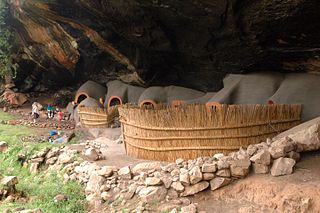
Berea is a district of Lesotho. In the west, Berea borders on the Free State Province of South Africa. Domestically, it borders on the following districts: Leribe District in the north, Thaba-Tseka District in southeast and Maseru District in the south. Teyateyaneng is the capital of the district. It is also home to the Kome Cave Dwellings. It is also the only district in Lesotho which is not named after its capital.

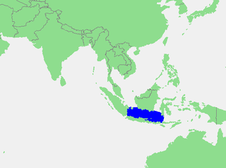
The Java Sea is an extensive shallow sea on the Sunda Shelf. It lies between the Indonesian islands of Borneo to the north, Java to the south, Sumatra to the west, and Sulawesi to the east. Karimata Strait to its northwest links it to the South China Sea. It is a part of the western Pacific Ocean.

Valdres is a traditional district in central, southern Norway, situated between Gudbrandsdalen and Hallingdal. The region around Valdres consists of the six municipalities of Nord-Aurdal, Sør-Aurdal, Øystre Slidre, Vestre Slidre, Vang and Etnedal. Valdres has about 18,000 inhabitants and is known for its excellent trout fishing and "beautiful" dialect. Its main road is E16 and Fylkesveg 51.

Janakpur was one of the fourteen zones of Nepal, reaching from the Indian border in the south to the Tibetan border in the north and Sagarmatha Zone in the east and Bagmati and Naryani Zones in the west.

Borchgrevink Glacier is a large glacier in the Victory Mountains, Victoria Land, draining south between Malta Plateau and Daniell Peninsula, and thence projecting into Glacier Strait, Ross Sea, as a floating glacier tongue, the Borchgrevink Glacier Tongue, just south of Cape Jones. It was named by the New Zealand Geological Survey Antarctic Expedition, 1957–58, for Carsten Borchgrevink, leader of the British Antarctic Expedition, 1898–1900. Borchgrevink visited the area in February 1900 and first observed the seaward portion of the glacier.

Narsinghpur district is a district of Madhya Pradesh state in central India. The city of Narsinghpur is administrative headquarters of the district.As of 2001 Narsinghpur is the most literate district of MP.

uMzinyathi is one of the 11 district municipalities ("districts") of KwaZulu-Natal province in South Africa. The seat of uMzinyathi is Dundee. The majority of its 456 452 people speak IsiZulu. The district code is DC24

Gert Sibande is one of the 3 districts of Mpumalanga province of South Africa. The seat of Gert Sibande is Ermelo. The majority of its 900 007 people speak IsiZulu. The district code is DC30. On 15 October 2004, the municipality changed its name from the "Eastvaal" to "Gert Sibande" District Municipality. The district is named after the ANC activist Gert Sibande.
Sơn Hòa is a rural district (huyện) of Phú Yên Province in the South Central Coastal region of Vietnam. As of 2003 the district had a population of 50,212. The district covers an area of 950 km². The district capital lies at Củng Sơn.
Bhumirajmandau is a village development committee in Doti District in the Seti Zone of western Nepal. At the time of the 1991 Nepal census it had a population of 3891 living in 743 individual households.

Govan Mbeki Local Municipality is a South African local municipality situated in the Gert Sibande District Municipality, of Mpumalanga. Secunda is the seat of the municipality.

Ba-Phalaborwa Local Municipality is located in the Mopani District Municipality of Limpopo province, South Africa. The seat of Ba-Phalaborwa Local Municipality is Phalaborwa.

The borders of the oceans are the limits of Earth's oceanic waters. The definition and number of oceans can vary depending on the adopted criteria.
Hood Glacier is a glacier about 25 nautical miles (46 km) long draining northward from Siege Dome in the Commonwealth Range of Antarctica. It enters the Ross Ice Shelf between the Commonwealth Range and the Separation Range. The glacier was discovered by the Southern Polar Party of the British Antarctic Expedition, 1907–09, under Ernest Shackleton, and was named for Admiral Sir Horace Hood, under whom Jameson Adams, a member of the party, had served in HMS Berwick.

The Electoral district of South Bourke was an electoral district of the Legislative Assembly in then Australian colony of Victoria. It was one of the original 36 electoral districts of the Assembly. It covered an area east of Melbourne, bounded by Dandenong Creek in the south and east, Moorabbin, Prahran and Hawthorn in the west and Templestowe in the north. It was abolished in 1889.
CD-35 was a C Type class escort ship (Kaibōkan) of the Imperial Japanese Navy during the Second World War.
CD-43 was a C Type class escort ship (Kaibōkan) of the Imperial Japanese Navy during the Second World War. She was laid down by Mitsubishi Heavy Industries at their Kobe Shipyard on 10 April 1944, launched on 22 June 1944, and completed and commissioned on 31 July 1944. During the war CD-43 was mostly busy on escort duties.
W-101 or No. 101 was a Bangor-class minesweeper that was seized by the Imperial Japanese Navy before completion during World War II and converted into a minesweeper.
References
- 1 2 3 "Islington". Census 2011.
Coordinates: 30°10′S29°55′E / 30.167°S 29.917°E
| This Mpumalanga location article is a stub. You can help Wikipedia by expanding it. |
