Archaeological evidence from surrounding areas suggests that people have lived on the land that later became White River for thousands of years. Remains of settlements from the 6th-century BC point to Iron Age African agricultural and livestock-keeping societies that lived in the area.[2][3] The Plaston site, east of White River, shows evidence of communities in the area from circa 620 CE.[4] Numerous Khoe-San rock painting sites nearby are indicative of even longer human settlement.[5] By the early 19th century, the area was inhabited by Eastern Sotho (MaPulana, Kutswe and Pai) societies and later Swazi chieftaincies.[4] What was known as the Emanzimhlope River, a tributary of the Crocodile, River flowed through the region. Emanzimhlope translates to 'White Waters' in siSwati.
Colonial Era
Malaria and animal trypanosomiasis pervasive in the lowveld in the 19th century meant that white settlers initially avoided year-round settlement in the White River area. Boer traders, hunters and farmers from settlements in the highveld only came down to the area in the winter. The first year round settlement in the White River area was an isolated farm only in 1873 by Bill Sanderson a Scottish gold prospector, hunter and trader.[6] Only after the 1890s African rinderpest epizootic, which wiped out trypanosomiasis, did white settlers begin to settle in the White River area. By claiming the most agriculturally productive, wettest areas with the best climates as their own, white settlers dispossessed Africans of land that they had lived on for generations.[7]
In 1905, after the South African War, Lord Alfred Milner (British administrator of the Transvaal) demarcated land along the Emanzimhlope river for settlement by British settlers, mainly demobilised BritishAnglo-Boer War soldiers. Milner tasked soldier Tom Lawrence to allocate land to the settlers. Lawrence became the first manager of the new settlement, with the longest street in the town still named after him. Initially, the colonial administration provided settlers with farming equipment and a weekly salary until they began to make an income from their tobacco, citrus, maize and other vegetable crops.[8] Farmers were heavily subsidized until 1907 and the building of a 25 kilometer long irrigation canal improved prospects for some. However, the scheme largely failed and many settlers gave up farming when their contracts ended.[9] In 1911, the Union government sold the farms at White River for a significant loss to a syndicate that planted scale citrus farms on the land.[10] After WWI, the settlement scheme expanded as the land was sold at discounted rates to demobilised white soldiers.[9]
In 1923, a tiny plot of land on the edge of White River was designated as a "location" for black wage workers and their families. The rest of White River was reserved for white settlers. In the mid 1960s, the Lowvelder newspaper reported that while the white residential areas of White River expanded significantly in the following decades, the black location remained confined to just 15 hectares, although the population of the community had expanded to over 3000 people.[11]
Apartheid Era
Under the Apartheid era Group Areas Act, White River was designated a white area. The aparthied state and white farmers forcibly resettled thousands of black people living in White River and as labour tenants on surrounding farms were to African reserves and towns like Bushbuckridge, Pienaar and Kabokweni. These removals accelerated, especially under policies of separate development in the 1960s and 1970s.[12][13] In 1968, the Bantu Affairs Department forcibly removed 3000 people from the White River location to a newly established township at Ngodini.[12] Many people in these resettled township communities commuted daily between what became the bantustan of KaNgwane to White River and other towns like Nelspruit segregated as white.[12]
White River was the base for the Whiteriver Commando, an infantry regiment of the South African Army.
Region
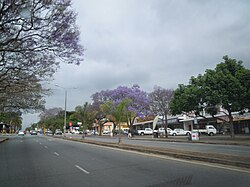
White River lies 20km north of Mbombela, and 46km south of Hazyview, not far from the border with Kruger National Park. It is 15km west-north-west of the Kruger Mpumalanga International Airport.[14] The town includes a residential, commercial, and industrial areas while agricultural holdings are on the outskirts of the town. The town features a library, municipal buildings, car dealerships, filling stations, lodges and hotels, churches, a mosque, a police station, and retail centers.[14] It is a popular holiday destination for those looking to visit the Crocodile River Valley, Panorama and Lowveld Legogote Tourism Routes and the Kruger National Park.[14] The town itself has a reputation for its arts and crafts. The Casterbridge Lifestyle Centre situated on the outskirts of the city is a popular tourist stop. Once a mango plantation, the centre now has a cinema, a vintage motor museum and restaurants and hosts art exhibitions, plays and concerts.[15]
Government
White River is in the Mbombela A Municipal Zone, falling under Ward 30 and is governed by the Democratic Alliance (DA), South Africa's official opposition party.
Agriculture
A view from Legogote Mountain of timber plantations, farms and indigenous bush surrounding White River
The White River area is one of the most fertile in the province and farming continues to be a central part of the local economy. After a 26km canal to channel water from the river was built, new farmers planted fruit trees and established new cultivation methods. Today, agriculture involves largely the production of tropical fruits, macadamia nuts, vegetables, flowers and timber. The farms tend to be relatively small and the agriculture is intensive. Farms are irrigated by nearby dams such as Longmere, Witklip and Klipkoppie.
White River is located in the low altitude subtropical Lowveld climatic zone. Savannah and woodland scattered with granite outcrops form the indigenous habitat. Compared to other parts of South Africa, the climate is mild with good rainfall. Nevertheless, like the rest of South Africa, White River and its surrounding farms are being adversely impacted by climate change. The area is especially prone to frost, veld fires and droughts that pose food production threats and economic risks to farmers.[16]
In 2003, 6 000 hectares of land on the outskirts of White River and surrounding areas were redistributed to the Matsafeni trust when the state purchased the land from Hall & Sons for R63 million under the South African national land reform program.[18] As of 2016, Mbombela, the municipality that White River falls under, had a housing backlog of 34 000 units, impacting low income families especially hard.[14] The persistence of Apartheid-era spatial planning means that land close to the town is expensive and privately owned. This, combined with the economic opportunities and employment, mainly in White River and Mbombela mean that informal settlements around Rocky Drift (Msholozi and Phumlani) and other nearby areas have been established in recent years.[14]
A park in White River
Districts
Parkville
Kingsview
Colts Hill
Yaverland
Media
The town's local newspaper, the White River Post was established in 2006 and has a distribution of 5000 copies every two weeks.[19] Larger local papers, such as the Lowvelder and Mpumalanga News also cover news in White River.
Nature Reserve
Wetland area in the White River Nature Reserve
In March 1994, a piece of land in White River was formally declared nature reserve. The nature reserve provides important habitat for local biodiveristy.
Botany
The wider area surrounding White River has many endemic plant species. These include:
↑Evers, T. M. (1977). "Plaston Early Iron Age Site, White River District, Eastern Transvaal, South Africa". The South African Archaeological Bulletin. 32 (126): 170–178. doi:10.2307/3888664. JSTOR3888664.
↑King, Brian H. (2007). "Developing KaNgwane: Geographies of Segregation and Integration in the New South Africa". The Geographical Journal. 173 (1): 13–25. doi:10.1111/j.1475-4959.2007.00228.x. JSTOR30113490.
This page is based on this Wikipedia article Text is available under the CC BY-SA 4.0 license; additional terms may apply. Images, videos and audio are available under their respective licenses.