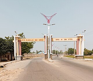
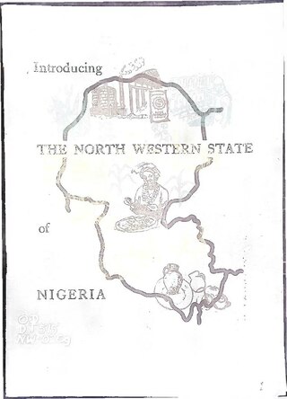
Kebbe is a Local Government Area in Sokoto State, Nigeria. Its headquarters are in the town of Kebbe. The LGA shares a border with Zamfara State in the east and Kebbi State in the south and west.

Ningi is a town, a local government area, and an emirate in Bauchi State, Nigeria. The Ningi emirate comprises two local government areas, Ningi and Warji, with a combined area of 5,250 km2 and a population of 501,912 according to the 2006 Census. The Ningi local government area covers an area of 4,625 km2 with a population of 387,192 at the 2006 Census. The area is inhabited mostly by hausa people, Duwa, Ningawa. Yunusa Muhammadu Danyaya was the longes Emir to reigned who ascended the throne from 1978 until his death on 25 August 2024..
Gwarzo is a Local Government Area in Kano State, Nigeria. Its headquarters are in the town of Gwarzo.

Gboko is a Local Government Area in Benue state, North-central Nigeria. It is headquartered in the town of Gboko.

Funtua is a local government area in Katsina State, Nigeria, and is headquartered in the town of Funtua on the A126 highway.
Gummi is a Local Government Area in Zamfara State, Nigeria. Its headquarters is in the town of Gummi at12°08′30″N5°07′30″E .
Danbatta is a Local Government Area in Kano State, Nigeria. It is located about 49 miles north of Kano city at the Northern border of Kano state with Jigawa state. It has headquarters at Danbatta town, located on the A2 highway.
Karaye is a Local Government Area and Headquarter of Karaye Emirate Council in Kano State, Nigeria. Its headquarters are in the town of Karaye.

Dawakin Tofa is a Local Government Area in Kano State, Nigeria. Its headquarters are in the town of Dawakin Tofa and It includes a number of cities and villages, such as Alajawa, Bagari, Bankaura, Dandalama, Jobenkun, Kaleku, Rumi and Yelwa. Hausa and Fulani ethnic divides being the two most notable tribes. The Hausa and Fufulde languages are widely spoken in the region, and Islam is the most commonly practiced religion there. The Dawakin Tofa General Hospital and the Dawakin Tofa Science College are well-known structures in Dawakin Tofa.
Fagge is a Local Government Area in Kano State, Nigeria, within the state metropolitan. Its headquarters are in the suburb of Waje.

Birnin Gwari is a Local Government Area in Kaduna State, Nigeria. Its headquarters are in the town of Birnin Gwari.
Soba is a Local Government Area in Kaduna State, Nigeria. Its headquarters is in the town of Maigana.
Anka is a Local Government Area in Zamfara State, Nigeria. Its headquarters is in the town of Anka at 12°06′30″N5°56′00″E.
Maradun is a Local Government Area in Zamfara State, Nigeria. Its headquarters is in the town of Maradun12°34′00″N6°14′40″E towards the south of the Area.
Shinkafi is a Local Government Area in Zamfara State of Nigeria. Its headquarters is in the town of Shinkafi an area of about 674mk2 and population of 135,649. It shares boundaries with Isa Local Government Area and Niger Republic from the north, Zurmi Local Government Area to the South and South-East, Maradun Local Government Area and Raba Local Government Area by the west. Distance from the State Capital, Gusau is approximately 116 km.
Bungudu is a Local Government Area in Zamfara State, Nigeria. Its headquarters is in the town of Bungudu at12°16′00″N6°33′24″E.
Tsafe is a Local Government Area L G A) in Zamfara State, Nigeria. Its headquarters is in the town of Chafe town. It shares boundaries with Gusau Local Government Area to the northwest, west, and south, while its northeastern and eastern borders connect with Katsina state. The local government council oversees public administration within the area, and its legislative council formulates laws that govern the local government jurisdiction.
Bakura is a Local Government Area in Zamfara State, Nigeria. Its headquarters are in the town of Bakura at12°42′37″N5°52′23″E in the north-east of the Local government area.Wind
Birnin Magaji/Kiyaw is a Local Government Area in Zamfara State, Nigeria. Its headquarters are in the town of Birnin Magaji in the north of the LGA at12°33′00″N6°49′00″E. The LGA is also named from the town of Kiyaw to the south.
Tureta is a Local Government Area in Sokoto State, Nigeria. Its headquarters is in the town of Tureta. It shares a border with Zamfara State in the south and east. They are mainly Hausa people predominantly Burmawa. Islam is there main religion. Fishing and farming are the major occupations. Currently Dr Muhammad Danrabi Tureta is their newly appointed king title as sarkin Burmin tureta.


