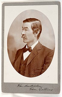
Joseph Furphy was an Australian author and poet who is widely regarded as the "Father of the Australian novel". He mostly wrote under the pseudonym Tom Collins and is best known for his novel Such Is Life (1903), regarded as an Australian classic.

Warragul is a town in Victoria, Australia, 102 kilometres south-east of Melbourne. Warragul lies between the Strzelecki Ranges to the south and the Mount Baw Baw Plateau of the Great Dividing Range to the north. As at the 2021 census, the town had a population of 19,857 people. Warragul forms part of a larger urban area that includes nearby Drouin that had an estimated total population of 37,928 at June 2018.

The Shire of Baw Baw is a local government area in Victoria, Australia, in the eastern part of the state. It covers an area of 4,028 square kilometres (1,555 sq mi) and in June 2018 had a population of 52,015.

Bulleen is an eastern suburb in Melbourne, Australia, 13 km north-east of the Melbourne central business district, located within the City of Manningham local government area. Bulleen recorded a population of 11,219 at the 2021 census.

Drouin is a town in the West Gippsland region, 90 kilometres (56 mi) east of Melbourne, in the Australian state of Victoria. Its local government area is the Shire of Baw Baw, and is home to the shire council’s headquarters despite being the second-largest town in the shire, behind neighbouring Warragul. The town’s name is believed to be an Aboriginal word meaning "north wind". New housing developments have accelerated the town's residential growth in recent years. As at the 2016 census, Drouin had a population of 11,887 people.
The Ellinbank and District Football League is an Australian rules football and Netball League, based in the West Gippsland region of Victoria for smaller towns and villages in the regions of Baw Baw, South Gippsland and Cardinia.

The County of Evelyn is one of the 37 counties of Victoria which are part of the cadastral divisions of Australia, used for land titles. It is located to the east of Melbourne, on both sides of the upper reaches of the Yarra River in the Yarra Valley. The Great Dividing Range is the boundary to the north. The county was proclaimed in 1849, and is named after John Evelyn, a famous diarist and gardener.

The County of Buln Buln is one of the 37 counties of Victoria which are part of the cadastral divisions of Australia, used for land titles. It was first proclaimed in government gazette on 24 Feb 1871 together with others from the Gipps Land District. It includes Wilsons Promontory, and the Victorian coast from around Venus Bay in the west to Lake Wellington in the east. Sale is near its north-eastern edge. Some time earlier maps showed proposed counties of Bass, Douro, and part of Haddington and Bruce occupying the area of Buln Buln.
John Delzoppo is an Australian retired politician who was Speaker of the Parliament of Victoria from 1992–1996 as part of the Liberal Kennett Government.
The City of Cranbourne was a local government area about 45 kilometres (28 mi) southeast of Melbourne, the state capital of Victoria, Australia. The city covered an area of 755 square kilometres (291.5 sq mi), and existed from 1860 until 1994. It was notable for being the last local government area to be declared a city prior to the large-scale amalgamations of 1994 – its former designation was the Shire of Cranbourne.

Longwarry is a town in Victoria, Australia, 83 kilometres (52 mi) south-east of Melbourne's Central Business District, located within the Shires of Baw Baw and Cardinia local government areas. Longwarry recorded a population of 2,436 at the 2021 census.
The Shire of Buln Buln was a local government area about 95 kilometres (59 mi) east-southeast of Melbourne, the state capital of Victoria, Australia. The shire covered an area of 1,259 square kilometres (486.1 sq mi) and existed from 1878 until 1994.

The Shire of Korumburra was a local government area located about 115 kilometres (71 mi) southeast of Melbourne, the state capital of Victoria, Australia. The shire covered an area of 613.8 square kilometres (237.0 sq mi), and existed from 1891 until 1994.

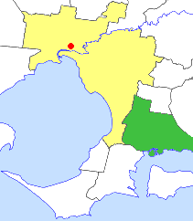
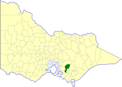
The Rural City of Warragul was a local government area about 100 kilometres (62 mi) east-southeast of Melbourne, the state capital of Victoria, Australia. The shire covered an area of 352.2 square kilometres (136.0 sq mi), and existed from 1881 until 1994.

The Shire of Narracan was a local government area about 120 kilometres (75 mi) east-southeast of Melbourne, the state capital of Victoria, Australia. The shire covered an area of 2,300 square kilometres (888.0 sq mi) and existed from 1878 until 1994.
Buln Buln is a town in West Gippsland, approximately 8 kilometres north of Warragul. At the 2021 Census, Buln Buln had a population of 551.
Buln Buln may refer to several places in Victoria, Australia:
Bena is a town in the South Gippsland region of Victoria, Australia. It is located 100 km south-east of Melbourne and 8 km from Korumburra.
Gippsland Province was an electorate of the Victorian Legislative Council from November 1882 until 2006. It was based in the Gippsland region of Victoria, Australia.
Colonel Quaritch, V.C.: A Tale of Country Life is an 1888 novel by H Rider Haggard.
