Busitema

Last updated
Busitema
Uganda location map.svg
Red pog.svg
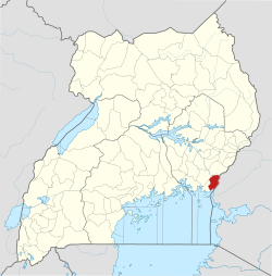
Busitema
Map of Uganda showing the location of Busitema
Coordinates: 00°34′21″N34°03′00″E / 0.57250°N 34.05000°E / 0.57250; 34.05000
CountryFlag of Uganda.svg Uganda
District Busia District
Elevation
1,080 m (3,540 ft)
Time zone UTC+3 (EAT)
Aerial view of Busitema area taken at one of the Busitema hills in Busitema University main campus Busitema University Main Campus.jpg
Aerial view of Busitema area taken at one of the Busitema hills in Busitema University main campus

Busitema is a settlement in eastern Uganda. It is the location of the Main Campus of Busitema University, one of the public universities in Uganda. [1]

Contents

Location

Busitema is located approximately 23 km (14 mi), by road, northwest of Busia, where the district headquarters are located. [2] This location is approximately 26 km (16 mi), by road, southwest of Tororo, the largest town in the sub-region. [3]

Population

As of April 2010, the exact population of Busitema was not known.

Landmarks

The landmarks within the town limits or close to the edges of town include:

References

  1. The Main Campus of Busitema University Located at Busitema
  2. "Road Distance Between Busia, Uganda And Busitema University Main Campus" (Map). Google Maps . Retrieved 2 October 2022.
  3. "Road Distance Between Tororo, Uganda And Busitema University Main Campus" (Map). Google Maps . Retrieved 2 October 2022.
  4. Location of the Seven Campuses of Busitema University

00°34′21″N34°03′00″E / 0.57250°N 34.05000°E / 0.57250; 34.05000