
The Eyre Peninsula is a triangular peninsula in South Australia. It is bounded on the east by Spencer Gulf, the west by the Great Australian Bight, and the north by the Gawler Ranges.

Buckleboo is a locality in the Australian state of South Australia on the Eyre Peninsula located about 313 kilometres (194 mi) northwest of the state capital of Adelaide and about 31 kilometres (19 mi) northwest of the municipal seat of Kimba.
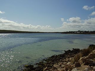
Coffin Bay, originally Coffin's Bay, is a town at the southern extremity of the Eyre Peninsula, a wheat growing area of South Australia. At the 2016 census, Coffin Bay had a population of 611.

Port Neill is a small coastal town on the eastern side of the Eyre Peninsula, in South Australia about 3 km off the Lincoln Highway between the major towns of Whyalla and Port Lincoln. It is 576 km by road from Adelaide.
Yallunda Flat is a locality in the Australian state of South Australia located on the Eyre Peninsula about 257 kilometres west of the state capital of Adelaide. Both its name and boundaries were created in 1998. The name is derived from the local landform of the same name. It includes the following two places which have been gazetted as “unbounded localities” - Kapinka and Urrano. Yallunda Flat is located within the federal division of Grey, the state electoral district of Flinders and the local government area of the District Council of Tumby Bay.
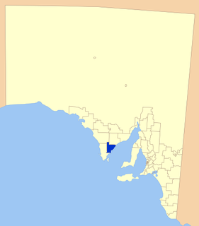
The Tumby Bay District Council is a local government area of South Australia covering an area of the North Eastern Eyre Peninsula. It was established in 1906, only six years after the town of Tumby Bay was established, when the district was severed from the former District Council of Lincoln to form the present council.
Ungarra is a small agricultural based town located on the Eyre Peninsula, in the Australian state of South Australia about 248 kilometres (154 mi) from the state's capital, Adelaide and around 80 kilometres (50 mi) north of Port Lincoln. At the 2006 census, Ungarra had a population of 241.
Lipson is an historic farming town on the Eyre Peninsula, located only 12 km from Tumby Bay, South Australia. At the 2006 census, Lipson had a population of 209.
Coorabie is a town and locality in the Australian state of South Australia located about 675 kilometres (419 mi) north-west of the state capital of Adelaide. It is outside of district council boundaries, and therefore managed by the Outback Communities Authority. It is located in the west of South Australia, and includes the Wahgunyah Conservation Park. The Eyre Highway passes through the locality, although the Coorabie township is south of the highway.

The County of Flinders is one of the 49 cadastral counties of South Australia. The county covers the southern part of the Eyre Peninsula “bounded on the north by a line connecting Point Drummond with Cape Burr, and on all other sides by the seacoast, including all islands adjacent to the main land.”
Koppio is a locality in the Australian state of South Australia located on the Eyre Peninsula about 256 kilometres (159 mi) west of the state capital of Adelaide and about 32 kilometres (20 mi) north of Port Lincoln, and within the Tod River catchment area. While long-established agricultural activities dominate the region is also prospective for graphite and iron ore. The Koppio Smithy Museum is a local tourist attraction replete with buildings and artifacts representing the early pioneer heritage of Eyre Peninsula.
Moody is a locality in the Australian state of South Australia located on the Eyre Peninsula about 257 kilometres west of the state capital of Adelaide. Its name and boundaries were both adopted and created in 1978. Its name is derived from the Hundred of Moody, the cadastral unit in which it is located. Moody is located within the federal division of Grey, the state electoral district of Flinders and the local government area of the District Council of Tumby Bay.
Hincks is a locality in the Australian state of South Australia located on the Eyre Peninsula about 253 kilometres west of the state capital of Adelaide.
Weeroona Island is a locality in the Australian state of South Australia about 209 kilometres north of the state capital of Adelaide and about 9.5 kilometres (5.9 mi) northeast of the city of Port Pirie.
Nadia is a locality in the Australian state of South Australia located on the state's west coast overlooking a bay associated with Great Australian Bight about 567 kilometres north-west of the Adelaide city centre and about 17 kilometres west of the town centre of Ceduna.
Colton is a locality in the Australian state of South Australia located on the west coast of Eyre Peninsula overlooking the Great Australian Bight about 374 kilometres (232 mi) north-west of the state capital of Adelaide and about 19 kilometres (12 mi) north of the municipal seat of Elliston.
Midgee is a locality in the Australian state of South Australia located on the east coast of Eyre Peninsula about 214 kilometres north-west of the state capital of Adelaide and about 37 kilometres north of the municipal seat of Cowell.
Kellidie Bay is a locality in the Australian state of South Australia located on the Eyre Peninsula in the state’s west overlooking parts of the body of water known as Coffin Bay about 290 kilometres (180 mi) west of the state capital of Adelaide and about 42 kilometres (26 mi) south-west of the municipal seat of Cummins.
Duck Ponds is a locality in the Australian state of South Australia located on the Eyre Peninsula in the state's west about 258 kilometres (160 mi) west of the state capital of Adelaide, about 51 kilometres (32 mi) south of the municipal seat of Cummins and about 6 kilometres (3.7 mi) west of the city of Port Lincoln.
Brooker is a locality in the Australian state of South Australia located in the state’s west on Eyre Peninsula about 266 kilometres (165 mi) west of the state capital of Adelaide and about 38 kilometres (24 mi) north-west of the municipal seat in Tumby Bay.
