
Aarwangen District was a district in the northeast corner of the canton of Bern in Switzerland, with its seat at Aarwangen. It was disbanded in December 2009. Its municipalities became part of the administrative region Emmental-Oberaargau.

Los Ríos is a province in Ecuador. The capital is Babahoyo. The province was founded on October 6, 1860. Under legislative decree. Babahoyo was made its capital on September 30, 1948.
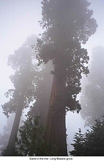
Sequoia National Forest is located in the southern Sierra Nevada mountains of California. The U.S. National Forest is named for the majestic Giant Sequoia trees which populate 38 distinct groves within the boundaries of the forest.

Srch is a village in the Pardubice Region of the Czech Republic. It has 1,547 inhabitants (2015).
Brackendale Eagles Provincial Park is a provincial park in British Columbia, Canada, located on the Squamish River adjacent to Brackendale, a suburban neighbourhood of Squamish.
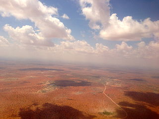
Wajir is the capital of the Wajir County of Kenya. It is situated in the former North Eastern Province.
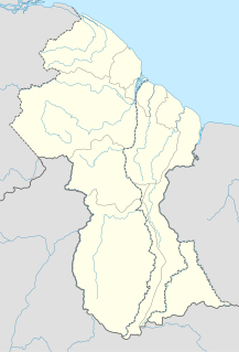
Providence is a community in the Demerara-Mahaica Region of Guyana, on the east bank of the Demerara River, located at 6°46′0″N58°10′0″W, altitude 1 metre. Providence is approximately 10 kilometres (6.2 mi) south of the capital, Georgetown.
The Lower Similkameen Indian Band or Lower Smelqmix, is a First Nations band government in the Canadian province of British Columbia. Their office is located in the village of Keremeos in the Similkameen region. They are a member of the Okanagan Nation Alliance.

The French submarine Rubis was a Saphir-class minelaying submarine which first served in the French submarine pavilion, then the Free French Naval Forces (FNFL) during the Second World War and back with the French Navy. The boat was awarded numerous awards. Accordingly, as a result of Rubis's service with the FNFL, the boat was made a companion of the Ordre de la Libération by a decree issued by General Charles de Gaulle on 14 October 1941.
Strand Fiord Pass is a mountain pass on southern Axel Heiberg Island, Nunavut, Canada.

Balavé is a department or commune of Banwa Province in western Burkina Faso. Its capital lies at the town of Balavé. According to the 1996 census the department has a total population of 14,820.

N'dorola is a department or commune of Kénédougou Province in south-western Burkina Faso. Its capital lies at the town of N'dorola.

Wolonkoto is a small department or commune of Léraba Province in south-western Burkina Faso. Its capital lies at the town of Wolonkoto. According to the 1996 census the department has a total population of 3,687.
Bradford is a town in western Sierra Leone, not far from the capital.

Desaguadero Municipality is the fourth municipal section of Ingavi Province in La Paz Department, Bolivia. Its capital is Desaguadero.
Uruca District, the seventh "district" of San José Canton, Costa Rica, comprises an important industrial and commercial area of San José. Commonly known as La Uruca, it's the second biggest district by area, and recognized as a heavily congested transportation hub.
Comaplix is the name of former mining town on the Incomappleux River in the northern Arrow Lakes region of British Columbia's Kootenay Country in Canada. The name of the town and an adjacent mountain and creek are derived from that of the river, which is an Okanagan word meaning "point at the head of the lake". The location, now flooded, is on the northeast side of Beaton Arm of Upper Arrow Lake, near the sites of Beaton and Camborne.

Chacarilla Municipality is the third municipal section of the Gualberto Villarroel Province in the La Paz Department, Bolivia. Its seat is Chacarilla. It had 23 inhabitants in 2001.
Echo Valley Provincial Park is a provincial park in Saskatchewan, Canada, located west of the Town of Fort Qu'Appelle in the Qu'Appelle Valley between Echo Lake and Pasqua Lake.

HMS Gore (K481) was a British Captain-class frigate of the Royal Navy in commission during World War II. Originally constructed as the United States Navy Evarts-class destroyer escort USS Herzog (DE-277), she served in the Royal Navy from 1943 to 1946.


