Dialakoro, Burkina Faso

Last updated
Dialakoro
Burkina Faso location map.svg
Red pog.svg
Dialakoro
Location in Burkina Faso
Coordinates: 11°11′N5°13′W / 11.183°N 5.217°W / 11.183; -5.217
Country Flag of Burkina Faso.svg Burkina Faso
Region Cascades Region
Province Comoé Province
Department Sidéradougou Department
Population (2005 est.)
  Total 1,078

Dialakoro is a town in the Sidéradougou Department of Comoé Province in south-western Burkina Faso. The town has a population of 1,078. [1]

Sidéradougou Department Department in Comoé Province, Burkina Faso

Sidéradougou is a department or commune of Comoé Province in southern Burkina Faso. Its capital lies at the town of Sidéradougou. According to the 1996 census the department has a total population of 76,210.

Comoé Province Province in Cascades Region, Burkina Faso

Comoé is one of the 45 provinces of Burkina Faso, located in its Cascades Region. The capital of Comoé is Banfora. The population of Comoé was 400,534 in 2006.

Burkina Faso country in Africa

Burkina Faso is a landlocked country in West Africa. It covers an area of around 274,200 square kilometres (105,900 sq mi) and is surrounded by six countries: Mali to the north; Niger to the east; Benin to the southeast; Togo and Ghana to the south; and Ivory Coast to the southwest. The July 2018 population estimate by the United Nations was 19,751,651. Burkina Faso is a francophone country, with French as the official language of government and business. Roughly 40% of the population speaks the Mossi language. Formerly called the Republic of Upper Volta (1958–1984), the country was renamed "Burkina Faso" on 4 August 1984 by then-President Thomas Sankara. Its citizens are known as Burkinabé. Its capital is Ouagadougou.

Related Research Articles

Gaira is a small town on the Caribbean coast of Colombia. Near the port of Santa Marta, it is also well known for El Rodadero, one of the most popular beaches in Colombia.

Washoda is a town in Suriname, located in the Nickerie district. The town lies on a bend in the Corantijn river (Courantyne), on the border with Guyana.

Saint Andrew Parish, Saint Vincent and the Grenadines Parish in Layou, Saint Vincent and the Grenadines

Saint Andrew is an administrative parish of Saint Vincent and the Grenadines, on the island of Saint Vincent. Its capital is Layou.

Kosihovce municipality of Slovakia

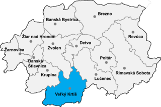
Kosihovce is a village and municipality in the Veľký Krtíš District of the Banská Bystrica Region of southern Slovakia.

Quípama Municipality and town in Boyacá, Colombia

Quípama is a town and municipality in the Colombian Department of Boyacá, part of the subregion of the Western Boyacá Province.

Ramón Santana Place in San Pedro de Macorís, Dominican Republic

Ramon Santana is a municipality (municipio) of the San Pedro de Macorís province in the Dominican Republic.

Santibáñez el Bajo is a municipality located in the province of Cáceres, Extremadura, Spain. According to the 2006 census (INE), the municipality has a population of 863 inhabitants.

Valdecaballeros is a municipality located in the province of Badajoz, Extremadura, Spain. According to the 2006 census (INE), the municipality has a population of 1264 inhabitants.

Vega de Ruiponce is a municipality located in the province of Valladolid, Castile and León, Spain. According to the 2004 census (INE), the municipality has a population of 129 inhabitants. Its economy is mainly focused on the primary sector, specifically livestock and agriculture.

Rouko Department Department in Centre-Nord Region, Burkina Faso

Rouko is a department or commune of Bam Province in north-western Burkina Faso. Its capital lies at the town of Rouko. According to the 1996 census the department has a total population of 13,175.

Nanoro Department Department in Boulkiemdé Province, Burkina Faso

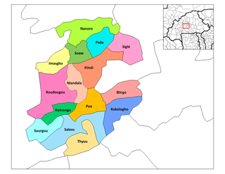
Nanoro is a department or commune of Boulkiemdé Province in central Burkina Faso. As of 2005 it has a population of 33,511. Its capital lies at the town of Nanoro.

Bonza is a town in the Solenzo Department of Banwa Province in western Burkina Faso. As of 2005 it had a population of 5,209.

Zabré Town - in Centre-Est Region, Burkina Faso

Zabré is a "town" in the Zabré Department of Boulgou Province in south-eastern Burkina Faso. As of 2005, the town has a population of 13,599.

Alderville First Nation

Alderville First Nation is a band of Mississaugas, a sub-nation of the Ojibways. The Alderville and Sugar Island 37A reserves belong to that First Nation band government.

Plenița Commune in Dolj County, Romania

Plenița is a commune in Dolj County, Romania with a population of 5,800 people. It is composed of two villages, Castrele Traiane and Plenița.

Somé is a town in the Nandiala Department of Boulkiemdé Province in central western Burkina Faso. It has a population of 3,073.

Cəfərli (39° 11 N 48° 13 E), Jalilabad Place in Jalilabad, Azerbaijan

Cəfərli is a village in the Jalilabad Rayon of Azerbaijan.

Coatzingo (municipality) is a town and municipality in Puebla in south-eastern Mexico.

Cohetzala (municipality) is a town and municipality in Puebla in south-eastern Mexico.

Fanfare Island is the northernmost of the Argentine Islands, lying 1.5 nautical miles (3 km) south of Herald Reef in the Wilhelm Archipelago. It was named by the UK Antarctic Place-Names Committee in 1961 from association with Herald Reef.

References

Coordinates: 11°11′N5°13′W / 11.183°N 5.217°W / 11.183; -5.217

Geographic coordinate system Coordinate system

A geographic coordinate system is a coordinate system that enables every location on Earth to be specified by a set of numbers, letters or symbols. The coordinates are often chosen such that one of the numbers represents a vertical position and two or three of the numbers represent a horizontal position; alternatively, a geographic position may be expressed in a combined three-dimensional Cartesian vector. A common choice of coordinates is latitude, longitude and elevation. To specify a location on a plane requires a map projection.