South Dennis is a census-designated place (CDP) in the town of Dennis in Barnstable County, Massachusetts, United States. The population was 3,643 at the 2010 census, the most of the 5 CDPs in Dennis.

Lloyd is a town in Ulster County, New York, United States. The population was 10,863 at the 2010 census. It is part of the New York City combined statistical area.

Mitchell Heights is a town in Logan County, West Virginia, United States. The population was 323 at the 2010 census. The town was named for an early farm on which it was established.

Eagle Point is a town in Chippewa County in the U.S. state of Wisconsin. The population was 3,053 at the 2010 census. The unincorporated communities of Eagle Point and Eagleton are located in the town.

A pole of inaccessibility with respect to a geographical criterion of inaccessibility marks a location that is the most challenging to reach according to that criterion. Often it refers to the most distant point from the coastline, implying a maximum degree of continentality or oceanity. In these cases, pole of inaccessibility can be defined as the center of the largest circle that can be drawn within an area of interest without encountering a coast. Where a coast is imprecisely defined, the pole will be similarly imprecise.

Hatfield is a town and civil parish in the Metropolitan Borough of Doncaster in South Yorkshire, England. It had a population of 16,776 at the 2011 Census, with its population split between the Hatfield and Thorne wards.

The N26 road is a national primary road in northeast County Mayo in Ireland connecting the N5 road at Swinford with the N58 at Foxford and then on to the N59 road at Ballina. The road also meets six regional roads along its route, and it is 29.79 kilometres (18.51 mi) long.

Ystradowen is a small village twelve miles west of Cardiff, located in the Vale of Glamorgan in south Wales; its nearest town is Cowbridge which is about three miles to the south.
Toral of the Guzmanes is a municipality located in the south of the province of León, Spain. It belongs to the autonomous community of Castile and León in the northwest of Spain, in the so denominated region of Esla-Oteros. Its surface is of about 21 km². In 2004 it had a population of 896 inhabitants of who 669 resided in the town. Toral is located in National 630 between León, Spain, which is 42 km away and Benavente, Zamora, to a distance of about 28 km, in also known as Via de la Plata, and 9 km away from Valencia de Don Juan, the local head, to which is connected by means of a local road, the CV-232. In addition the town gets exit to the A-66 highway that links León and Benavente.
Mozota is a small town and municipality in Zaragoza province 25 km southwest of Zaragoza, Aragon, Spain.

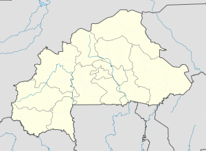
Soubakaniédougou is a department or commune of Comoé Province in south-western Burkina Faso. Its capital lies at the town of Soubakaniédougou. According to the 1996 census the department has a total population of 24,136.

Damana is a town in the Soubakaniédougou Department of Comoé Province in south-western Burkina Faso. The town has a population of 1,205.
Gouera is a town in the Soubakaniédougou Department of Comoé Province in south-western Burkina Faso. The town has a population of 1,924.
Gouindougouba is a town in the Soubakaniédougou Department of Comoé Province in south-western Burkina Faso. The town has a population of 1,626.
Gouindougouni is a town in the Soubakaniédougou Department of Comoé Province in south-western Burkina Faso. The town has a population of 1,254.
Panga is a town in the Soubakaniédougou Department of Comoé Province in south-western Burkina Faso. The town has a population of 2,263.

Mecatlán is a municipality in Veracruz, Mexico. It is located in the north zone of the State of Veracruz, about 327 km from state capital Xalapa. It has an area of 48.53 km2. It is located at 20°13′N97°41′W.
Mecayapan is a municipality and city in Veracruz, Mexico. It is located in south-east zone of the State of Veracruz, about 428 km from state capital Xalapa. It has a surface of 523.96 km2. It is located at 18°13′N94°50′W.

The Poesten Kill is a 26.2-mile-long (42.2 km) creek in upstate New York located entirely in Rensselaer County, which flows westerly from its source at Dyken Pond in the town of Berlin to its mouth at the Hudson River in the city of Troy. It has been used historically as a source of water for local inhabitants and farmers and became even more important as a source of water power during the Industrial Revolution, during which many mills and factories sprung up along its banks.