Cape Longing is a rocky cape on the east coast of Graham Land, Antarctica, forming the south end of a large ice-covered promontory which marks the west side of the south entrance to Prince Gustav Channel. It was discovered by the Swedish Antarctic Expedition under Otto Nordenskiöld in 1902, and so named by him because from the position of his winter hut on Snow Hill Island the cape lay in the direction of his "land of longing" which he was anxious to explore.
Urzainqui is a town and municipality located in the province and autonomous community of Navarre, northern Spain.

Grenadines is an administrative parish of Saint Vincent and the Grenadines, comprising the islands of the Grenadines other than those belonging to Grenada. The capital is Port Elizabeth.
Southeast Alabama is the term used to identify the southeastern counties in the state of Alabama. Other names for the area are The Wiregrass and Lower Alabama. The area includeds the Counties of Dale, Pike, Houston, Coffee, Henry, Geneva, Barbour, Crenshaw and Covington. The area is dominated by the most populous cities of Dothan, Alabama, Enterprise, Alabama, and Ozark, Alabama.

Rpety is a village in Central Bohemian Region of the Czech Republic. It has around 440 inhabitants.

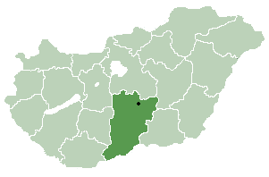
Dunaegyháza is a village in Bács-Kiskun county, in the Southern Great Plain region of Hungary.
German submarine U-217 was a Type VIID mine-laying U-boat of Nazi Germany's Kriegsmarine during World War II.

Ariceștii Rahtivani is a commune in Prahova County, Romania. It is composed of five villages: Ariceștii Rahtivani, Buda, Nedelea, Stoenești and Târgșoru Nou.

Botiz is a commune of 4,698 inhabitants situated in Satu Mare County, Romania. It is composed of a single village, Botiz. Until 2004, it also included Agriș and Ciuperceni villages, but these were split off that year to form Agriș Commune.
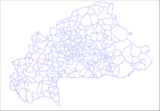
Koutiama is a village in the Bissiga Department of Boulgou Province in south-eastern Burkina Faso. As of 2005, the village has a population of 481.
Niarba is a town in the Niaogho Department of Boulgou Province in south-eastern Burkina Faso. As of 2005, the town has a population of 1,649.

Rozdzielna is a village in the administrative district of Gmina Dmosin, within Brzeziny County, Łódź Voivodeship, in central Poland. It lies approximately 6 kilometres (4 mi) north-east of Dmosin, 18 km (11 mi) north of Brzeziny, and 32 km (20 mi) north-east of the regional capital Łódź.
Diamon is a village in the Moussodougou Department of Comoé Province in south-western Burkina Faso. The village has a population of 881.

Bethausen is a commune in Timiș County, Romania. It is composed of six villages: Bethausen, Cladova (Kladova), Cliciova (Klicsó), Cutina (Gutonya), Leucușești (Lőkösfalva) and Nevrincea (Nőrincse).

Kolonia Jeziorzany is a village in the administrative district of Gmina Tarczyn, within Piaseczno County, Masovian Voivodeship, in east-central Poland. It lies approximately 4 kilometres (2 mi) south of Tarczyn, 19 km (12 mi) south-west of Piaseczno, and 32 km (20 mi) south of Warsaw.

Budy Piaseczne is a village in the administrative district of Gmina Zawidz, within Sierpc County, Masovian Voivodeship, in east-central Poland. It lies approximately 6 kilometres (4 mi) east of Zawidz, 20 km (12 mi) east of Sierpc, and 99 km (62 mi) north-west of Warsaw.
The Copperneedle River originates within the northern Hearne Domain, Western Churchill province of the Churchill craton, the northwest section of the Canadian Shield in Nunavut's Kivalliq Region. There are rapids along the river, approximately 15 km (9.3 mi) from Hudson Bay's Dawson Inlet.
Alekere is a village in Mustvee Parish, Jõgeva County in northeastern Estonia.
Turvalepa is a village in Lääne-Nigula Parish, Lääne County, in western Estonia.
Kumma is a village in Kehtna Parish, Rapla County in northern-central Estonia.


