
The Arctic Archipelago, also known as the Canadian Arctic Archipelago, is a group of islands north of the Canadian mainland.

Grenadines is an administrative parish of Saint Vincent and the Grenadines, comprising the islands of the Grenadines other than those belonging to Grenada. The capital is Port Elizabeth.

Gemerské Michalovce is a village and municipality in the Rimavská Sobota District of the Banská Bystrica Region of southern Slovakia.
Roseți is a commune in Călărași County, Romania. It is composed of a single village, Roseți.
Piña de Campos is a municipality located in the province of Palencia, Castile and León, Spain. According to the 2004 census (INE), the municipality had a population of 279 inhabitants.

Șuțești is a commune located in Brăila County, Romania. It is composed of two villages, Mihail Kogălniceanu and Șuțești.
Loungo is a village in the Sabce Department of Bam Province in northern-central Burkina Faso. It has a population of 723.
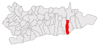
Dâmbovicioara is a commune in Argeș County, in southern central Romania. It is composed of three villages: Ciocanu, Dâmbovicioara and Podu Dâmboviței.

Gnatowo is a village in the administrative district of Gmina Grabowo, within Kolno County, Podlaskie Voivodeship, in north-eastern Poland. It lies approximately 19 kilometres (12 mi) east of Kolno and 73 km (45 mi) north-west of the regional capital Białystok.

St Ives Bay is a bay on the Atlantic coast of north-west Cornwall, England, United Kingdom. It is in the form of a shallow crescent, some 4 miles or 6 km across, between St Ives in the west and Godrevy Head in the east.
Ptaszkowo is a village in the administrative district of Gmina Grodzisk Wielkopolski, within Grodzisk Wielkopolski County, Greater Poland Voivodeship, in west-central Poland. It lies approximately 5 kilometres (3 mi) east of Grodzisk Wielkopolski and 39 km (24 mi) south-west of the regional capital Poznań.
Zawarpie is a village in the administrative district of Gmina Siewierz, within Będzin County, Silesian Voivodeship, in southern Poland. It lies approximately 5 kilometres (3 mi) south of Siewierz, 14 km (9 mi) north-east of Będzin, and 26 km (16 mi) north-east of the regional capital Katowice.
Borów is a village in the administrative district of Gmina Świebodzin, within Świebodzin County, Lubusz Voivodeship, in western Poland. It lies approximately 8 kilometres (5 mi) south-west of Świebodzin, 32 km (20 mi) north of Zielona Góra, and 59 km (37 mi) south of Gorzów Wielkopolski.

Lương Thành is a commune (xã) and village in Na Rì District, Bắc Kạn Province, in Vietnam.
Igriés is a small village located in the Hoya de Huesca, in the province of Aragón in northern Spain.

Sturgeon Lake 154 is an Indian reserve in northern Alberta, Canada. It is located on Highway 43, 3.5 km (2.2 mi) west of the Town of Valleyview and approximately 85 km (53 mi) east of the City of Grande Prairie. It and the adjacent Sturgeon Lake 154B Indian Reserve are surrounded by the Municipal District of Greenview No. 16. It is under the administration of the Sturgeon Lake Cree Nation.

Saka is a village in Toila Parish, Ida-Viru County in northeastern Estonia.
Uuta is a village in Nõo Parish, Tartu County in eastern Estonia.
German submarine U-433 was a Type VIIC U-boat built for Nazi Germany's Kriegsmarine for service during World War II. She was laid down on 4 January 1940 by Schichau-Werke, Danzig as yard number 1474, launched on 15 March 1941 and commissioned on 24 May 1941 under Oberleutnant zur See Hans Ey.


