The Mexican Riviera refers collectively to twenty cities and lagoons lying on the western coast of Mexico. Although there are long distances between these cities, they are often collectively referred to as the Mexican Riviera because of their many oceanfront resorts and their popularity among tourists. Cruise ships often visit three or four of these destinations on their longer cruises. In a 2005 interview Stanley McDonald, the founder of Princess Cruises, mentioned:
The call of the "Mexican Riviera" was coined by Princess Cruise Line. Now everyone refers to it as the Mexican Riviera. I believe that it really spoke to the quality and beauty of what people would see down there. We all know the French Riviera -- the Mexican Riviera was something we had in the western hemisphere.

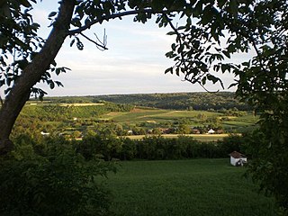
Sot is a village located in Syrmia, Vojvodina, Serbia. It is situated in the Šid municipality, in the Syrmia District. The village is ethnically mixed and its population numbering 791 people.
Port Morant is a town in southeastern Jamaica. It was, in the early years of European settlement, one of the island's chief ports, with export of bananas and production of rum being major industries.

Šmigovec is a village and municipality in Snina District in the Prešov Region of north-eastern Slovakia.

Cazenovia Township, Township 28 North, Range 2 West, is located in Woodford County, Illinois. It includes most of the town of Washburn, Illinois and the villages of Cazenovia and Low Point, Illinois and is traversed by State Route 89. As of the 2010 census, its population was 1,768 and it contained 721 housing units.
Derrymore is a small village and townland in County Antrim, Northern Ireland. In the 2001 Census it had a population of 243 people. It lies on the shores of Lough Neagh, within the Craigavon Borough Council area.
Los Ausines is a municipality located in the province of Burgos, Castile and León, Spain. According to the 2004 census (INE), the municipality has a population of 136 inhabitants.
Sissin is a village in the Zimtenga Department of Bam Province in northern-central Burkina Faso. It has a population of 195.

Borbor is a village in the Davachi Rayon of Azerbaijan. The village forms part of the municipality of Padar.

Kabagtepe is a village in the Lachin Rayon of Azerbaijan.
Komona is a village in the Manni Department of Gnagna Province in eastern Burkina Faso. The village has a population of 246.
Lipaka is a town in the Manni Department of Gnagna Province in eastern Burkina Faso. The town has a population of 1,507.
The following radio stations broadcast on AM frequency 900 kHz: 900 AM is a Mexican and Canadian clear channel frequency. XEW and CKBI share Class A status of 900 kHz.
Tlaltetela is a municipality located in the montane central zone in the State of Veracruz, about 25 km from state capital Xalapa. It has a surface of 266.50 km2. It is located at 19°19′N96°54′W. The name comes from the language Náhuatl, Atl-Xoxoc-Apan; that means “In the acid water". By the decree 373 of May 8, 1979 the municipality is named Tlaltetela, suprimiendo Axocuapan's name; in the year of 1998 there is constructed the first recreative park and the municipal library.

Lezo is a town located in the province of Gipuzkoa, in the autonomous community of Basque Country, northern Spain.
Atzitzintla (municipality) is a town and municipality in Puebla in south-eastern Mexico.

Bou Hanifia is a town and commune located at 35° 18′ 58″ North 0° 02′ 54″ East in Mascara Province, Algeria. According to the 1998 census it has a population of 16,953. and a density of 77 hab./km2
Mõraste is a village in Märjamaa Parish, Rapla County in western Estonia. It is located on the bank of the Kasari River
Thion, Burkina Faso is a town in the Thion Department of Gnagna Province in eastern Burkina Faso. The town has a population of 3030 and it is the capital of the Thion Department.


