Victoria Island is a large island in the Canadian Arctic Archipelago that straddles the boundary between Nunavut and the Northwest Territories of Canada. It is the eighth largest island in the world, and at 217,291 km2 (83,897 sq mi) in area, it is Canada's second largest island. It is nearly double the size of Newfoundland (111,390 km2 [43,008 sq mi]), and is slightly larger than the island of Great Britain (209,331 km2 [80,823 sq mi]) but smaller than Honshu (225,800 km2 [87,182 sq mi]). It contains the world's largest island within an island within an island. The western third of the island belongs to the Inuvik Region in the Northwest Territories; the remainder is part of Nunavut's Kitikmeot Region.

The Regional District of Central Kootenay (RDCK) is a regional district in the province of British Columbia, Canada. As of the 2016 census, the population was 59,517. The area is 22,130.72 square kilometres. The administrative centre is located in the city of Nelson. Other municipalities include the City of Castlegar, the Town of Creston, the Village of Salmo, the Village of Nakusp, the Village of Kaslo, the Village of New Denver, the Village of Silverton, the Village of Ymir and the Village of Slocan.

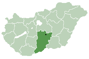
Öregcsertő is a village in Bács-Kiskun county, in the Southern Great Plain region of southern Hungary.

This is a list of the extreme points of the Philippines, the points that are farther north, south, east or west than any other location in the country.
Nangouna is a town in the Tansila Department of Banwa Province in western Burkina Faso. As of 2005 it had a population of 1,483.
Intiédougou is a town in the Bondigui Department of Bougouriba Province in south-western Burkina Faso. The town has a population of 1,170.
Tomena is a village in the Iolonioro Department of Bougouriba Province in south-western Burkina Faso. The village has a population of 503.

Milewo-Gałązki is a village in the administrative district of Gmina Grabowo, within Kolno County, Podlaskie Voivodeship, in north-eastern Poland. It lies approximately 17 kilometres (11 mi) north-east of Kolno and 83 km (52 mi) north-west of the regional capital Białystok.

Dumbrava is a commune located in Mehedinți County, Romania. It is composed of eleven villages: Albulești, Brâgleasa, Dumbrava de Jos, Dumbrava de Mijloc, Dumbrava de Sus, Golineasa, Higiu, Rocșoreni, Valea Marcului, Varodia and Vlădica.
chhapchour is a town and municipality in Gulmi District in the Lumbini Zone of central Nepal. At the time of the 1991 Nepal census it had a population of 4047 persons living in 784 individual households.
Grav is a district in the municipality of Bærum, Norway. Mainly a residential area, the population (2009) is 4,463.

Lauda is a village in the administrative district of Gmina Lidzbark Warmiński, within Lidzbark County, Warmian-Masurian Voivodeship, in northern Poland. It lies approximately 5 kilometres (3 mi) west of Lidzbark Warmiński and 37 km (23 mi) north of the regional capital Olsztyn.

Przećmino is a village in the administrative district of Gmina Kołobrzeg, within Kołobrzeg County, West Pomeranian Voivodeship, in north-western Poland. It lies approximately 7 kilometres (4 mi) south-west of Kołobrzeg and 100 km (62 mi) north-east of the regional capital Szczecin.
Mui is a village in Saaremaa Parish, Saare County in western Estonia.
Reina is a village in Saaremaa Parish, Saare County in western Estonia.
Castañares de Rioja is a village in the province and autonomous community of La Rioja, Spain. The municipality covers an area of 11 square kilometres (4.2 sq mi) and as of 2011 had a population of 486 people.
Torre en Cameros is a village in the province and autonomous community of La Rioja, Spain. The municipality covers an area of 11.64 square kilometres (4.49 sq mi) and as of 2011 had a population of 12 people.
El Casar de Escalona is a village in the province of Toledo and autonomous community of Castile-La Mancha, Spain.
German submarine U-600 was a Type VIIC U-boat built for Nazi Germany's Kriegsmarine for service during World War II. She was laid down on 25 January 1941 by Blohm & Voss in Hamburg as yard number 576, launched on 16 October 1941 and commissioned on 11 December 1941 under Kapitänleutnant Bernhard Zurmühlen.

Babadıl Islands are two small Mediterranean islands in Turkey. They are named after the former name of the village Sipahili in the mainland facing the islands. According to the British captain Francis Beaufort who was tasked to map the Mediterranean coasts of Turkey in 1811-12, the names of the islands were Papadoulae, in the antiquity.


