Related Research Articles

Gustin Township is a civil township of Alcona County in the U.S. state of Michigan. The population was 795 at the 2010 census.

Kinderhook Township is a civil township of Branch County in the U.S. state of Michigan. As of the 2010 census, the township population was 1,497.

Ovid Township is a civil township of Branch County in the U.S. state of Michigan. The population was 2,326 at the 2010 census.

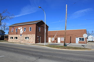
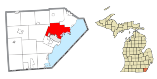
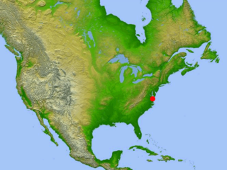
Calvin Township is a civil township of Cass County in the U.S. state of Michigan. The population was 2,037 at the 2010 census.

Newberg Township is a civil township of Cass County in the U.S. state of Michigan. The population was 1,632 at the 2010 census.

Porter Township is a civil township of Cass County in the U.S. state of Michigan. The population was 3,798 at the 2010 census.

Oscoda Township is a charter township of Iosco County in the U.S. state of Michigan. The population was 6,788 at the 2020 census. The Wurtsmith Air Force Base is located within the township.

Rolland Township is a civil township of Isabella County in the U.S. state of Michigan. The population was 1,210 at the 2000 census.

Elmwood Township is a charter township of Leelanau County in the U.S. state of Michigan. The population was 4,892 at the 2020 census, making it the largest township in Leelanau County by population. The southeasternmost township of Leelanau County, Elmwood Township is suburbanized, as it is immediately adjacent Traverse City, the largest city in Northern Michigan.

Forsyth Township is a civil township of Marquette County in the U.S. state of Michigan. The population was 6,194 at the 2020 census.
Dundee Township is a civil township of Monroe County in the U.S. state of Michigan. The population was 8,145 at the 2020 census. The township contains the village of Dundee, and the majority of the township is served by Dundee Community Schools.

Erie Township is a civil township of Monroe County in the U.S. state of Michigan. The population was 4,299 at the 2020 census. Sharing a southern border with the city of Toledo about 35 miles (56.3 km) south of the city of Detroit, the township is one of the southernmost areas included in the Detroit–Warren–Ann Arbor Combined Statistical Area.
Frenchtown Charter Township is a charter township within Monroe County in the U.S. state of Michigan. The population was 20,428 as per the 2010 census.

Ida Township is a civil township of Monroe County in the U.S. state of Michigan. The population was 4,964 at the 2010 census. The township was organized in 1837 and named after local civic leader Ida M. Taylor.

Whiteford Township is a civil township of Monroe County in the U.S. state of Michigan. The population was 4,602 at the 2010 census.

Robin Glen-Indiantown is a census-designated place (CDP) in Buena Vista Charter Township, Saginaw County in the U.S. state of Michigan. The CDP is used for statistical purposes and has no legal status as an incorporated municipality. The population was 1,158 at the 2000 census.
The Chesapeake Bay impact crater is a buried impact crater, located beneath the mouth of Chesapeake Bay, United States. It was formed by a bolide that struck the eastern shore of North America about 35.5 ± 0.3 million years ago, in the late Eocene epoch. It is one of the best-preserved "wet-target" impact craters in the world.
Flynn Creek crater, is an impact crater situated in Jackson County, approximately 8 km south of Gainesboro, Tennessee, USA. It was formed approximately 360 million years ago as a shallow, saucer-shaped crater, 3.8 km (2.4 mi) in diameter and about 150 m deep. A large central hill, highly deformed rim strata, and a breccia lens 40 m (130 ft) in thickness were produced during formation. Over 2 km2 of flat lying Middle and Upper Paleozoic limestone and dolomite were brecciated and mixed to a depth of 200 m (660 ft), and at least half of the breccia was ejected from the crater. The remaining breccia contains fragments ranging in size from small grains to megabreccia blocks 100 m (330 ft) in length. Undisturbed strata lie 100 m below the original crater floor.

The Popigai impact structure is the eroded remnant of an impact crater in northern Siberia, Russia. It is tied with the Manicouagan structure as the fourth largest verified impact structure on Earth. A large bolide impact created the 100-kilometre (62 mi) diameter crater approximately 35 million years ago during the late Eocene epoch. It might be linked to the Eocene–Oligocene extinction event.
References
- 1 2 "Craters are evidence of ancient meteorite strikes". The University Record. September 12, 1994. Archived from the original on June 6, 2007. Retrieved May 26, 2006.
- ↑ "Calvin". Earth Impact Database . Planetary and Space Science Centre University of New Brunswick Fredericton . Retrieved 2009-08-12.
41°50′N85°57′W / 41.83°N 85.95°W

